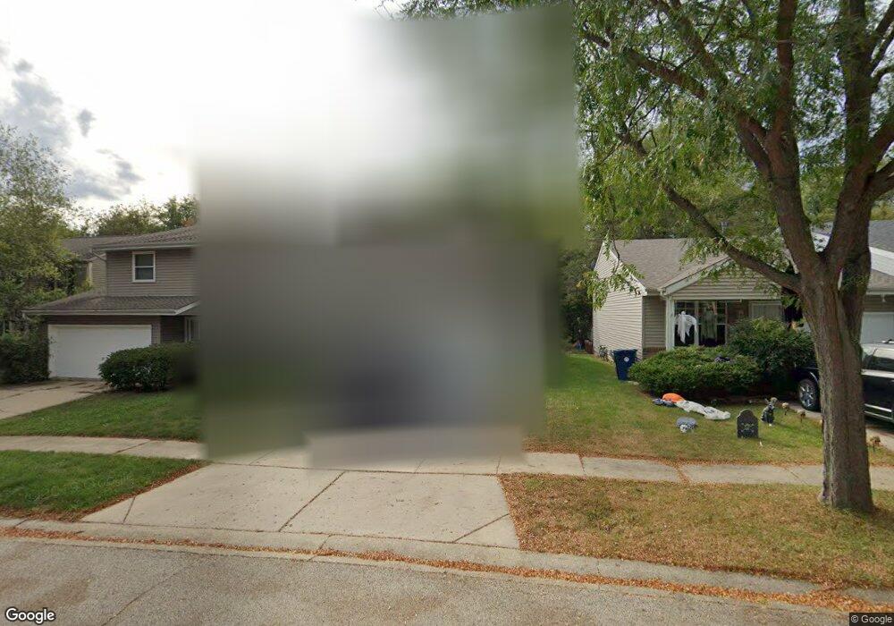
1250 Minniehaha Trail Algonquin, IL 60102
Estimated Value: $235,331 - $325,000
--
Bed
--
Bath
900
Sq Ft
$328/Sq Ft
Est. Value
About This Home
This home is located at 1250 Minniehaha Trail, Algonquin, IL 60102 and is currently estimated at $295,333, approximately $328 per square foot. 1250 Minniehaha Trail is a home located in Kane County with nearby schools including Eastview Elementary School, Algonquin Middle School, and Dundee-Crown High School.
Ownership History
Date
Name
Owned For
Owner Type
Purchase Details
Closed on
Apr 14, 2021
Sold by
Fridstrom Lorraine H
Bought by
Fridstrom John T
Current Estimated Value
Home Financials for this Owner
Home Financials are based on the most recent Mortgage that was taken out on this home.
Original Mortgage
$150,000
Outstanding Balance
$136,500
Interest Rate
3.37%
Mortgage Type
New Conventional
Estimated Equity
$158,833
Purchase Details
Closed on
Jun 19, 2006
Sold by
Hardin Robert E
Bought by
Citimortgage Inc
Purchase Details
Closed on
May 26, 2006
Sold by
Hardin Robert E
Bought by
Citimortgage Inc
Purchase Details
Closed on
Nov 1, 2001
Sold by
Hardin Joan M
Bought by
Hardin Robert E
Home Financials for this Owner
Home Financials are based on the most recent Mortgage that was taken out on this home.
Original Mortgage
$112,500
Interest Rate
6.53%
Create a Home Valuation Report for This Property
The Home Valuation Report is an in-depth analysis detailing your home's value as well as a comparison with similar homes in the area
Home Values in the Area
Average Home Value in this Area
Purchase History
| Date | Buyer | Sale Price | Title Company |
|---|---|---|---|
| Fridstrom John T | -- | Attorney | |
| Citimortgage Inc | -- | None Available | |
| Citimortgage Inc | -- | None Available | |
| Hardin Robert E | -- | World Title Guaranty Inc |
Source: Public Records
Mortgage History
| Date | Status | Borrower | Loan Amount |
|---|---|---|---|
| Previous Owner | Hardin Robert E | $112,500 |
Source: Public Records
Tax History Compared to Growth
Tax History
| Year | Tax Paid | Tax Assessment Tax Assessment Total Assessment is a certain percentage of the fair market value that is determined by local assessors to be the total taxable value of land and additions on the property. | Land | Improvement |
|---|---|---|---|---|
| 2024 | $417 | $5,859 | $715 | $5,144 |
| 2023 | $454 | $5,961 | $1,333 | $4,628 |
| 2022 | $412 | $5,271 | $643 | $4,628 |
| 2021 | $401 | $4,977 | $607 | $4,370 |
| 2020 | $394 | $4,865 | $593 | $4,272 |
| 2019 | $384 | $4,618 | $563 | $4,055 |
| 2018 | $391 | $4,527 | $552 | $3,975 |
| 2017 | $376 | $4,234 | $516 | $3,718 |
| 2016 | $746 | $7,903 | $1,123 | $6,780 |
| 2015 | -- | $7,405 | $1,052 | $6,353 |
| 2014 | -- | $7,201 | $1,023 | $6,178 |
| 2013 | -- | $7,421 | $1,054 | $6,367 |
Source: Public Records
Map
Nearby Homes
- 1114 Riverwood Dr Unit 1114
- 910 S Vista Dr
- lot 13-17 Pokagon Dr
- 9999 Sandbloom Rd
- 610 Chelsea Dr
- lot 25 Wabican Trail
- 1525 Teri Ln Unit 4
- 345 Souwanas Trail
- 0 Natoma Trail
- 551 Golden Valley Ln
- 20 Hickory Ln
- Lot 4 b Ryan Pkwy
- 1659 E Algonquin Rd
- 901 Wesley Ln
- 600 E Algonquin Rd
- 1188 E Algonquin Rd
- 632 Oceola Dr
- 1531 Cumberland Pkwy
- 2003 Magenta Ln
- 920 Plymouth Ct
- 1250 Minniehaha Trail
- 1234 Riverwood Dr Unit 2
- 1232 Riverwood Dr
- 1300 Riverwood Dr
- 1230 Riverwood Dr
- 1228 Riverwood Dr
- 1304 Riverwood Dr Unit 2
- 1222 Stratford Ln
- 1224 Stratford Ln Unit 2
- 1310 Riverwood Dr
- 1226 Stratford Ln
- 1220 Stratford Ln
- 1320 Riverwood Dr
- 1218 Stratford Ln
- 1330 Riverwood Dr
- 1226 Riverwood Dr
- 1216 Stratford Ln
- 1305 Riverwood Dr
- 1255 Riverwood Dr
- 1214 Stratford Ln
