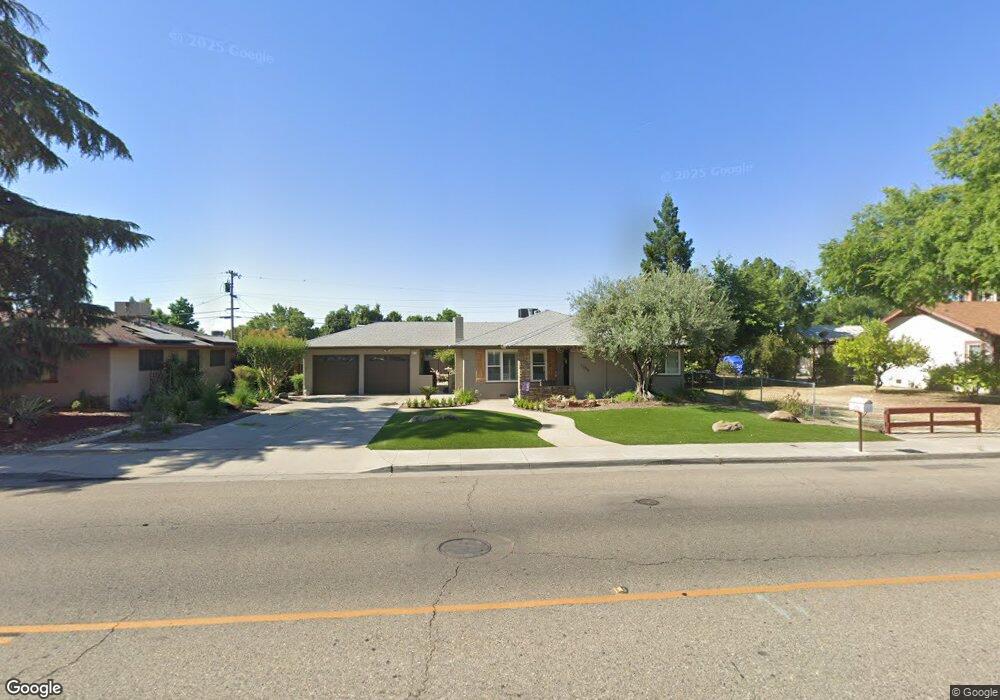
1258 5th St Clovis, CA 93612
Estimated Value: $295,534 - $354,000
2
Beds
2
Baths
1,097
Sq Ft
$292/Sq Ft
Est. Value
About This Home
This home is located at 1258 5th St, Clovis, CA 93612 and is currently estimated at $320,845, approximately $292 per square foot. 1258 5th St is a home located in Fresno County with nearby schools including Clovis Elementary School, Clark Intermediate School, and Clovis High School.
Ownership History
Date
Name
Owned For
Owner Type
Purchase Details
Closed on
Apr 28, 2021
Sold by
Prieto Bobby and Prieto Larry G
Bought by
Prieto Bobby and Prieto Karen L
Current Estimated Value
Purchase Details
Closed on
Feb 4, 2021
Sold by
Prieto Betty Lou
Bought by
Julio S And Betty L Prieto Living Trust and Prieto
Purchase Details
Closed on
Feb 2, 2021
Sold by
Prieto Julio S and Prieto Julio S
Bought by
Prieto Bobby and Prieto Larry G
Purchase Details
Closed on
Sep 27, 2005
Sold by
Prieto Julio S and Prieto Betty L
Bought by
Prieto Julio S and Prieto Betty L
Create a Home Valuation Report for This Property
The Home Valuation Report is an in-depth analysis detailing your home's value as well as a comparison with similar homes in the area
Home Values in the Area
Average Home Value in this Area
Purchase History
| Date | Buyer | Sale Price | Title Company |
|---|---|---|---|
| Prieto Bobby | -- | None Available | |
| Julio S And Betty L Prieto Living Trust | -- | -- | |
| Prieto Bobby | -- | None Available | |
| Prieto Julio S | -- | -- |
Source: Public Records
Tax History
| Year | Tax Paid | Tax Assessment Tax Assessment Total Assessment is a certain percentage of the fair market value that is determined by local assessors to be the total taxable value of land and additions on the property. | Land | Improvement |
|---|---|---|---|---|
| 2025 | $778 | $64,408 | $14,521 | $49,887 |
| 2023 | $749 | $61,908 | $13,958 | $47,950 |
| 2022 | $739 | $60,695 | $13,685 | $47,010 |
| 2021 | $637 | $59,506 | $13,417 | $46,089 |
| 2020 | $633 | $58,897 | $13,280 | $45,617 |
| 2019 | $620 | $57,743 | $13,020 | $44,723 |
| 2018 | $605 | $56,612 | $12,765 | $43,847 |
| 2017 | $594 | $55,503 | $12,515 | $42,988 |
| 2016 | $572 | $54,416 | $12,270 | $42,146 |
| 2015 | $563 | $53,599 | $12,086 | $41,513 |
| 2014 | $551 | $52,550 | $11,850 | $40,700 |
Source: Public Records
Map
Nearby Homes
- 1272 Bullard Ave
- 760 Sunnyside Ave
- 1498 Escalon Ave
- 1228 Jefferson Ave
- 911 Stanford Ave
- 860 Mcarthur Ave
- 1606 Barstow Ave
- 1428 Miami Ave
- 1855 Vartikian Ave
- 1946 Calimyrna Ave
- 1622 Dennis Ave
- 1273 Bundy Ave
- 22 N Bliss Ave
- 96 Burgan Ave
- 1334 Shirley Ave
- 1234 No Address Available
- 127 5th St
- 1721 Beverly Ave
- 142 9th St
- 1515 Keats Ave
- 1272 5th St
- 1242 5th St
- 1269 Bullard Ave
- 1255 Bullard Ave
- 1304 5th St
- 1279 Bullard Ave
- 539 Music Ave
- 1311 Bullard Ave
- 1318 5th St
- 1321 Bullard Ave
- 603 Music Ave
- 1262 Bullard Ave
- 508 Sunnyside Ave
- 518 Sunnyside Ave
- 1302 Bullard Ave
- 544 Sunnyside Ave
- 613 Music Ave
- 1310 Bullard Ave
- 1320 Bullard Ave
- 1328 Bullard Ave
Your Personal Tour Guide
Ask me questions while you tour the home.