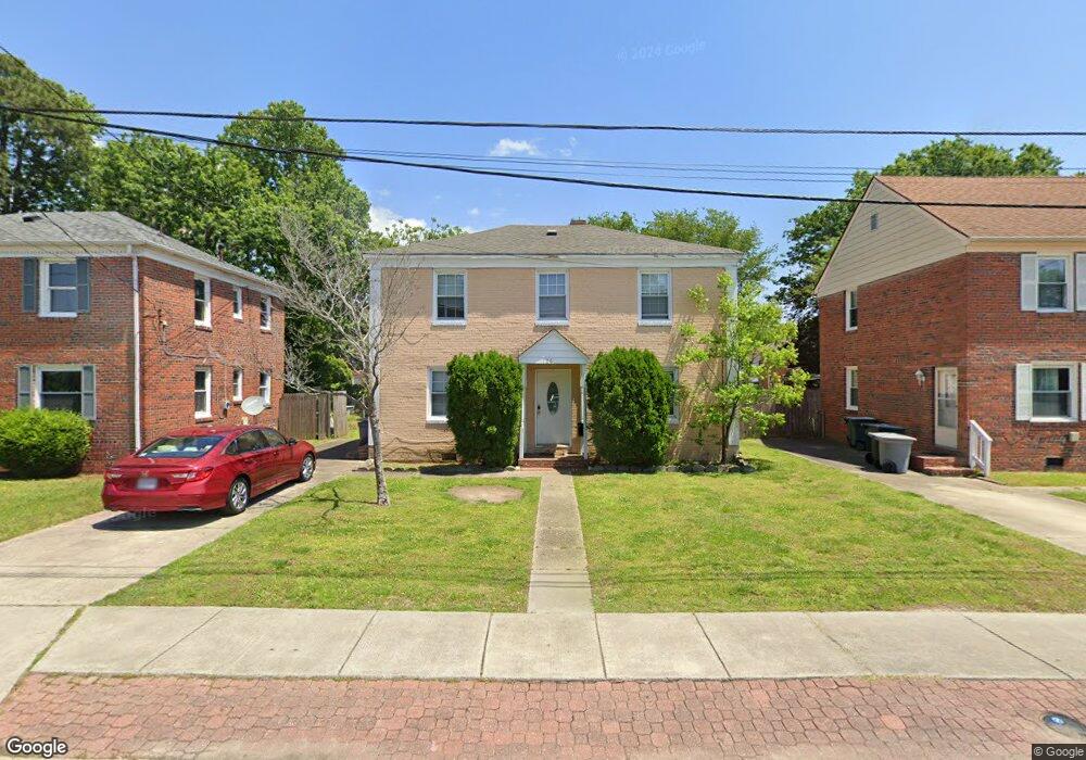
126 Burns St Hampton, VA 23669
Newtown-Crown Point NeighborhoodEstimated Value: $154,000 - $262,000
4
Beds
2
Baths
1,584
Sq Ft
$143/Sq Ft
Est. Value
About This Home
This home is located at 126 Burns St, Hampton, VA 23669 and is currently estimated at $226,543, approximately $143 per square foot. 126 Burns St is a home located in Hampton City with nearby schools including Hunter B. Andrews PK-8 School, C. Alton Lindsay Middle School, and Phoebus High School.
Ownership History
Date
Name
Owned For
Owner Type
Purchase Details
Closed on
Nov 13, 2015
Sold by
U S Bank Na As Trustee For Residential A
Bought by
Sliva Yekaterina
Current Estimated Value
Purchase Details
Closed on
Feb 4, 2015
Sold by
Samuel I White Pc Sub Tr and Heller Joseph C
Bought by
U S Bank Na
Purchase Details
Closed on
Jun 29, 2006
Sold by
Skees Timothy M
Bought by
Heller Joseph C
Home Financials for this Owner
Home Financials are based on the most recent Mortgage that was taken out on this home.
Original Mortgage
$116,000
Interest Rate
6.71%
Mortgage Type
New Conventional
Create a Home Valuation Report for This Property
The Home Valuation Report is an in-depth analysis detailing your home's value as well as a comparison with similar homes in the area
Home Values in the Area
Average Home Value in this Area
Purchase History
| Date | Buyer | Sale Price | Title Company |
|---|---|---|---|
| Sliva Yekaterina | $56,200 | Attorney | |
| U S Bank Na | $66,000 | -- | |
| Heller Joseph C | $145,000 | -- |
Source: Public Records
Mortgage History
| Date | Status | Borrower | Loan Amount |
|---|---|---|---|
| Previous Owner | Heller Joseph C | $116,000 |
Source: Public Records
Tax History
| Year | Tax Paid | Tax Assessment Tax Assessment Total Assessment is a certain percentage of the fair market value that is determined by local assessors to be the total taxable value of land and additions on the property. | Land | Improvement |
|---|---|---|---|---|
| 2025 | $2,115 | $179,700 | $50,000 | $129,700 |
| 2024 | $1,885 | $163,900 | $50,000 | $113,900 |
| 2023 | $1,636 | $141,000 | $48,000 | $93,000 |
| 2022 | $1,534 | $130,000 | $42,000 | $88,000 |
| 2021 | $1,479 | $108,800 | $37,500 | $71,300 |
| 2020 | $1,331 | $107,300 | $37,500 | $69,800 |
| 2019 | $1,298 | $104,700 | $37,500 | $67,200 |
| 2018 | $694 | $104,400 | $37,500 | $66,900 |
| 2017 | $1,389 | $0 | $0 | $0 |
| 2016 | $1,389 | $104,400 | $0 | $0 |
| 2015 | $759 | $0 | $0 | $0 |
| 2014 | $1,610 | $114,800 | $37,500 | $77,300 |
Source: Public Records
Map
Nearby Homes
- 106 Clyde St
- 3829 Roads View Ave
- 3614 Matoaka Rd
- 29 Moss Ave
- 4207 Chesapeake Ave
- 27 Trail St
- 44 Henry St
- 144 Algonquin Rd
- 39 W Sunset Rd
- 355 Ivy Home Rd
- 19 Capps Qtrs Unit 1
- 19 Capps Qtrs
- 6 Capps Qtrs Unit 2
- 438 Highland Ave
- 138 Hampton Roads Ave
- 163 Columbia Ave
- 159 Columbia Ave
- 19 Capps Quarters Unit 1
- 460 England Ave
- 4 Cedar Point Dr
Your Personal Tour Guide
Ask me questions while you tour the home.