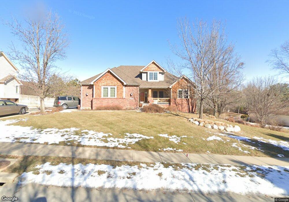
12634 Decatur St Omaha, NE 68154
Bryn Mawr NeighborhoodEstimated Value: $487,836 - $589,000
3
Beds
4
Baths
2,509
Sq Ft
$214/Sq Ft
Est. Value
About This Home
This home is located at 12634 Decatur St, Omaha, NE 68154 and is currently estimated at $536,209, approximately $213 per square foot. 12634 Decatur St is a home located in Douglas County with nearby schools including Columbian Elementary School, Beveridge Magnet Middle School, and Burke High School.
Create a Home Valuation Report for This Property
The Home Valuation Report is an in-depth analysis detailing your home's value as well as a comparison with similar homes in the area
Home Values in the Area
Average Home Value in this Area
Tax History Compared to Growth
Tax History
| Year | Tax Paid | Tax Assessment Tax Assessment Total Assessment is a certain percentage of the fair market value that is determined by local assessors to be the total taxable value of land and additions on the property. | Land | Improvement |
|---|---|---|---|---|
| 2025 | $6,957 | $485,700 | $46,500 | $439,200 |
| 2024 | $9,076 | $430,200 | $46,500 | $383,700 |
| 2023 | $9,076 | $430,200 | $46,500 | $383,700 |
| 2022 | $8,030 | $376,200 | $46,500 | $329,700 |
| 2021 | $7,963 | $376,200 | $46,500 | $329,700 |
| 2020 | $7,793 | $364,000 | $46,500 | $317,500 |
| 2019 | $7,816 | $364,000 | $46,500 | $317,500 |
| 2018 | $6,861 | $319,100 | $46,500 | $272,600 |
| 2017 | $6,895 | $319,100 | $46,500 | $272,600 |
| 2016 | $6,899 | $321,500 | $48,200 | $273,300 |
| 2015 | $6,360 | $300,400 | $45,000 | $255,400 |
| 2014 | $6,360 | $300,400 | $45,000 | $255,400 |
Source: Public Records
Map
Nearby Homes
- 12627 Patrick Cir
- 12360 Franklin St
- 12329 Parker Cir
- 2118 N 125th Cir
- 2024 N 124th Cir
- 12311 Decatur St
- 2305 N 127th Cir
- 12717 Erskine St
- 12930 Hamilton St
- 1325 N 127th Ave
- 1726 N 131st Cir
- 12236 Rose Ln
- 2635 N 122nd Cir
- 2741 N 129th Cir
- 12924 Izard St
- 13407 Seward St
- 13441 Burdette St
- 2905 N 120th Avenue Cir
- 922 N 122nd St
- 13426 Seward St
- 12702 Decatur St
- 12614 Decatur St
- 1751 N 127th St
- 12712 Decatur St
- 12612 Decatur St
- 1754 N 127th St
- 12615 Decatur St
- 1741 N 127th St
- 12722 Decatur St
- 12621 Patrick Cir
- 1744 N 127th St
- 1806 N 126th St
- 12605 Decatur St
- 1724 N 126th St
- 12721 Decatur St
- 12531 Patrick Cir
- 1812 N 126th St
- 1812 N 126th Cir
- 12633 Patrick Cir
- 12527 Patrick Cir