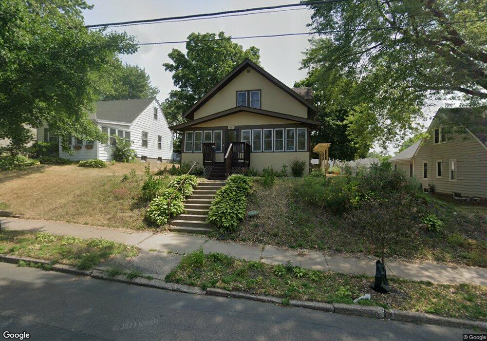
1268 1268 Dale St N St. Paul, MN 55117
North End NeighborhoodEstimated Value: $279,703 - $334,000
3
Beds
1
Bath
1,183
Sq Ft
$255/Sq Ft
Est. Value
About This Home
This home is located at 1268 1268 Dale St N, St. Paul, MN 55117 and is currently estimated at $301,426, approximately $254 per square foot. 1268 1268 Dale St N is a home located in Ramsey County with nearby schools including Como Park Elementary School, Murray Middle School, and Como Park Senior High School.
Ownership History
Date
Name
Owned For
Owner Type
Purchase Details
Closed on
Apr 10, 2019
Sold by
Kirk Alexis M
Bought by
Allen Rita
Current Estimated Value
Home Financials for this Owner
Home Financials are based on the most recent Mortgage that was taken out on this home.
Original Mortgage
$196,500
Outstanding Balance
$172,758
Interest Rate
4.3%
Mortgage Type
New Conventional
Estimated Equity
$128,668
Purchase Details
Closed on
Oct 8, 2018
Sold by
Browing Nathaniel
Bought by
Browning Land Trust
Purchase Details
Closed on
Sep 28, 2009
Sold by
Deutsche Bank National Trust Company
Bought by
Taylor Landon M
Purchase Details
Closed on
Aug 1, 1994
Sold by
Kredit William and Kredit Evelyn A
Bought by
Villarreal Salvador R and Villarreal Elaine C
Purchase Details
Closed on
Dec 6, 1986
Sold by
Kill Margie May and Melco Howard M
Bought by
Kredit William and Kredit Evelyn
Create a Home Valuation Report for This Property
The Home Valuation Report is an in-depth analysis detailing your home's value as well as a comparison with similar homes in the area
Home Values in the Area
Average Home Value in this Area
Purchase History
| Date | Buyer | Sale Price | Title Company |
|---|---|---|---|
| Allen Rita | $225,000 | First Fincl Ttl Agcy Of Mn I | |
| Browning Land Trust | $145,100 | Edgewater Title Group Llc | |
| Taylor Landon M | $47,000 | -- | |
| Villarreal Salvador R | $64,000 | -- | |
| Kredit William | $40,000 | -- |
Source: Public Records
Mortgage History
| Date | Status | Borrower | Loan Amount |
|---|---|---|---|
| Open | Allen Rita | $196,500 |
Source: Public Records
Tax History Compared to Growth
Tax History
| Year | Tax Paid | Tax Assessment Tax Assessment Total Assessment is a certain percentage of the fair market value that is determined by local assessors to be the total taxable value of land and additions on the property. | Land | Improvement |
|---|---|---|---|---|
| 2025 | $3,954 | $277,900 | $40,000 | $237,900 |
| 2023 | $3,954 | $263,500 | $40,000 | $223,500 |
| 2022 | $3,192 | $237,200 | $40,000 | $197,200 |
| 2021 | $3,158 | $210,400 | $40,000 | $170,400 |
| 2020 | $2,712 | $215,300 | $34,000 | $181,300 |
| 2019 | $2,724 | $177,400 | $34,000 | $143,400 |
| 2018 | $2,548 | $166,200 | $34,000 | $132,200 |
| 2017 | $2,692 | $163,100 | $34,000 | $129,100 |
| 2016 | $2,226 | $0 | $0 | $0 |
| 2015 | $2,008 | $136,800 | $30,200 | $106,600 |
| 2014 | $1,988 | $0 | $0 | $0 |
Source: Public Records
Map
Nearby Homes
- 1241 Maywood St
- 1342 Dale St N
- tbd MacKubin St
- 1165 Norton St
- 766 Maryland Ave W
- 1176 Norton St
- 1175 Arundel St
- 1464 Maywood St
- 1104 MacKubin St
- 1063 Dale St N
- 1049 Kent St
- 1005 Como Blvd E
- 1222 Como Blvd E
- 397 Cottage Ave W Unit 3
- 1457 Arundel St
- 705 Como Ave
- 408 Arlington Ave W
- 1539 Dale St N
- 740 Como Ave
- 569 Hatch Ave
- 1268 1268 Dale-Street-n
- 1268 Dale St N
- 1274 Dale St N
- 1264 Dale St N
- 601 Orange Ave W
- 1280 Dale St N
- 1258 Dale St N
- 1283 Danforth St
- 595 Orange Ave W
- 1286 Dale St N
- 1275 Dale St N
- 1281 Dale St N
- 1254 Dale St N
- 1269 1269 Dale St N
- 1269 Dale St N
- 1289 Danforth St
- 1255 Danforth St
- 1261 Dale St N
- 1302 Dale St N
- 1287 Dale St N