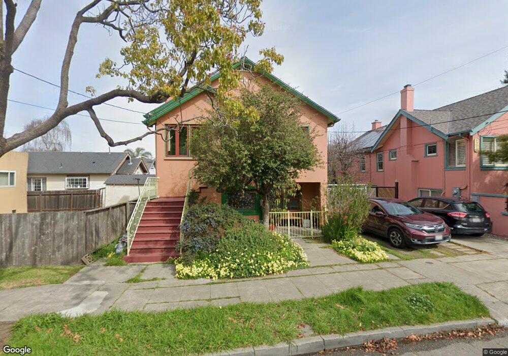
1269 Hearst Ave Berkeley, CA 94702
West Berkeley NeighborhoodEstimated Value: $879,000 - $1,741,619
6
Beds
2
Baths
2,629
Sq Ft
$518/Sq Ft
Est. Value
About This Home
This home is located at 1269 Hearst Ave, Berkeley, CA 94702 and is currently estimated at $1,362,405, approximately $518 per square foot. 1269 Hearst Ave is a home located in Alameda County with nearby schools including Rosa Parks Elementary School, Ruth Acty Elementary, and Berkeley Arts Magnet at Whittier School.
Ownership History
Date
Name
Owned For
Owner Type
Purchase Details
Closed on
May 20, 2015
Sold by
Deangelis Mino and De Angelis Fusako
Bought by
De Angelis Family Living Trust
Current Estimated Value
Purchase Details
Closed on
May 16, 2002
Sold by
Deangelis Mino and Deangelis Fusako
Bought by
Deangelis Mino and Deangelis Fusako
Purchase Details
Closed on
Jan 12, 2000
Sold by
Deangelis Mino and Deangelis Fusako
Bought by
Deangelis Mino and Deangelis Fusako
Create a Home Valuation Report for This Property
The Home Valuation Report is an in-depth analysis detailing your home's value as well as a comparison with similar homes in the area
Home Values in the Area
Average Home Value in this Area
Purchase History
| Date | Buyer | Sale Price | Title Company |
|---|---|---|---|
| De Angelis Family Living Trust | -- | None Available | |
| Deangelis Mino | -- | -- | |
| Deangelis Mino | -- | -- |
Source: Public Records
Tax History
| Year | Tax Paid | Tax Assessment Tax Assessment Total Assessment is a certain percentage of the fair market value that is determined by local assessors to be the total taxable value of land and additions on the property. | Land | Improvement |
|---|---|---|---|---|
| 2025 | $8,023 | $244,290 | $138,027 | $113,263 |
| 2024 | $8,023 | $239,364 | $135,321 | $111,043 |
| 2023 | $7,756 | $241,533 | $132,668 | $108,865 |
| 2022 | $7,466 | $229,798 | $130,067 | $106,731 |
| 2021 | $7,422 | $225,155 | $127,517 | $104,638 |
| 2020 | $6,839 | $229,774 | $126,209 | $103,565 |
| 2019 | $6,357 | $225,270 | $123,735 | $101,535 |
| 2018 | $6,186 | $220,853 | $121,309 | $99,544 |
| 2017 | $5,941 | $216,524 | $118,931 | $97,593 |
| 2016 | $5,593 | $212,278 | $116,599 | $95,679 |
| 2015 | $5,486 | $209,091 | $114,848 | $94,243 |
| 2014 | -- | $204,996 | $112,599 | $92,397 |
Source: Public Records
Map
Nearby Homes
- 1919 Curtis St
- 1728 Curtis St
- 1128 Delaware St
- 1322 Virginia St
- 1631 Belvedere Ave
- 1411 Hearst Ave Unit 2
- 2144 Curtis St
- 1813 Sacramento St
- 1013 Addison St
- 2013 9th St
- 940 Delaware St
- 995 Virginia St
- 1368 Rose St
- 2118 California St
- 2324 Browning St
- 1504 10th St
- 2241 Ninth St
- 1578 Allston Way
- 2327 10th St Unit 4
- 1050 Allston Way
- 1273 Hearst Ave
- 1821 Chestnut St
- 1817 Chestnut St
- 1825 Chestnut St
- 1275 Hearst Ave
- 1815 Chestnut St
- 1277 Hearst Ave
- 1811 Chestnut St
- 1901 Chestnut St
- 1809 Chestnut St
- 1274A Delaware St
- 1820 Chestnut St
- 1822 Chestnut St
- 1822 Chestnut St
- 1266 Hearst Ave
- 1285 Hearst Ave
- 1270 Hearst Ave
- 1274 Delaware St
- 1274 Hearst Ave
- 1905 Chestnut St
Your Personal Tour Guide
Ask me questions while you tour the home.