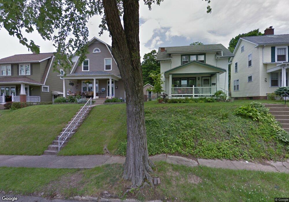
127 Marks Ave Lancaster, OH 43130
Estimated Value: $226,848 - $246,000
3
Beds
2
Baths
1,320
Sq Ft
$179/Sq Ft
Est. Value
About This Home
This home is located at 127 Marks Ave, Lancaster, OH 43130 and is currently estimated at $235,712, approximately $178 per square foot. 127 Marks Ave is a home located in Fairfield County with nearby schools including Tarhe Elementary School, General Sherman Junior High School, and Lancaster High School.
Ownership History
Date
Name
Owned For
Owner Type
Purchase Details
Closed on
Jul 23, 2020
Sold by
Dean Brian N and Dean Wendy L
Bought by
Kirchgessner Isaiah L
Current Estimated Value
Home Financials for this Owner
Home Financials are based on the most recent Mortgage that was taken out on this home.
Original Mortgage
$147,925
Outstanding Balance
$129,734
Interest Rate
3%
Mortgage Type
New Conventional
Estimated Equity
$105,978
Purchase Details
Closed on
Jan 9, 1998
Sold by
Klontz Carl F
Bought by
Dean Brian N and Dean Wendy L
Home Financials for this Owner
Home Financials are based on the most recent Mortgage that was taken out on this home.
Original Mortgage
$74,400
Interest Rate
7.26%
Mortgage Type
New Conventional
Purchase Details
Closed on
Dec 1, 1987
Create a Home Valuation Report for This Property
The Home Valuation Report is an in-depth analysis detailing your home's value as well as a comparison with similar homes in the area
Home Values in the Area
Average Home Value in this Area
Purchase History
| Date | Buyer | Sale Price | Title Company |
|---|---|---|---|
| Kirchgessner Isaiah L | $152,500 | None Available | |
| Dean Brian N | $93,000 | -- | |
| -- | $58,000 | -- |
Source: Public Records
Mortgage History
| Date | Status | Borrower | Loan Amount |
|---|---|---|---|
| Open | Kirchgessner Isaiah L | $147,925 | |
| Previous Owner | Dean Brian N | $74,400 |
Source: Public Records
Tax History
| Year | Tax Paid | Tax Assessment Tax Assessment Total Assessment is a certain percentage of the fair market value that is determined by local assessors to be the total taxable value of land and additions on the property. | Land | Improvement |
|---|---|---|---|---|
| 2025 | $4,738 | $73,070 | $17,640 | $55,430 |
| 2024 | $4,738 | $52,700 | $10,580 | $42,120 |
| 2023 | $1,918 | $52,700 | $10,580 | $42,120 |
| 2022 | $1,926 | $52,700 | $10,580 | $42,120 |
| 2021 | $1,570 | $40,230 | $8,820 | $31,410 |
| 2020 | $1,502 | $39,710 | $8,820 | $30,890 |
| 2019 | $1,412 | $39,710 | $8,820 | $30,890 |
| 2018 | $1,304 | $31,300 | $8,820 | $22,480 |
| 2017 | $1,308 | $34,950 | $10,290 | $24,660 |
| 2016 | $1,274 | $34,950 | $10,290 | $24,660 |
| 2015 | $1,275 | $33,940 | $10,290 | $23,650 |
| 2014 | $1,215 | $33,940 | $10,290 | $23,650 |
| 2013 | $1,215 | $33,940 | $10,290 | $23,650 |
Source: Public Records
Map
Nearby Homes
- 148 Marks Ave
- 1156 Forest Rose Ave
- 0 Hillside Ave
- 0 Marks Ave Unit 225036443
- 330 Park St
- 130 W Fair Ave
- 336 Reber Ave
- 0 Wacker Dr Unit 225036189
- 820 N Broad St
- 165 Lake St
- 123 Arnold Ave
- 17 Red Bud Ln
- 202 Wildwood Ave
- 1000 Goodwin Ave
- 311 E Allen St
- 526 N Columbus St
- 600 N High St
- 233 E 6th Ave
- 515 N Columbus St
- 1836 Glenmar Dr
Your Personal Tour Guide
Ask me questions while you tour the home.