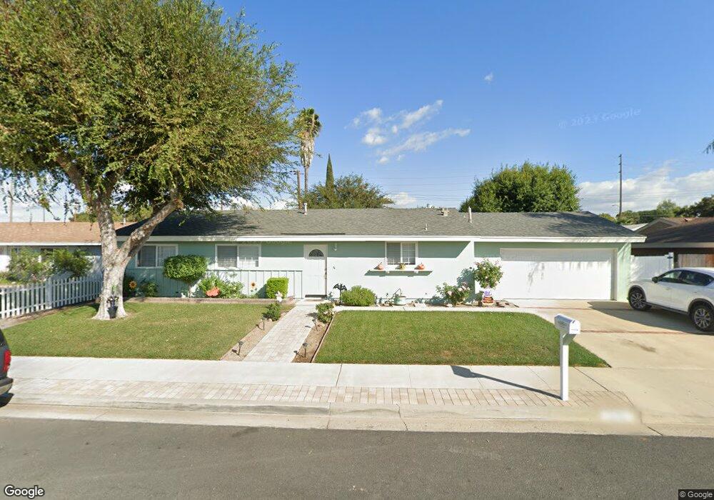
1276 Lawrence Cir Simi Valley, CA 93065
West Simi Valley NeighborhoodEstimated Value: $628,000 - $742,000
About This Home
This home is located at 1276 Lawrence Cir, Simi Valley, CA 93065 and is currently estimated at $689,081, approximately $562 per square foot. 1276 Lawrence Cir is a home located in Ventura County with nearby schools including Berylwood Elementary School, Sinaloa Middle School, and Royal High School.
Ownership History
We collect this data history from publicly available records. To have your information removed, we recommend requesting removal directly through your county’s website.
Purchase Details
Purchase Details
Purchase Details
Home Values in the Area
Average Home Value in this Area
Purchase History
We collect this data history from publicly available records. To have your information removed, we recommend requesting removal directly through your county’s website.
| Date | Buyer | Sale Price | Title Company |
|---|---|---|---|
| -- | None Available | ||
| -- | -- | ||
| $158,000 | Chicago Title Co |
Mortgage History
We collect this data history from publicly available records. To have your information removed, we recommend requesting removal directly through your county’s website.
| Date | Status | Borrower | Loan Amount |
|---|---|---|---|
| Open | $260,000 | ||
| Closed | $240,000 | ||
| Closed | $241,000 | ||
| Closed | $260,000 | ||
| Closed | $231,000 | ||
| Closed | $198,000 | ||
| Closed | $194,059 |
Tax History
We collect this data history from publicly available records. To have your information removed, we recommend requesting removal directly through your county’s website.
| Year | Tax Paid | Tax Assessment Tax Assessment Total Assessment is a certain percentage of the fair market value that is determined by local assessors to be the total taxable value of land and additions on the property. | Land | Improvement |
|---|---|---|---|---|
| 2025 | $3,359 | $246,399 | $73,201 | $173,198 |
| 2024 | $3,359 | $241,568 | $71,766 | $169,802 |
| 2023 | $3,155 | $236,832 | $70,359 | $166,473 |
| 2022 | $3,118 | $232,189 | $68,980 | $163,209 |
| 2021 | $3,074 | $227,637 | $67,628 | $160,009 |
| 2020 | $2,996 | $225,305 | $66,936 | $158,369 |
| 2019 | $2,856 | $220,888 | $65,624 | $155,264 |
| 2018 | $2,817 | $216,558 | $64,338 | $152,220 |
| 2017 | $2,743 | $212,313 | $63,077 | $149,236 |
| 2016 | $2,614 | $208,151 | $61,841 | $146,310 |
| 2015 | $2,548 | $205,026 | $60,913 | $144,113 |
| 2014 | $2,498 | $201,012 | $59,721 | $141,291 |
Map
- 2025 Royal Ave
- 2094 Elizondo Ave
- 1582 Dakin Ave
- 1948 Heywood St Unit L
- 1932 Heywood St Unit B
- 1573 Arcane St
- 2053 Malcolm St
- 1561 Arcane St
- 1904 Heywood St Unit L
- 995 Vallejo Ave
- 2118 Rosecrans St
- 992 Vallejo Ave
- 988 Vallejo Ave
- 1963 Covington Ave
- 1548 Wallace St
- 1232 Whitcomb Ave
- 1690 Heywood St Unit C
- 2041 Covington Ave
- 1755 Heywood St Unit 106
- 1755 Heywood St Unit 203
- 1262 Lawrence Cir
- 1277 Erringer Rd
- 1291 Erringer Rd
- 1263 Erringer Rd
- 1279 Lawrence Cir
- 1248 Lawrence Cir
- 1267 Lawrence Cir
- 1291 Lawrence Cir
- 1249 Erringer Rd
- 1895 Sutter Ave
- 1234 Lawrence Cir
- 1258 Able Cir
- 1309 Erringer Rd
- 1276 Able Cir
- 1243 Lawrence Cir
- 1855 Kearney Ave
- 1235 Erringer Rd
- 1889 Sutter Ave
- 1220 Lawrence Cir
- 1325 Erringer Rd
Ask me questions while you tour the home.