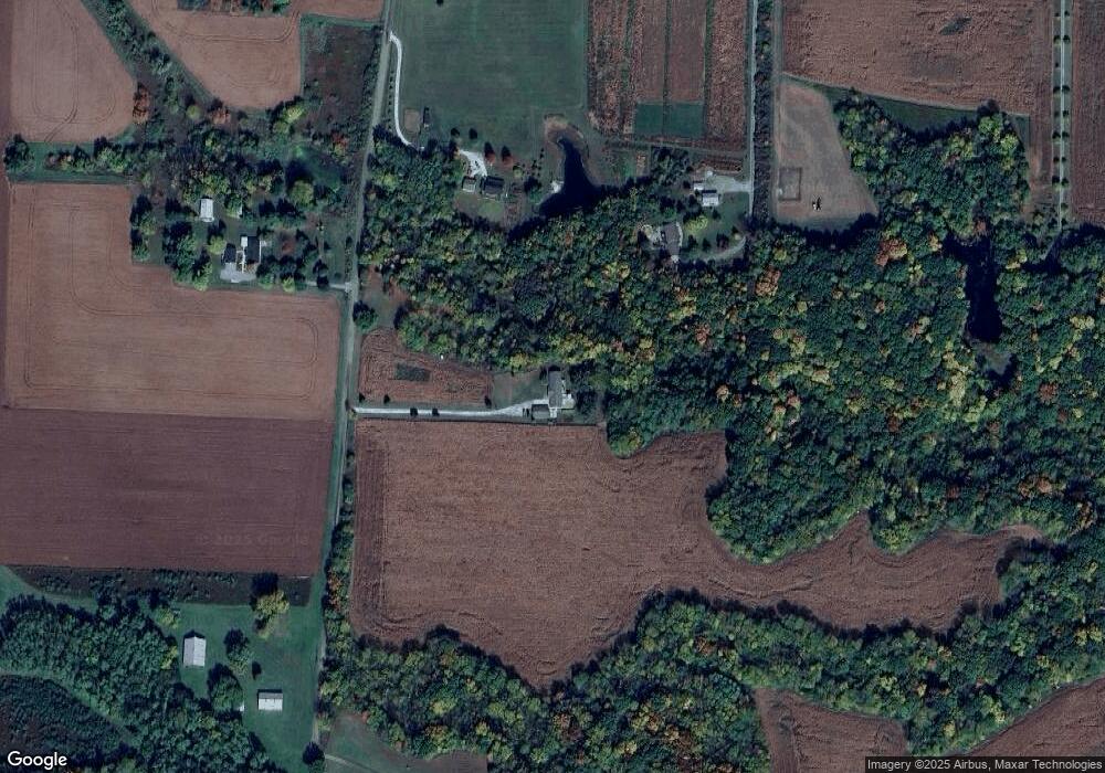
12764 Solomon Rd de Witt, IL 61735
Estimated Value: $373,000 - $427,488
4
Beds
4
Baths
1,344
Sq Ft
$298/Sq Ft
Est. Value
About This Home
This home is located at 12764 Solomon Rd, de Witt, IL 61735 and is currently estimated at $400,244, approximately $297 per square foot. 12764 Solomon Rd is a home located in De Witt County with nearby schools including Clinton High School.
Ownership History
Date
Name
Owned For
Owner Type
Purchase Details
Closed on
Oct 20, 2017
Sold by
Mcgee Ryan E and Mcgee Sada A
Bought by
Trudeau Dylan and Gramm Moriah
Current Estimated Value
Home Financials for this Owner
Home Financials are based on the most recent Mortgage that was taken out on this home.
Original Mortgage
$255,290
Outstanding Balance
$217,650
Interest Rate
4.62%
Mortgage Type
FHA
Estimated Equity
$182,594
Create a Home Valuation Report for This Property
The Home Valuation Report is an in-depth analysis detailing your home's value as well as a comparison with similar homes in the area
Home Values in the Area
Average Home Value in this Area
Purchase History
| Date | Buyer | Sale Price | Title Company |
|---|---|---|---|
| Trudeau Dylan | $260,000 | Frontier Title |
Source: Public Records
Mortgage History
| Date | Status | Borrower | Loan Amount |
|---|---|---|---|
| Open | Trudeau Dylan | $255,290 |
Source: Public Records
Tax History Compared to Growth
Tax History
| Year | Tax Paid | Tax Assessment Tax Assessment Total Assessment is a certain percentage of the fair market value that is determined by local assessors to be the total taxable value of land and additions on the property. | Land | Improvement |
|---|---|---|---|---|
| 2024 | $5,933 | $105,665 | $5,499 | $100,166 |
| 2023 | $5,352 | $95,930 | $4,704 | $91,226 |
| 2022 | $4,997 | $90,490 | $4,428 | $86,062 |
| 2021 | $4,756 | $87,840 | $4,285 | $83,555 |
| 2020 | $4,962 | $87,824 | $4,269 | $83,555 |
| 2019 | $5,046 | $87,808 | $4,253 | $83,555 |
| 2018 | $4,906 | $85,740 | $4,143 | $81,597 |
| 2017 | $3,729 | $65,213 | $3,976 | $61,237 |
| 2016 | $3,688 | $63,925 | $3,889 | $60,036 |
| 2015 | $3,694 | $63,915 | $3,879 | $60,036 |
| 2014 | $3,694 | $63,897 | $3,861 | $60,036 |
| 2013 | -- | $63,891 | $3,855 | $60,036 |
Source: Public Records
Map
Nearby Homes
- 215 Chicago St
- 269 Chicago St
- 52 Moss Dr
- 10 Moss Dr
- 11 Moss Dr
- 1000 Clinton Ave E
- 4 Moss Lake Rd
- 1008 Bloomington St
- 21027 Prairie Chapel Rd
- 000 Adam Rd
- 7705 Lakewood Rd
- 302 Mockingbird Ln
- 112 Fox Run Ct
- 114 Fox Run Ct
- 108 Cardinal Dr
- 14477 U S Highway 51
- 100 S 4th St
- 000 Lot 6 Sunset Dr
- 000 Lot 4 Sunset Dr
- 000 Lot 5 Sunset Dr
- 12764 Solomon Rd
- 17234 Toad Hill Rd
- 12954 Solomon Rd
- 12825 Solomon Rd
- 16972 Toad Hill Rd
- 17400 Toad Hill Rd
- 12588 Solomon Rd
- 12435 Solomon Rd
- 12311 Solomon Rd
- 17601 Farmers Rd
- 13235 Sportsman Rd
- 12247 Solomon Rd
- 12655 Cardinal Rd
- 12485 Cardinal Rd
- 0 Cardinal Rd Unit 2170808
- 0 Cardinal Rd Unit 10223130
- 17185 Parnell Rd
- 17185 Parnell Rd
- 16791 Parnell Rd
- 12200 Pear Tree Rd
