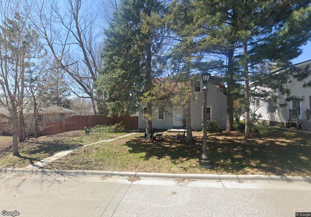
1277 Kent St Saint Paul, MN 55117
North End NeighborhoodEstimated Value: $301,000 - $348,000
3
Beds
2
Baths
844
Sq Ft
$385/Sq Ft
Est. Value
About This Home
This home is located at 1277 Kent St, Saint Paul, MN 55117 and is currently estimated at $324,872, approximately $384 per square foot. 1277 Kent St is a home located in Ramsey County with nearby schools including Como Park Elementary School, Murray Middle School, and Como Park Senior High School.
Ownership History
Date
Name
Owned For
Owner Type
Purchase Details
Closed on
May 27, 2016
Sold by
Zugschwert Christopher and Zugschwert Alison R
Bought by
Intemann Joshua A and Intemann Nichole M
Current Estimated Value
Home Financials for this Owner
Home Financials are based on the most recent Mortgage that was taken out on this home.
Original Mortgage
$179,120
Outstanding Balance
$142,976
Interest Rate
3.66%
Estimated Equity
$181,896
Purchase Details
Closed on
Mar 18, 2011
Sold by
Haulish Jean Ann and Rehbeik Patricia Regina
Bought by
Zugschwert Christopher
Create a Home Valuation Report for This Property
The Home Valuation Report is an in-depth analysis detailing your home's value as well as a comparison with similar homes in the area
Home Values in the Area
Average Home Value in this Area
Purchase History
| Date | Buyer | Sale Price | Title Company |
|---|---|---|---|
| Intemann Joshua A | $223,900 | Stewart Title Company | |
| Zugschwert Christopher | $72,500 | -- |
Source: Public Records
Mortgage History
| Date | Status | Borrower | Loan Amount |
|---|---|---|---|
| Open | Intemann Joshua A | $179,120 |
Source: Public Records
Tax History Compared to Growth
Tax History
| Year | Tax Paid | Tax Assessment Tax Assessment Total Assessment is a certain percentage of the fair market value that is determined by local assessors to be the total taxable value of land and additions on the property. | Land | Improvement |
|---|---|---|---|---|
| 2025 | $4,894 | $310,500 | $50,000 | $260,500 |
| 2023 | $4,894 | $299,800 | $50,000 | $249,800 |
| 2022 | $4,198 | $302,500 | $50,000 | $252,500 |
| 2021 | $3,792 | $244,300 | $50,000 | $194,300 |
| 2020 | $3,706 | $245,300 | $50,300 | $195,000 |
| 2019 | $3,664 | $232,800 | $50,300 | $182,500 |
| 2018 | $3,062 | $217,100 | $50,300 | $166,800 |
| 2017 | $1,578 | $200,100 | $50,300 | $149,800 |
| 2016 | $2,154 | $0 | $0 | $0 |
| 2015 | $1,792 | $104,100 | $50,300 | $53,800 |
| 2014 | $1,754 | $0 | $0 | $0 |
Source: Public Records
Map
Nearby Homes
- tbd MacKubin St
- 1342 Dale St N
- 1241 Maywood St
- 1165 Norton St
- 1176 Norton St
- 1175 Arundel St
- 1464 Maywood St
- 397 Cottage Ave W Unit 3
- 1104 MacKubin St
- 1457 Arundel St
- 408 Arlington Ave W
- 766 Maryland Ave W
- 1063 Dale St N
- 1049 Kent St
- 1539 Dale St N
- 1083 Western Ave N
- 1005 Como Blvd E
- 1110 Virginia St
- 1222 Como Blvd E
- 705 Como Ave
- 1283 Kent St
- 1271 Kent St
- 1287 Kent St
- 1287 1287 Kent-Street-
- 569 Orange Ave W
- 1291 Kent St
- 1276 Danforth St
- 1272 Danforth St
- 1291 1291 Kent-Street-
- 1284 Danforth St
- 559 Orange Ave W
- 1278 Kent St
- 1264 Danforth St
- 1295 Kent St
- 1286 Kent St
- 1286 1286 Kent-Street-
- 1290 Kent St
- 1294 Danforth St
- 545 Orange Ave W
- 1294 1294 Kent-Street-