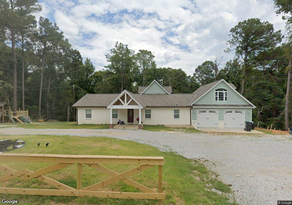
128 County Road 217 Oxford, MS 38655
Estimated Value: $252,000 - $1,428,971
Studio
1
Bath
1,226
Sq Ft
$477/Sq Ft
Est. Value
About This Home
This home is located at 128 County Road 217, Oxford, MS 38655 and is currently estimated at $585,243, approximately $477 per square foot. 128 County Road 217 is a home located in Lafayette County with nearby schools including Della Davidson Elementary School, Bramlett Elementary School, and Central Elementary School.
Ownership History
Date
Name
Owned For
Owner Type
Purchase Details
Closed on
Nov 7, 2024
Sold by
Punkin Water Association Inc
Bought by
City Of Oxford
Current Estimated Value
Purchase Details
Closed on
Oct 3, 2022
Sold by
James E Davis Revocable Trust
Bought by
Sohom Lorenzo and Chapeta Manuela
Purchase Details
Closed on
Apr 13, 2006
Sold by
Oxford University Bank
Bought by
Frye Gregory Gene and Frye Jennifer Renee
Home Financials for this Owner
Home Financials are based on the most recent Mortgage that was taken out on this home.
Original Mortgage
$41,730
Interest Rate
6.31%
Mortgage Type
Unknown
Create a Home Valuation Report for This Property
The Home Valuation Report is an in-depth analysis detailing your home's value as well as a comparison with similar homes in the area
Purchase History
| Date | Buyer | Sale Price | Title Company |
|---|---|---|---|
| City Of Oxford | -- | None Listed On Document | |
| Sohom Lorenzo | -- | -- | |
| Frye Gregory Gene | -- | None Available |
Source: Public Records
Mortgage History
| Date | Status | Borrower | Loan Amount |
|---|---|---|---|
| Previous Owner | Frye Gregory Gene | $41,730 |
Source: Public Records
Tax History
| Year | Tax Paid | Tax Assessment Tax Assessment Total Assessment is a certain percentage of the fair market value that is determined by local assessors to be the total taxable value of land and additions on the property. | Land | Improvement |
|---|---|---|---|---|
| 2025 | $330 | $3,203 | $0 | $0 |
| 2024 | $330 | $3,152 | $0 | $0 |
| 2023 | $332 | $3,269 | $0 | $0 |
| 2022 | $337 | $10,337 | $0 | $0 |
| 2021 | $409 | $10,473 | $0 | $0 |
| 2020 | $465 | $12,266 | $0 | $0 |
| 2019 | $471 | $12,422 | $0 | $0 |
| 2018 | $476 | $12,558 | $0 | $0 |
| 2017 | $470 | $12,402 | $0 | $0 |
| 2016 | $425 | $11,549 | $0 | $0 |
| 2015 | -- | $11,237 | $0 | $0 |
| 2014 | -- | $10,964 | $0 | $0 |
Source: Public Records
Map
Nearby Homes
- 203 Bur Oak Cove
- 915 Georgia Oak Cove
- 930 Georgia Oak Cove
- 800 Bear Oak Pointe
- 918 Georgia Oak Cove
- 924 Georgia Oak Cove
- 1018 Nuttall Oak Dr
- 804 Bear Oak Pointe
- 926 Georgia Oak Cove
- 1014 Nuttall Oak Dr
- 1021 Nuttall Oak Dr
- 1010 Nuttall Oak Dr
- 1012 Nuttall Oak Dr
- 1017 Nuttall Oak Dr
- 1023 Nuttall Oak Dr
- 920 Georgia Oak Cove
- 923 Georgia Oak Cove
- 927 Georgia Oak Cove
- 203 Mississippi 6
- 0
- 30 County Road 217
- 19 County Road 236
- 9 County Road 236
- 20 County Road 236
- 22 County Road 236
- 5 County Road 236
- 5 Cr 236
- 6 County Road 236
- 106 County Road 217
- 104 County Road 217
- 104 County Road 217
- 98 County Road 217
- 112 C R 217
- 98 C R 217
- 112 County Road 217
- 114 County Road 217
- 104 C R 217
- 106 C R 217
- 107 C R 217
- 92 County Road 217
Your Personal Tour Guide
Ask me questions while you tour the home.