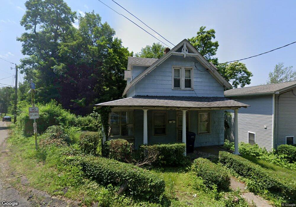
128 Platt St Ansonia, CT 06401
Estimated Value: $159,000 - $295,000
3
Beds
1
Bath
792
Sq Ft
$301/Sq Ft
Est. Value
About This Home
This home is located at 128 Platt St, Ansonia, CT 06401 and is currently estimated at $238,351, approximately $300 per square foot. 128 Platt St is a home located in New Haven County with nearby schools including Ansonia Middle School, Ansonia High School, and St Mary & St Michael School.
Ownership History
Date
Name
Owned For
Owner Type
Purchase Details
Closed on
Sep 14, 2000
Sold by
Haney Jeffrey
Bought by
Kingston Peter D
Current Estimated Value
Home Financials for this Owner
Home Financials are based on the most recent Mortgage that was taken out on this home.
Original Mortgage
$40,000
Interest Rate
8.07%
Purchase Details
Closed on
Dec 6, 1999
Sold by
Kingston Alfred C
Bought by
Haney Jeffrey
Home Financials for this Owner
Home Financials are based on the most recent Mortgage that was taken out on this home.
Original Mortgage
$28,000
Interest Rate
11.75%
Create a Home Valuation Report for This Property
The Home Valuation Report is an in-depth analysis detailing your home's value as well as a comparison with similar homes in the area
Home Values in the Area
Average Home Value in this Area
Purchase History
| Date | Buyer | Sale Price | Title Company |
|---|---|---|---|
| Kingston Peter D | $50,000 | -- | |
| Haney Jeffrey | $35,000 | -- |
Source: Public Records
Mortgage History
| Date | Status | Borrower | Loan Amount |
|---|---|---|---|
| Closed | Haney Jeffrey | $39,000 | |
| Closed | Haney Jeffrey | $40,000 | |
| Previous Owner | Haney Jeffrey | $28,000 |
Source: Public Records
Tax History
| Year | Tax Paid | Tax Assessment Tax Assessment Total Assessment is a certain percentage of the fair market value that is determined by local assessors to be the total taxable value of land and additions on the property. | Land | Improvement |
|---|---|---|---|---|
| 2025 | $2,816 | $98,630 | $41,300 | $57,330 |
| 2024 | $2,613 | $98,630 | $41,300 | $57,330 |
| 2023 | $2,588 | $98,630 | $41,300 | $57,330 |
| 2022 | $2,552 | $67,500 | $33,600 | $33,900 |
| 2021 | $2,552 | $67,500 | $33,600 | $33,900 |
| 2020 | $2,552 | $67,500 | $33,600 | $33,900 |
| 2019 | $2,552 | $67,500 | $33,600 | $33,900 |
| 2018 | $2,519 | $67,500 | $33,600 | $33,900 |
| 2017 | $2,672 | $71,600 | $38,600 | $33,000 |
| 2016 | $2,672 | $71,600 | $38,600 | $33,000 |
| 2015 | $2,686 | $71,600 | $38,600 | $33,000 |
| 2014 | $2,764 | $71,600 | $38,600 | $33,000 |
| 2013 | $2,817 | $71,600 | $38,600 | $33,000 |
Source: Public Records
Map
Nearby Homes
- 32 Spring St
- 20 Columbia St
- 84 Hodge Ave
- 4 Beverly Dr
- 6 Fairview St
- 4 N Spring St
- 25 Beechwood Dr
- 273 Derby Ave Unit 507
- 91 Division St
- 7 Cook St
- 94 Sunset Dr
- 26 Farrel Dr
- 100 Mount Pleasant St
- 40 Iannotti Ln
- 4 Fairview Terrace
- 110 Beaver St
- 55 David Humphrey Rd
- 81 Myrtle Ave
- 28 Mclaughlin Terrace
- 226-228 Seymour Ave
Your Personal Tour Guide
Ask me questions while you tour the home.