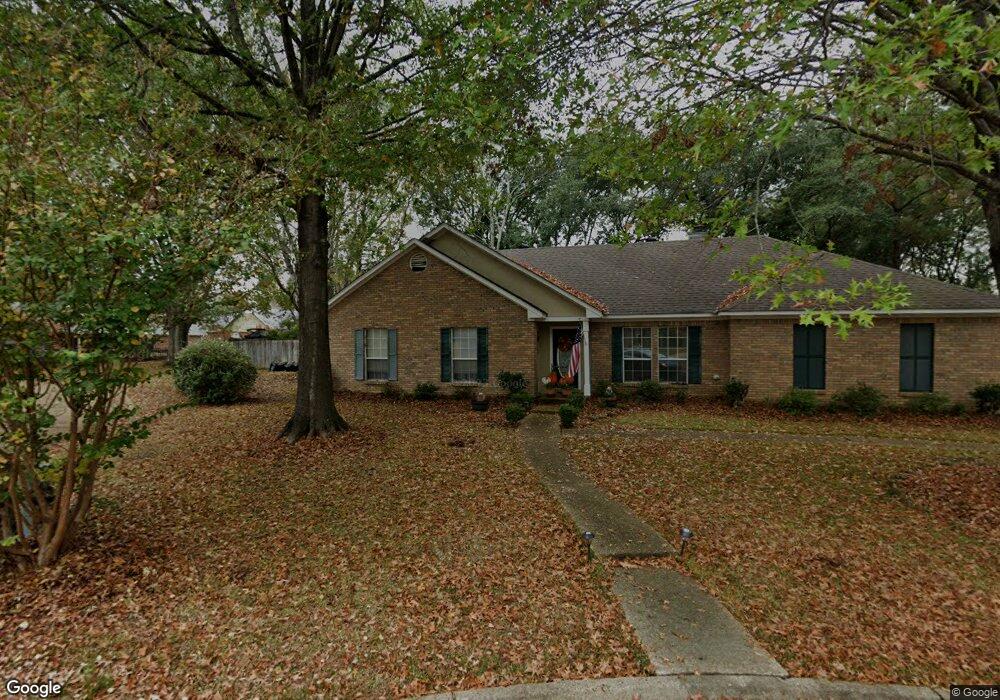
128 St Regis Dr Madison, MS 39110
Estimated Value: $673,000 - $928,000
--
Bed
--
Bath
4,362
Sq Ft
$179/Sq Ft
Est. Value
About This Home
This home is located at 128 St Regis Dr, Madison, MS 39110 and is currently estimated at $780,760, approximately $178 per square foot. 128 St Regis Dr is a home with nearby schools including Madison Avenue Upper Elementary School, Madison Avenue Elementary, and Madison Middle School.
Ownership History
Date
Name
Owned For
Owner Type
Purchase Details
Closed on
Jan 3, 2014
Sold by
Cedarstone Construction Corp
Bought by
Sample Christopher and Sample Brooke
Current Estimated Value
Home Financials for this Owner
Home Financials are based on the most recent Mortgage that was taken out on this home.
Original Mortgage
$291,000
Outstanding Balance
$218,843
Interest Rate
4.29%
Mortgage Type
New Conventional
Estimated Equity
$561,917
Purchase Details
Closed on
Oct 3, 2013
Sold by
Es&K Warren Properties Llc
Bought by
Cedarstone Construction Corp
Purchase Details
Closed on
May 15, 2013
Sold by
Florence Investment Corp
Bought by
Es&K Properties Llc
Create a Home Valuation Report for This Property
The Home Valuation Report is an in-depth analysis detailing your home's value as well as a comparison with similar homes in the area
Home Values in the Area
Average Home Value in this Area
Purchase History
| Date | Buyer | Sale Price | Title Company |
|---|---|---|---|
| Sample Christopher | -- | None Available | |
| Cedarstone Construction Corp | -- | First Guaranty Title Inc | |
| Es&K Properties Llc | -- | First Guaranty Title Inc |
Source: Public Records
Mortgage History
| Date | Status | Borrower | Loan Amount |
|---|---|---|---|
| Open | Sample Christopher | $291,000 |
Source: Public Records
Tax History Compared to Growth
Tax History
| Year | Tax Paid | Tax Assessment Tax Assessment Total Assessment is a certain percentage of the fair market value that is determined by local assessors to be the total taxable value of land and additions on the property. | Land | Improvement |
|---|---|---|---|---|
| 2024 | $4,997 | $45,459 | $0 | $0 |
| 2023 | $4,997 | $45,459 | $0 | $0 |
| 2022 | $4,997 | $45,459 | $0 | $0 |
| 2021 | $4,781 | $43,604 | $0 | $0 |
| 2020 | $4,834 | $44,053 | $0 | $0 |
| 2019 | $4,834 | $44,053 | $0 | $0 |
| 2018 | $4,834 | $44,053 | $0 | $0 |
| 2017 | $4,746 | $43,299 | $0 | $0 |
| 2016 | $4,746 | $43,299 | $0 | $0 |
| 2015 | $4,746 | $43,299 | $0 | $0 |
| 2014 | $682 | $5,850 | $0 | $0 |
Source: Public Records
Map
Nearby Homes
- 0 Sundial Rd Unit 4104072
- 202 Saint Pierre Cove
- 268 Sundial Rd
- 557 Spring Hill Dr
- 204 Street Charlotte Cove
- 418 Wildwood Pointe
- 423 W Oak Cir
- 123 Klaas Blvd
- 865 Wellington Way
- 108 Oak Ridge Cir
- 265 Woodland Brook Dr
- 116 Hampton Way
- 1005 Laramie Ct
- 109 Carrington Dr
- 133 Oak Ridge Cir
- 106 Wethersfield Dr
- Lot 4 Chantilly Dr
- 1128 Windrose Cir
- 0 Cottesbrooke Cir Unit 4122984
- 28 Deerfield Dr
- 130 St Regis Dr
- 126 St Regis Dr
- 100 St Livie Ct
- 132 St Regis Dr
- 124 St Regis Dr
- 101 St Livie Ct
- 102 St Livie Ct
- 137 St Regis Dr
- 134 Saint Regis Dr
- 134 St Regis Dr
- 103 St Livie Ct
- 200 St Charlotte Cove
- 200 St Charlotte Cove
- 202 St Charlotte Cove
- 136 St Regis Dr
- 104 St Livie Ct
- 100 St Charlotte Ct
- 105 St Livie Ct
- 223 Sundial Rd
- 138 St Regis Dr