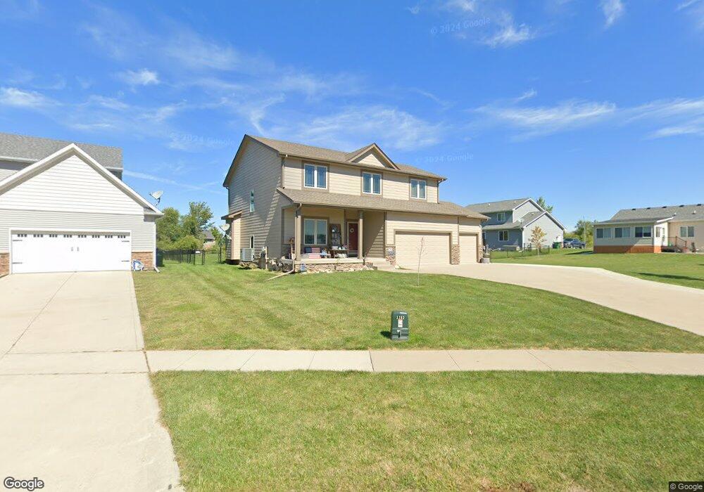
1282 Adams St SE Bondurant, IA 50035
Estimated Value: $373,000 - $391,243
4
Beds
3
Baths
2,252
Sq Ft
$169/Sq Ft
Est. Value
About This Home
This home is located at 1282 Adams St SE, Bondurant, IA 50035 and is currently estimated at $380,311, approximately $168 per square foot. 1282 Adams St SE is a home with nearby schools including Morris Elementary School, Anderson Elementary School, and Bondurant-Farrar Junior High.
Ownership History
Date
Name
Owned For
Owner Type
Purchase Details
Closed on
Sep 30, 2025
Sold by
Rowe Jason Nathaniel
Bought by
Newton-Rowe Nicole Christine
Current Estimated Value
Purchase Details
Closed on
Oct 6, 2011
Sold by
Simple Things Llc
Bought by
Rowe Jason N and Rowe Nicole C
Home Financials for this Owner
Home Financials are based on the most recent Mortgage that was taken out on this home.
Original Mortgage
$220,500
Interest Rate
4.12%
Mortgage Type
Future Advance Clause Open End Mortgage
Create a Home Valuation Report for This Property
The Home Valuation Report is an in-depth analysis detailing your home's value as well as a comparison with similar homes in the area
Home Values in the Area
Average Home Value in this Area
Purchase History
| Date | Buyer | Sale Price | Title Company |
|---|---|---|---|
| Newton-Rowe Nicole Christine | -- | None Listed On Document | |
| Rowe Jason N | $38,500 | None Available |
Source: Public Records
Mortgage History
| Date | Status | Borrower | Loan Amount |
|---|---|---|---|
| Previous Owner | Rowe Jason N | $220,500 |
Source: Public Records
Tax History Compared to Growth
Tax History
| Year | Tax Paid | Tax Assessment Tax Assessment Total Assessment is a certain percentage of the fair market value that is determined by local assessors to be the total taxable value of land and additions on the property. | Land | Improvement |
|---|---|---|---|---|
| 2025 | $6,232 | $391,200 | $72,600 | $318,600 |
| 2024 | $6,232 | $358,300 | $65,500 | $292,800 |
| 2023 | $6,172 | $358,300 | $65,500 | $292,800 |
| 2022 | $6,138 | $296,400 | $56,000 | $240,400 |
| 2021 | $6,388 | $296,400 | $56,000 | $240,400 |
| 2020 | $6,314 | $279,800 | $52,900 | $226,900 |
| 2019 | $5,540 | $279,800 | $52,900 | $226,900 |
| 2018 | $4,730 | $256,300 | $47,500 | $208,800 |
| 2017 | $3,460 | $256,300 | $47,500 | $208,800 |
| 2016 | $2,676 | $230,000 | $42,200 | $187,800 |
| 2015 | $2,676 | $230,000 | $42,200 | $187,800 |
| 2014 | $5,124 | $221,700 | $40,300 | $181,400 |
Source: Public Records
Map
Nearby Homes
- 500 15th St SE
- 1004 Dee St SE
- Hamilton Plan at Prairie Point View
- 901 Dee St SE
- 509 Fireside Dr NW
- 800 9th Ct SE
- 1110 Caitlin Dr SE
- 816 9th Ct SE
- 705 Jefferson Ave SE
- 505 Cleveland Ave SE
- LT 2 Ja-Mar Village
- 1301 Caitlin Ct SE
- LT 6 Ja-Mar Village
- 1209 Caitlin Dr SE
- 1 NE 80th St
- 706 Pleasant St SE
- 112 Blaine St NW
- 420 Eva Point Dr SW
- 00 2nd St NW
- 901 8th St NW
- 1286 Adams St SE
- 1248 Lincoln St SE
- 1309 Adams St SE
- 1290 Adams St SE
- 1252 Lincoln St SE
- 1244 Lincoln St SE
- 1256 Lincoln St SE
- 1300 Adams St SE
- 1313 Adams St SE
- 1305 Adams St SE
- 1317 Adams St SE
- 1301 Adams St SE
- 1304 Adams St SE
- 708 14th St SE
- 1253 Lincoln St SE
- 712 14th St SE
- 1257 Lincoln St SE
- 1261 Lincoln St SE
- 801 13th St SE
- 1300 Audrey St SE