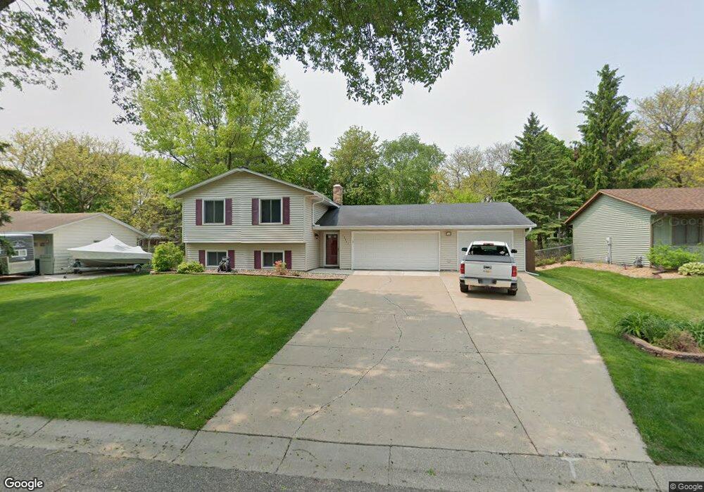
12847 Euclid Ave Saint Paul, MN 55124
Scott Highlands NeighborhoodEstimated Value: $366,000 - $405,000
4
Beds
2
Baths
879
Sq Ft
$443/Sq Ft
Est. Value
About This Home
This home is located at 12847 Euclid Ave, Saint Paul, MN 55124 and is currently estimated at $389,749, approximately $443 per square foot. 12847 Euclid Ave is a home located in Dakota County with nearby schools including Highland Elementary School, Falcon Ridge Middle School, and Eastview Senior High School.
Ownership History
Date
Name
Owned For
Owner Type
Purchase Details
Closed on
May 22, 2025
Sold by
Jackels Michael and Jackels Michelle
Bought by
Jackels Michael and Jackels Michelle
Current Estimated Value
Purchase Details
Closed on
May 14, 2013
Sold by
Jackels Brian
Bought by
Jackels Michael
Purchase Details
Closed on
Mar 28, 2007
Sold by
Lambie Wallace J and Lambie Sharon A
Bought by
Jacobs Michael and Jacobs Brian
Home Financials for this Owner
Home Financials are based on the most recent Mortgage that was taken out on this home.
Original Mortgage
$160,000
Interest Rate
6.2%
Mortgage Type
New Conventional
Create a Home Valuation Report for This Property
The Home Valuation Report is an in-depth analysis detailing your home's value as well as a comparison with similar homes in the area
Home Values in the Area
Average Home Value in this Area
Purchase History
| Date | Buyer | Sale Price | Title Company |
|---|---|---|---|
| Jackels Michael | $500 | None Listed On Document | |
| Jackels Michael | -- | None Available | |
| Jacobs Michael | $232,500 | -- |
Source: Public Records
Mortgage History
| Date | Status | Borrower | Loan Amount |
|---|---|---|---|
| Previous Owner | Jacobs Michael | $160,000 |
Source: Public Records
Tax History Compared to Growth
Tax History
| Year | Tax Paid | Tax Assessment Tax Assessment Total Assessment is a certain percentage of the fair market value that is determined by local assessors to be the total taxable value of land and additions on the property. | Land | Improvement |
|---|---|---|---|---|
| 2024 | $4,012 | $345,000 | $105,800 | $239,200 |
| 2023 | $4,012 | $357,200 | $106,000 | $251,200 |
| 2022 | $3,442 | $353,700 | $105,700 | $248,000 |
| 2021 | $3,298 | $302,800 | $91,900 | $210,900 |
| 2020 | $3,296 | $285,200 | $87,500 | $197,700 |
| 2019 | $2,982 | $277,000 | $83,400 | $193,600 |
| 2018 | $2,811 | $263,600 | $79,400 | $184,200 |
| 2017 | $2,739 | $240,100 | $75,600 | $164,500 |
| 2016 | $2,704 | $223,800 | $72,000 | $151,800 |
| 2015 | $2,560 | $201,470 | $64,949 | $136,521 |
| 2014 | -- | $191,987 | $62,079 | $129,908 |
| 2013 | -- | $179,997 | $56,808 | $123,189 |
Source: Public Records
Map
Nearby Homes
- 13169X Diamond Path
- 12740 Eveleth Path
- 12640 Eveleth Path
- 12785 Edinbrook Path
- 13150 Elderberry Ct
- 13000 Echo Ln
- 12932 Echo Ln
- 5040 127th St W
- 12816 Falcon Dr
- 6118 132nd St W
- 12888 Falcon Dr
- 13641 Everton Ave
- 12451 Drayton Trail
- 12459 Drayton Trail
- 13213 Ferris Ave
- 12443 Drayton Trail
- 12439 Drayton Trail
- 12855 Dory Ave
- Inverness II Plan at The Villas at Applewood Pointe - Villa II Collection
- Stirling II Plan at The Villas at Applewood Pointe - Villa II Collection
- 12884 Eveleth Ave
- 12844 Eveleth Ave
- 12887 Euclid Ave
- 12807 Euclid Ave
- 12846 Euclid Ave
- 12904 Eveleth Ave
- 12866 Euclid Ave
- 12826 Euclid Ave
- 12824 Eveleth Ave
- 12886 Euclid Ave
- 5500 128th St W
- 12907 Euclid Ave
- 12924 Eveleth Ave
- 12806 Euclid Ave
- 12906 Euclid Ave
- 12892 Essex Way
- 12865 Eveleth Ave
- 12885 Eveleth Ave
- 12804 Eveleth Ave
- 12886 Essex Way