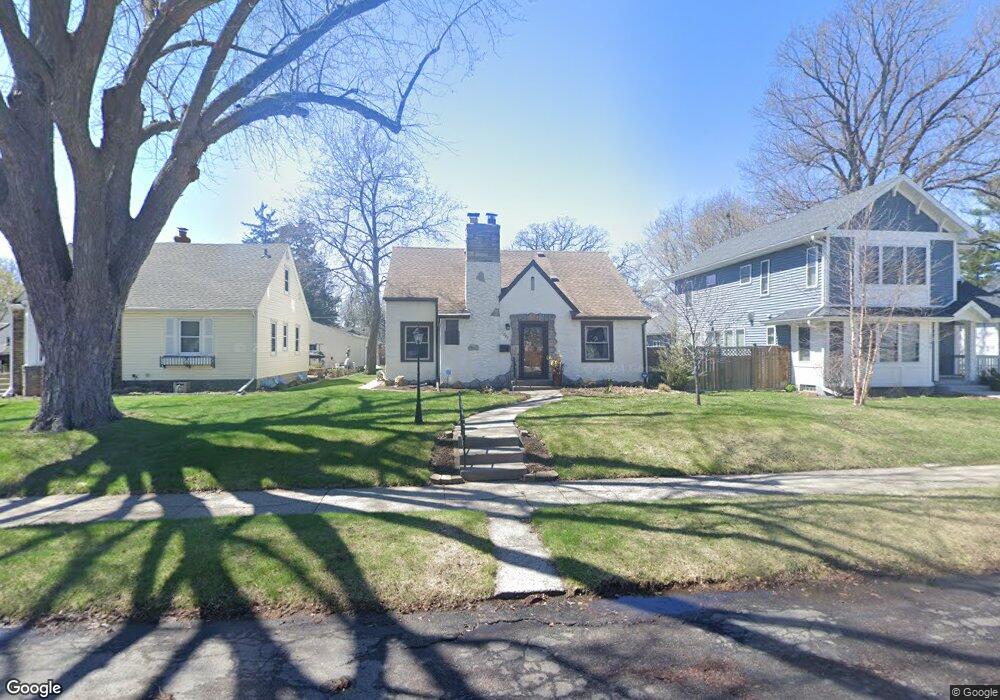
1285 Folsom St Saint Paul, MN 55117
Como Park NeighborhoodEstimated Value: $401,000 - $498,000
3
Beds
2
Baths
1,366
Sq Ft
$321/Sq Ft
Est. Value
About This Home
This home is located at 1285 Folsom St, Saint Paul, MN 55117 and is currently estimated at $439,105, approximately $321 per square foot. 1285 Folsom St is a home located in Ramsey County with nearby schools including Como Park Elementary School, Murray Middle School, and Como Park Senior High School.
Ownership History
Date
Name
Owned For
Owner Type
Purchase Details
Closed on
Sep 4, 2014
Sold by
Mattison Daniel N and Mattison Constance H
Bought by
Vanschyndel William D and Vanschyndel Karen S
Current Estimated Value
Home Financials for this Owner
Home Financials are based on the most recent Mortgage that was taken out on this home.
Original Mortgage
$223,200
Outstanding Balance
$170,937
Interest Rate
4.15%
Mortgage Type
New Conventional
Estimated Equity
$268,168
Purchase Details
Closed on
Nov 15, 1996
Sold by
Johnson Mary Q and Rjay Penelope M J
Bought by
Krumrie Constance H and Mattison Daniel N
Create a Home Valuation Report for This Property
The Home Valuation Report is an in-depth analysis detailing your home's value as well as a comparison with similar homes in the area
Home Values in the Area
Average Home Value in this Area
Purchase History
| Date | Buyer | Sale Price | Title Company |
|---|---|---|---|
| Vanschyndel William D | $287,454 | Network Title Inc | |
| Krumrie Constance H | $104,900 | -- |
Source: Public Records
Mortgage History
| Date | Status | Borrower | Loan Amount |
|---|---|---|---|
| Open | Vanschyndel William D | $223,200 |
Source: Public Records
Tax History Compared to Growth
Tax History
| Year | Tax Paid | Tax Assessment Tax Assessment Total Assessment is a certain percentage of the fair market value that is determined by local assessors to be the total taxable value of land and additions on the property. | Land | Improvement |
|---|---|---|---|---|
| 2025 | $5,962 | $435,500 | $60,000 | $375,500 |
| 2023 | $5,962 | $384,900 | $60,000 | $324,900 |
| 2022 | $5,300 | $379,700 | $60,000 | $319,700 |
| 2021 | $5,200 | $332,700 | $60,000 | $272,700 |
| 2020 | $5,444 | $338,200 | $60,000 | $278,200 |
| 2019 | $5,082 | $329,800 | $55,000 | $274,800 |
| 2018 | $4,636 | $305,900 | $55,000 | $250,900 |
| 2017 | $4,236 | $289,100 | $46,400 | $242,700 |
| 2016 | $4,372 | $0 | $0 | $0 |
| 2015 | $3,476 | $273,900 | $46,400 | $227,500 |
| 2014 | $3,618 | $0 | $0 | $0 |
Source: Public Records
Map
Nearby Homes
- 1222 Como Blvd E
- 766 Maryland Ave W
- 1005 Como Blvd E
- 1241 Maywood St
- 1342 Dale St N
- 1464 Maywood St
- 1084 Ryde St
- 740 Como Ave
- 1063 Dale St N
- tbd MacKubin St
- 1539 Dale St N
- 705 Como Ave
- 1038 Colne St
- 1083 Chatsworth St N
- 989 Barrett St
- 1049 Kent St
- 1165 Norton St
- 1174 Lexington Pkwy N
- 1176 Norton St
- 1104 MacKubin St
- 1291 Folsom St
- 1281 Folsom St
- 1275 Folsom St
- 1299 Folsom St
- 1299 1299 Folsom-Street-
- 1288 Avon St N
- 1284 Avon St N
- 1292 Avon St N
- 1278 Avon St N
- 1298 Avon St N
- 1307 Folsom St
- 1286 Folsom St
- 1290 Folsom St
- 1269 Folsom St
- 1302 Avon St N
- 1298 Folsom St
- 1276 Folsom St
- 779 Wheelock Pkwy W
- 1302 Folsom St
- 1309 Folsom St