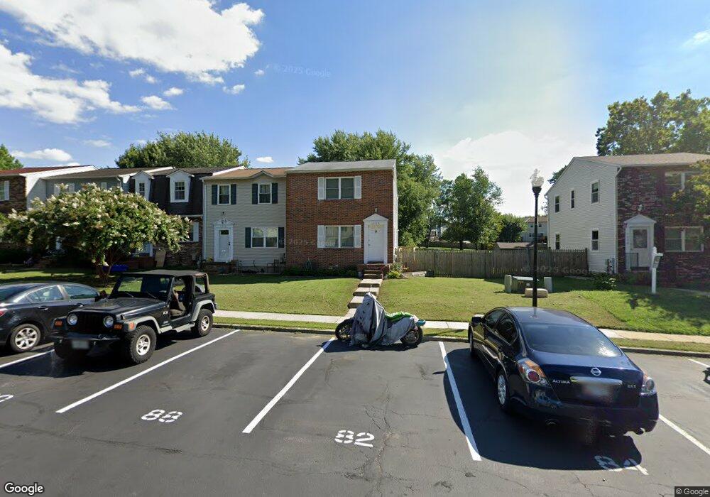
1288 Holmespun Dr Pasadena, MD 21122
Estimated Value: $332,000 - $358,000
Studio
3
Baths
1,240
Sq Ft
$275/Sq Ft
Est. Value
About This Home
This home is located at 1288 Holmespun Dr, Pasadena, MD 21122 and is currently estimated at $341,070, approximately $275 per square foot. 1288 Holmespun Dr is a home located in Anne Arundel County with nearby schools including High Point Elementary School, Northeast Middle School, and Northeast High School.
Ownership History
Date
Name
Owned For
Owner Type
Purchase Details
Closed on
Mar 5, 2021
Sold by
Barone Steven C and Barone Lori
Bought by
Barone Steven C and Chesney Kristine E
Current Estimated Value
Home Financials for this Owner
Home Financials are based on the most recent Mortgage that was taken out on this home.
Original Mortgage
$221,815
Outstanding Balance
$200,163
Interest Rate
3.1%
Mortgage Type
New Conventional
Estimated Equity
$140,907
Purchase Details
Closed on
Aug 31, 2001
Sold by
Snyder Michael D
Bought by
Barone Steven C and Barone Lisa
Purchase Details
Closed on
Feb 9, 1996
Sold by
Merkle William W
Bought by
Snyder Michael D and Snyder Charles J
Create a Home Valuation Report for This Property
The Home Valuation Report is an in-depth analysis detailing your home's value as well as a comparison with similar homes in the area
Home Values in the Area
Average Home Value in this Area
Purchase History
| Date | Buyer | Sale Price | Title Company |
|---|---|---|---|
| Barone Steven C | -- | First Equity Title | |
| Barone Steven C | $114,900 | -- | |
| Snyder Michael D | $102,000 | -- |
Source: Public Records
Mortgage History
| Date | Status | Borrower | Loan Amount |
|---|---|---|---|
| Open | Barone Steven C | $221,815 | |
| Closed | Snyder Michael D | -- |
Source: Public Records
Tax History
| Year | Tax Paid | Tax Assessment Tax Assessment Total Assessment is a certain percentage of the fair market value that is determined by local assessors to be the total taxable value of land and additions on the property. | Land | Improvement |
|---|---|---|---|---|
| 2025 | $3,098 | $252,467 | -- | -- |
| 2024 | $3,098 | $242,400 | $115,000 | $127,400 |
| 2023 | $2,971 | $233,800 | $0 | $0 |
| 2022 | $2,730 | $225,200 | $0 | $0 |
| 2020 | $2,592 | $215,933 | $0 | $0 |
| 2019 | $2,588 | $215,267 | $0 | $0 |
| 2018 | $2,176 | $214,600 | $95,000 | $119,600 |
| 2017 | $2,434 | $206,300 | $0 | $0 |
| 2016 | -- | $198,000 | $0 | $0 |
| 2015 | -- | $189,700 | $0 | $0 |
| 2014 | -- | $189,700 | $0 | $0 |
Source: Public Records
Map
Nearby Homes
- 8649 Cobscook Harbour
- 1042 Cape Splitt Harbour
- 7722 Vena Ct
- 1217 Valley Rd
- 1056 Saybrook Harbour
- 1202 Hillcreek Rd
- 7662 Pine Haven Dr
- 961 Mount Desert Harbour
- 7665 Cedar Dr
- 7686 Briar Ln
- 969 10th St
- 7818 Renshaw Rd
- 7715 Woodlawn Ave
- 7713 Woodlawn Ave
- 101 Cottage Grove Dr
- 941 8th St
- 7913 Kings Bench Place
- 852 Riverside Dr
- 8561 Kim Marie Ct
- 128 Cottage Grove Dr
- 1286 Holmespun Dr
- 1290 Holmespun Dr
- 1284 Holmespun Dr
- 1292 Holmespun Dr
- 1282 Holmespun Dr
- 1294 Holmespun Dr
- 1280 Holmespun Dr
- 1296 Holmespun Dr
- 1298 Holmespun Dr
- 1260 Holmespun Dr
- 1258 Holmespun Dr
- 1262 Holmespun Dr
- 1264 Holmespun Dr
- 1256 Holmespun Dr
- 1278 Holmespun Dr
- 1254 Holmespun Dr
- 1266 Holmespun Dr
- 1276 Holmespun Dr
- 1252 Holmespun Dr
- 1274 Holmespun Dr
Your Personal Tour Guide
Ask me questions while you tour the home.