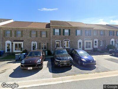
129 Cannonball Ln Newark, DE 19702
Bear NeighborhoodEstimated Value: $296,000 - $384,000
3
Beds
3
Baths
1,375
Sq Ft
$234/Sq Ft
Est. Value
About This Home
This home is located at 129 Cannonball Ln, Newark, DE 19702 and is currently estimated at $322,200, approximately $234 per square foot. 129 Cannonball Ln is a home located in New Castle County with nearby schools including Marshall (Thurgood) Elementary School, Christiana High School, and Kirk (George V.) Middle School.
Ownership History
Date
Name
Owned For
Owner Type
Purchase Details
Closed on
Nov 16, 2009
Sold by
Miller Kia A and Gaines Kia A
Bought by
Davis Keisha M
Current Estimated Value
Home Financials for this Owner
Home Financials are based on the most recent Mortgage that was taken out on this home.
Original Mortgage
$186,558
Interest Rate
4.98%
Mortgage Type
FHA
Purchase Details
Closed on
Sep 26, 2002
Sold by
Brown Emmanuel Valerie
Bought by
Miller Kia A
Home Financials for this Owner
Home Financials are based on the most recent Mortgage that was taken out on this home.
Original Mortgage
$123,000
Interest Rate
6.25%
Create a Home Valuation Report for This Property
The Home Valuation Report is an in-depth analysis detailing your home's value as well as a comparison with similar homes in the area
Home Values in the Area
Average Home Value in this Area
Purchase History
| Date | Buyer | Sale Price | Title Company |
|---|---|---|---|
| Davis Keisha M | $190,000 | None Available | |
| Miller Kia A | $126,900 | -- |
Source: Public Records
Mortgage History
| Date | Status | Borrower | Loan Amount |
|---|---|---|---|
| Open | Davis Keisha M | $253,662 | |
| Closed | Davis Keisha | $25,000 | |
| Closed | Davis Keisha M | $177,452 | |
| Closed | Davis Keisha M | $14,289 | |
| Closed | Davis Keisha M | $186,558 | |
| Previous Owner | Miller Kia A | $50,000 | |
| Previous Owner | Miller Kia | $35,000 | |
| Previous Owner | Miller Kia A | $123,000 |
Source: Public Records
Tax History Compared to Growth
Tax History
| Year | Tax Paid | Tax Assessment Tax Assessment Total Assessment is a certain percentage of the fair market value that is determined by local assessors to be the total taxable value of land and additions on the property. | Land | Improvement |
|---|---|---|---|---|
| 2024 | $2,435 | $55,400 | $8,200 | $47,200 |
| 2023 | $2,371 | $55,400 | $8,200 | $47,200 |
| 2022 | $2,354 | $55,400 | $8,200 | $47,200 |
| 2021 | $2,304 | $55,400 | $8,200 | $47,200 |
| 2020 | $2,241 | $55,400 | $8,200 | $47,200 |
| 2019 | $2,295 | $55,400 | $8,200 | $47,200 |
| 2018 | $1,943 | $55,400 | $8,200 | $47,200 |
| 2017 | $1,876 | $55,400 | $8,200 | $47,200 |
| 2016 | $1,861 | $55,400 | $8,200 | $47,200 |
| 2015 | $1,702 | $55,400 | $8,200 | $47,200 |
| 2014 | $1,703 | $55,400 | $8,200 | $47,200 |
Source: Public Records
Map
Nearby Homes
- 317 Goldsmith Ln
- 28 Thomas Jefferson Blvd
- 111 Woodshade Dr
- 306 Basswood Dr
- 614 Timber Wood Blvd
- 51 Verdi Cir
- 13 Sumac Ct
- 12 W Kapok Dr
- 7 Tiverton Cir
- 12 Rogers Cir
- 4 Defoe Cir
- 155 Galleon Dr
- 514 Blackbird Dr
- 229 Smalleys Dam Rd
- 28 Denny Cir
- 109 Giles Ct
- 33 Whitson Dr
- 119 Balmoral Way
- 106 Pattie Dr
- 16 Ross Ct
- 129 Cannonball Ln
- 131 Cannonball Ln
- 127 Cannonball Ln
- 133 Cannonball Ln
- 125 Cannonball Ln
- 123 Cannonball Ln
- 135 Cannonball Ln
- 121 Cannonball Ln
- 119 Cannonball Ln
- 117 Cannonball Ln
- 114 Cannonball Ln
- 116 Cannonball Ln
- 118 Cannonball Ln
- 112 Cannonball Ln
- 115 Cannonball Ln
- 120 Cannonball Ln
- 110 Cannonball Ln
- 122 Cannonball Ln
- 124 Cannonball Ln
- 108 Cannonball Ln