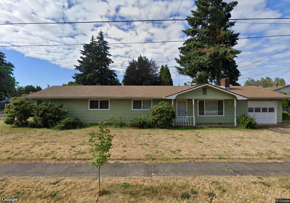
1296 Calvin St Eugene, OR 97401
Harlow NeighborhoodEstimated Value: $536,000 - $578,000
4
Beds
2
Baths
1,772
Sq Ft
$313/Sq Ft
Est. Value
About This Home
This home is located at 1296 Calvin St, Eugene, OR 97401 and is currently estimated at $554,415, approximately $312 per square foot. 1296 Calvin St is a home located in Lane County with nearby schools including Holt Elementary School, Monroe Middle School, and Sheldon High School.
Ownership History
Date
Name
Owned For
Owner Type
Purchase Details
Closed on
Feb 2, 2021
Sold by
Bell Charles Wade
Bought by
Lochenvar Enterprises
Current Estimated Value
Purchase Details
Closed on
Sep 1, 2005
Sold by
Dilts Patricia Lynn and Dilts Edith M
Bought by
Bell Charles Wade
Home Financials for this Owner
Home Financials are based on the most recent Mortgage that was taken out on this home.
Original Mortgage
$102,000
Interest Rate
5.27%
Mortgage Type
Fannie Mae Freddie Mac
Purchase Details
Closed on
Jan 30, 1998
Sold by
Dilts Edith M
Bought by
Dilts Patricia Lynn
Create a Home Valuation Report for This Property
The Home Valuation Report is an in-depth analysis detailing your home's value as well as a comparison with similar homes in the area
Home Values in the Area
Average Home Value in this Area
Purchase History
| Date | Buyer | Sale Price | Title Company |
|---|---|---|---|
| Lochenvar Enterprises | -- | None Available | |
| Bell Charles Wade | $225,000 | Fidelity National Title Insu | |
| Dilts Patricia Lynn | -- | -- |
Source: Public Records
Mortgage History
| Date | Status | Borrower | Loan Amount |
|---|---|---|---|
| Previous Owner | Bell Charles Wade | $102,000 |
Source: Public Records
Tax History
| Year | Tax Paid | Tax Assessment Tax Assessment Total Assessment is a certain percentage of the fair market value that is determined by local assessors to be the total taxable value of land and additions on the property. | Land | Improvement |
|---|---|---|---|---|
| 2025 | $5,173 | $265,481 | -- | -- |
| 2024 | $5,108 | $257,749 | -- | -- |
| 2023 | $5,108 | $250,242 | $0 | $0 |
| 2022 | $4,786 | $242,954 | $0 | $0 |
| 2021 | $4,495 | $235,878 | $0 | $0 |
| 2020 | $4,511 | $229,008 | $0 | $0 |
| 2019 | $4,356 | $222,338 | $0 | $0 |
| 2018 | $4,101 | $209,576 | $0 | $0 |
| 2017 | $3,917 | $209,576 | $0 | $0 |
| 2016 | $3,697 | $203,472 | $0 | $0 |
| 2015 | $3,557 | $197,546 | $0 | $0 |
| 2014 | $3,588 | $191,792 | $0 | $0 |
Source: Public Records
Map
Nearby Homes
- 1270 Calvin St
- 1271 Arcadia Dr
- 1491 Victorian Way
- 1038 President St
- 1564 Regency Dr
- 3700 Babcock Ln Unit 119
- 3700 Babcock Ln Unit 106
- 3025 Bailey Ln
- 0 Sprig Ln Unit Lot 3
- 0 Sprig Ln Unit Lot 3 766109892
- 3090 Willakenzie Rd
- 825 Waverly St
- 1794 Kings St N
- 2727 Gateway St Unit 27
- 2872 Suffolk Ct
- 446 Kodiak St
- 1993 Best Ln
- 950 Coburg Rd
- 2846 El Toro Ct
- 2994 Dapple Way
- 3510 Elwing Ave
- 1265 President St
- 3555 Elwing Ave
- 1297 Calvin St
- 1262 Calvin St
- 3513 Elwing Ave
- 1277 Calvin St
- 1235 President St
- 3625 Elwing Ave
- 3630 Elwing Ave
- 1290 President St
- 3386 Bailey Ln
- 3388 Bailey Ln
- 1260 President St
- 3545 Dulles Ave
- 3515 Dulles Ave
- 1257 Calvin St
- 1300 President St
- 3384 Bailey Ln
Your Personal Tour Guide
Ask me questions while you tour the home.