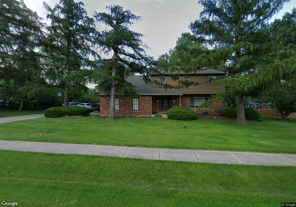
12S039 Book Rd Naperville, IL 60564
Wheatland South NeighborhoodEstimated Value: $467,319 - $566,000
--
Bed
1
Bath
2,515
Sq Ft
$206/Sq Ft
Est. Value
About This Home
This home is located at 12S039 Book Rd, Naperville, IL 60564 and is currently estimated at $518,580, approximately $206 per square foot. 12S039 Book Rd is a home with nearby schools including Ellsworth Elementary School, Gordon Gregory Middle School, and Neuqua Valley High School.
Ownership History
Date
Name
Owned For
Owner Type
Purchase Details
Closed on
Nov 11, 2020
Sold by
Sumeraj Stephen and Sumeraj Brigette J
Bought by
Sumeraj Stephen and Sumeraj Brigette J
Current Estimated Value
Purchase Details
Closed on
Nov 19, 1997
Sold by
Firstar Bank Illinois
Bought by
Sumeraj Stephen and Sumeraj Brigette J
Home Financials for this Owner
Home Financials are based on the most recent Mortgage that was taken out on this home.
Original Mortgage
$176,400
Outstanding Balance
$29,206
Interest Rate
7.38%
Estimated Equity
$489,374
Purchase Details
Closed on
Apr 15, 1993
Bought by
Sumeraj Stephen
Create a Home Valuation Report for This Property
The Home Valuation Report is an in-depth analysis detailing your home's value as well as a comparison with similar homes in the area
Home Values in the Area
Average Home Value in this Area
Purchase History
| Date | Buyer | Sale Price | Title Company |
|---|---|---|---|
| Sumeraj Stephen | -- | None Available | |
| Sumeraj Stephen | $196,000 | -- | |
| Sumeraj Stephen | $170,000 | -- |
Source: Public Records
Mortgage History
| Date | Status | Borrower | Loan Amount |
|---|---|---|---|
| Open | Sumeraj Stephen | $176,400 |
Source: Public Records
Tax History Compared to Growth
Tax History
| Year | Tax Paid | Tax Assessment Tax Assessment Total Assessment is a certain percentage of the fair market value that is determined by local assessors to be the total taxable value of land and additions on the property. | Land | Improvement |
|---|---|---|---|---|
| 2024 | $9,020 | $146,438 | $25,941 | $120,497 |
| 2023 | $9,020 | $129,362 | $22,916 | $106,446 |
| 2022 | $8,180 | $119,538 | $21,679 | $97,859 |
| 2021 | $7,793 | $113,846 | $20,647 | $93,199 |
| 2020 | $7,646 | $112,042 | $20,320 | $91,722 |
| 2019 | $7,508 | $108,884 | $19,747 | $89,137 |
| 2018 | $7,992 | $113,268 | $19,312 | $93,956 |
| 2017 | $7,882 | $110,343 | $18,813 | $91,530 |
| 2016 | $7,846 | $107,968 | $18,408 | $89,560 |
| 2015 | $7,229 | $103,815 | $17,700 | $86,115 |
| 2014 | $7,229 | $93,780 | $17,700 | $76,080 |
| 2013 | $7,229 | $93,780 | $17,700 | $76,080 |
Source: Public Records
Map
Nearby Homes
- 1804 Princess Cir
- 2255 Wendt Cir
- 1736 Robert Ln
- 29W316 Andermann Dr
- 3616 Eliot Ln
- 4007 Heron Ct Unit 1
- 1112 Saratoga Ct
- 3816 Rosada Dr
- 3432 Caine Dr
- 3212 Austin Ct
- 1116 Hollingswood Ave
- 3508 Tussell St
- 2711 Wait Rd
- 2949 Brossman St
- 3004 Bennett Dr
- 3707 Junebreeze Ln
- 2207 Sisters Ave
- 945 Winners Cup Ct Unit 945
- 3105 Saganashkee Ln
- 1987 Baldwin Way
- 12S019 Book Rd
- 12S059 Book Rd
- 12S038 Robert Dr
- 12S018 Robert Dr
- 12s Robert Dr
- 12S056 Robert Dr
- 12S050 Book Rd
- 12S039 Robert Dr
- 12S059 Robert Dr
- 12S019 Robert Dr
- 11S767 Book Rd
- 12S075 Robert Dr
- 11S766 Robert Dr
- 11S789 Robert Dr
- 29W012 103rd St
- 29W026 103rd St
- 1844 Robert Ln
- 29W040 103rd St
- 11S767 Robert Dr
- 11S749 Book Rd