
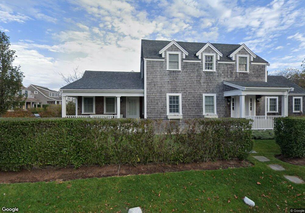
13 Derrymore Rd Nantucket, MA 02554
0.11
Acre
$9,318,182
Price per Acre
4,792
Sq Ft Lot
About This Lot
As of November 2018Not Listed in LINK
Property Details
Property Type
- Land
Est. Annual Taxes
- $13,406
Year Built
- 2013
Lot Details
- 4,792 Sq Ft Lot
- Property is zoned R10
Listing and Financial Details
- Assessor Parcel Number 125
Ownership History
Date
Name
Owned For
Owner Type
Purchase Details
Closed on
Feb 6, 2006
Sold by
English Ft and English
Bought by
Derrymore Equities Llc
Total Days on Market
0
Current Estimated Value
Map
Create a Home Valuation Report for This Property
The Home Valuation Report is an in-depth analysis detailing your home's value as well as a comparison with similar homes in the area
Similar Properties in Nantucket, MA
Home Values in the Area
Average Home Value in this Area
Purchase History
| Date | Type | Sale Price | Title Company |
|---|---|---|---|
| Land Court Massachusetts | $1,275,000 | -- | |
| Land Court Massachusetts | $1,275,000 | -- |
Source: Public Records
Mortgage History
| Date | Status | Loan Amount | Loan Type |
|---|---|---|---|
| Open | $2,118,750 | Purchase Money Mortgage | |
| Closed | $2,118,750 | Purchase Money Mortgage | |
| Closed | $0 | No Value Available |
Source: Public Records
Property History
| Date | Event | Price | Change | Sq Ft Price |
|---|---|---|---|---|
| 11/05/2018 11/05/18 | Sold | $2,825,000 | -3.4% | $928 / Sq Ft |
| 10/06/2018 10/06/18 | Pending | -- | -- | -- |
| 08/25/2018 08/25/18 | For Sale | $2,925,000 | +11.0% | $961 / Sq Ft |
| 09/21/2015 09/21/15 | Sold | $2,635,000 | -9.1% | $755 / Sq Ft |
| 08/22/2015 08/22/15 | Pending | -- | -- | -- |
| 05/20/2014 05/20/14 | For Sale | $2,899,000 | +182.8% | $831 / Sq Ft |
| 08/30/2013 08/30/13 | Sold | $1,025,000 | 0.0% | -- |
| 08/30/2013 08/30/13 | For Sale | $1,025,000 | +70.8% | -- |
| 06/01/2012 06/01/12 | Sold | $600,000 | -24.5% | -- |
| 05/02/2012 05/02/12 | Pending | -- | -- | -- |
| 05/31/2011 05/31/11 | For Sale | $795,000 | -- | -- |
Source: LINK
Tax History
| Year | Tax Paid | Tax Assessment Tax Assessment Total Assessment is a certain percentage of the fair market value that is determined by local assessors to be the total taxable value of land and additions on the property. | Land | Improvement |
|---|---|---|---|---|
| 2025 | $13,406 | $4,087,300 | $1,532,900 | $2,554,400 |
| 2024 | $12,681 | $4,051,300 | $1,532,900 | $2,518,400 |
| 2023 | $10,749 | $3,348,500 | $1,459,700 | $1,888,800 |
| 2022 | $9,902 | $2,647,600 | $1,216,400 | $1,431,200 |
| 2021 | $9,262 | $2,551,600 | $1,120,400 | $1,431,200 |
| 2020 | $9,056 | $2,625,000 | $1,120,400 | $1,504,600 |
| 2019 | $8,871 | $2,640,300 | $1,120,400 | $1,519,900 |
| 2018 | $7,931 | $2,505,800 | $1,120,400 | $1,385,400 |
| 2017 | $8,368 | $2,468,400 | $1,120,400 | $1,348,000 |
| 2016 | $6,098 | $1,814,900 | $640,200 | $1,174,700 |
| 2015 | $6,608 | $1,830,400 | $552,100 | $1,278,300 |
| 2014 | $2,076 | $552,100 | $552,100 | $0 |
Source: Public Records
Source: LINK
MLS Number: 78249
APN: NANT-000-041-000-000-0001-25-000-000
Nearby Homes
- 13 Derrymore Rd
- 6 Gingy Ln
- 47 W Chester St
- 15 Delaney Rd
- 60 Cliff Rd
- 49A W Chester St
- 8 Derry Ln
- 51 N Liberty St
- 4 Sunset Hill Ln
- 35 W Chester St
- 78 Cliff Rd
- 84 Cliff Rd
- 23 B W Chester St
- 19 Sherburne Turnpike
- 6 & 8 Sherburne Turnpike
- 27 N Liberty St
- 5 Stone Barn Way Unit D
- 7 Shady Ln
- 10 Cliff Rd
- 11 Meadow Ln