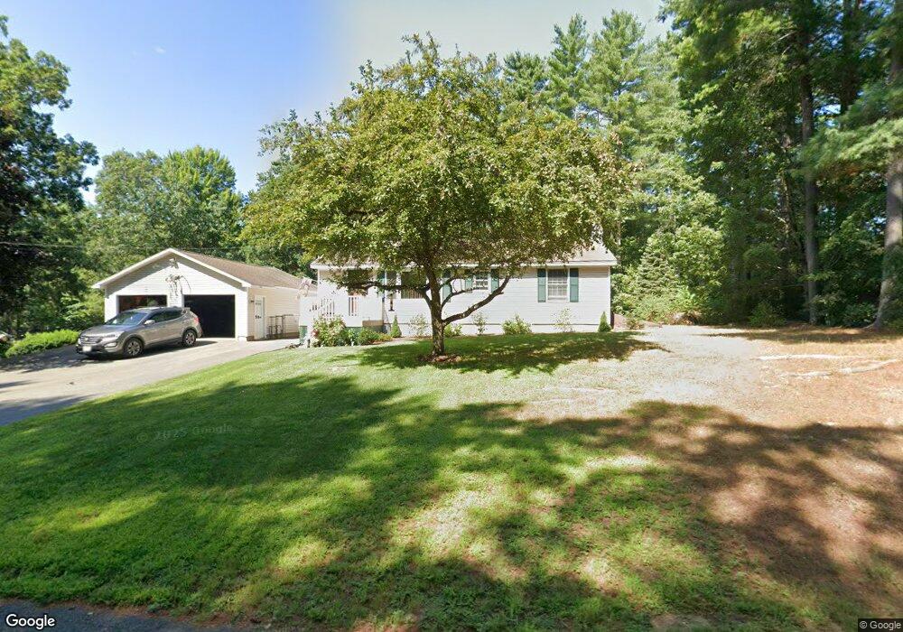
13 Memory Ln Orange, MA 01364
Estimated Value: $344,010 - $447,000
3
Beds
1
Bath
1,288
Sq Ft
$290/Sq Ft
Est. Value
About This Home
This home is located at 13 Memory Ln, Orange, MA 01364 and is currently estimated at $374,003, approximately $290 per square foot. 13 Memory Ln is a home located in Franklin County with nearby schools including Fisher Hill and Ralph C Mahar Regional School.
Ownership History
Date
Name
Owned For
Owner Type
Purchase Details
Closed on
Aug 30, 2023
Sold by
Songer Scott D
Bought by
Songer Scott D and Lozier Anne
Current Estimated Value
Purchase Details
Closed on
Jul 22, 1992
Sold by
Fed Natl Mtg Assn
Bought by
Songer Scott D and Songer Sandra L
Create a Home Valuation Report for This Property
The Home Valuation Report is an in-depth analysis detailing your home's value as well as a comparison with similar homes in the area
Home Values in the Area
Average Home Value in this Area
Purchase History
| Date | Buyer | Sale Price | Title Company |
|---|---|---|---|
| Songer Scott D | -- | None Available | |
| Songer Scott D | $72,900 | -- |
Source: Public Records
Mortgage History
| Date | Status | Borrower | Loan Amount |
|---|---|---|---|
| Previous Owner | Songer Scott D | $68,000 | |
| Previous Owner | Songer Scott D | $20,000 | |
| Previous Owner | Songer Scott D | $82,300 | |
| Previous Owner | Songer Scott D | $68,250 |
Source: Public Records
Tax History
| Year | Tax Paid | Tax Assessment Tax Assessment Total Assessment is a certain percentage of the fair market value that is determined by local assessors to be the total taxable value of land and additions on the property. | Land | Improvement |
|---|---|---|---|---|
| 2025 | $53 | $322,900 | $31,600 | $291,300 |
| 2024 | $4,885 | $280,100 | $31,600 | $248,500 |
| 2023 | $4,711 | $262,300 | $31,600 | $230,700 |
| 2022 | $4,401 | $230,200 | $31,600 | $198,600 |
| 2021 | $3,910 | $195,000 | $53,700 | $141,300 |
| 2020 | $3,848 | $189,300 | $53,300 | $136,000 |
| 2019 | $3,565 | $158,300 | $47,800 | $110,500 |
| 2018 | $3,399 | $154,900 | $47,000 | $107,900 |
| 2017 | $3,289 | $154,900 | $47,000 | $107,900 |
| 2016 | $3,318 | $152,900 | $47,000 | $105,900 |
| 2015 | $3,244 | $156,200 | $47,000 | $109,200 |
| 2014 | $3,154 | $159,800 | $47,000 | $112,800 |
Source: Public Records
Map
Nearby Homes
Your Personal Tour Guide
Ask me questions while you tour the home.