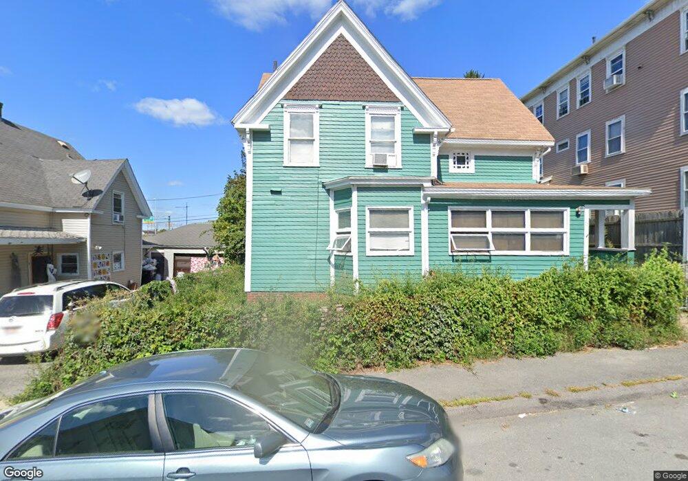
13 Whitney St Worcester, MA 01610
Vernon Hill NeighborhoodEstimated Value: $310,000 - $362,000
3
Beds
2
Baths
1,281
Sq Ft
$263/Sq Ft
Est. Value
About This Home
This home is located at 13 Whitney St, Worcester, MA 01610 and is currently estimated at $336,830, approximately $262 per square foot. 13 Whitney St is a home located in Worcester County with nearby schools including Quinsigamond School, Jacob Hiatt Magnet School, and Chandler Magnet.
Ownership History
Date
Name
Owned For
Owner Type
Purchase Details
Closed on
Jun 12, 2007
Sold by
Perch John
Bought by
Skazek John P and Perch John
Current Estimated Value
Purchase Details
Closed on
Dec 2, 1997
Sold by
Chysna Robert H and Chysna Donna M
Bought by
Perch John C
Home Financials for this Owner
Home Financials are based on the most recent Mortgage that was taken out on this home.
Original Mortgage
$38,000
Interest Rate
7.26%
Mortgage Type
Purchase Money Mortgage
Create a Home Valuation Report for This Property
The Home Valuation Report is an in-depth analysis detailing your home's value as well as a comparison with similar homes in the area
Home Values in the Area
Average Home Value in this Area
Purchase History
| Date | Buyer | Sale Price | Title Company |
|---|---|---|---|
| Skazek John P | -- | -- | |
| Perch John C | $47,500 | -- |
Source: Public Records
Mortgage History
| Date | Status | Borrower | Loan Amount |
|---|---|---|---|
| Previous Owner | Perch John C | $38,000 |
Source: Public Records
Tax History Compared to Growth
Tax History
| Year | Tax Paid | Tax Assessment Tax Assessment Total Assessment is a certain percentage of the fair market value that is determined by local assessors to be the total taxable value of land and additions on the property. | Land | Improvement |
|---|---|---|---|---|
| 2025 | $3,313 | $251,200 | $48,200 | $203,000 |
| 2024 | $3,127 | $227,400 | $48,200 | $179,200 |
| 2023 | $2,986 | $208,200 | $38,700 | $169,500 |
| 2022 | $2,785 | $183,100 | $30,900 | $152,200 |
| 2021 | $2,683 | $164,800 | $24,700 | $140,100 |
| 2020 | $2,519 | $148,200 | $24,800 | $123,400 |
| 2019 | $2,461 | $136,700 | $24,500 | $112,200 |
| 2018 | $2,439 | $129,000 | $24,500 | $104,500 |
| 2017 | $2,312 | $120,300 | $24,500 | $95,800 |
| 2016 | $2,420 | $117,400 | $20,700 | $96,700 |
| 2015 | $2,356 | $117,400 | $20,700 | $96,700 |
| 2014 | $2,294 | $117,400 | $20,700 | $96,700 |
Source: Public Records
Map
Nearby Homes
- 172 Perry Ave Unit 172-3B
- 78 Harlem St
- 16 Hillside St
- 26 Maxwell St
- 607 Cambridge St Unit 4
- 64 Stockton St
- 17 Riley St
- Lot 1 Stockton St
- 32 Ames St
- 96 Vernon St
- 20 Washburn St
- 13 Sigel St
- 33 Sigel St Unit B
- 39 Sigel St
- 6 Holcombe St
- 9 Winthrop St
- 1 N Woodford St
- 7 Winthrop St
- 49 Richland St
- 340 Harding St
- 15 Whitney St
- 9 Whitney St
- 19 Whitney St
- 10 Whitney St
- 8 Whitney St
- 8 Whitney Street Ct
- 12 Whitney St
- 12 Whitney St Unit 2
- 8 S Harlem St
- 8 S Harlem St Unit 1
- 6 Whitney St
- 6 S Harlem St
- 14 Whitney St
- 7 Diamond St
- 7 Diamond St Unit 3
- 569 Millbury St
- 5 Diamond St
- 4 S Harlem St
- 4 S Harlem St Unit 1
- 9 Diamond St