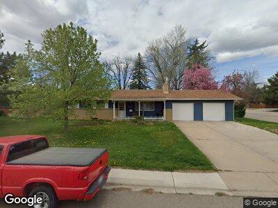
1301 Robertson St Fort Collins, CO 80524
University Acres NeighborhoodEstimated Value: $598,000 - $688,000
3
Beds
1
Bath
1,246
Sq Ft
$512/Sq Ft
Est. Value
About This Home
This home is located at 1301 Robertson St, Fort Collins, CO 80524 and is currently estimated at $638,531, approximately $512 per square foot. 1301 Robertson St is a home located in Larimer County with nearby schools including Laurel Elementary School, Lesher Middle School, and Fort Collins High School.
Ownership History
Date
Name
Owned For
Owner Type
Purchase Details
Closed on
Jun 28, 1999
Sold by
Ward Cynthia A
Bought by
Stansbury Robert Lynn and Shaughnessy Margaret Donella
Current Estimated Value
Home Financials for this Owner
Home Financials are based on the most recent Mortgage that was taken out on this home.
Original Mortgage
$92,500
Interest Rate
7.21%
Purchase Details
Closed on
Mar 1, 1995
Sold by
Ward Merla O
Bought by
Ward Merla O
Create a Home Valuation Report for This Property
The Home Valuation Report is an in-depth analysis detailing your home's value as well as a comparison with similar homes in the area
Home Values in the Area
Average Home Value in this Area
Purchase History
| Date | Buyer | Sale Price | Title Company |
|---|---|---|---|
| Stansbury Robert Lynn | -- | Land Title | |
| Stansbury Robert Lynn | $162,500 | Land Title | |
| Ward Merla O | -- | -- |
Source: Public Records
Mortgage History
| Date | Status | Borrower | Loan Amount |
|---|---|---|---|
| Closed | Stansbury Robert Lynn | $78,500 | |
| Closed | Stansbury Robert Lynn | $92,500 |
Source: Public Records
Tax History Compared to Growth
Tax History
| Year | Tax Paid | Tax Assessment Tax Assessment Total Assessment is a certain percentage of the fair market value that is determined by local assessors to be the total taxable value of land and additions on the property. | Land | Improvement |
|---|---|---|---|---|
| 2025 | $3,002 | $41,674 | $3,350 | $38,324 |
| 2024 | $2,857 | $41,674 | $3,350 | $38,324 |
| 2022 | $2,452 | $32,922 | $3,475 | $29,447 |
| 2021 | $3,142 | $33,870 | $3,575 | $30,295 |
| 2020 | $3,287 | $35,135 | $3,575 | $31,560 |
| 2019 | $3,302 | $35,135 | $3,575 | $31,560 |
| 2018 | $2,703 | $29,657 | $3,600 | $26,057 |
| 2017 | $2,694 | $29,657 | $3,600 | $26,057 |
| 2016 | $2,196 | $24,055 | $3,980 | $20,075 |
| 2015 | $2,180 | $24,060 | $3,980 | $20,080 |
| 2014 | $1,826 | $20,020 | $3,980 | $16,040 |
Source: Public Records
Map
Nearby Homes
- 1320 Lory St
- 1602 Robertson Unit D
- 1658 Freewheel Dr
- 1004 E Elizabeth St
- 605 E Prospect Rd
- 601 Garfield St
- 603 E Prospect Rd
- 718 Brookhaven Ct Unit F718
- 529 Deines Ct
- 1521 Whedbee St
- 1900 Seminole Dr
- 622 Lesser Dr
- 628 Endicott St
- 612 Lesser Dr
- 1128 Mchugh St
- 304 Garfield St
- 809 E Myrtle St
- 425 E Laurel St
- 717 Dartmouth Trail
- 1632 E Pitkin St
- 1301 Robertson St
- 1305 Robertson St
- 1300 Green St
- 1304 Green St
- 1300 Robertson St
- 1304 Robertson St
- 1308 Green St
- 1220 Green St
- 1313 Robertson St
- 1000 E Pitkin St
- 1221 Robertson St
- 1312 Green St
- 1301 Green St
- 1301 Lory St
- 1312 Robertson St
- 1216 Green St
- 1305 Green St
- 1305 Lory St
- 1317 Robertson St
- 1216 Robertson St