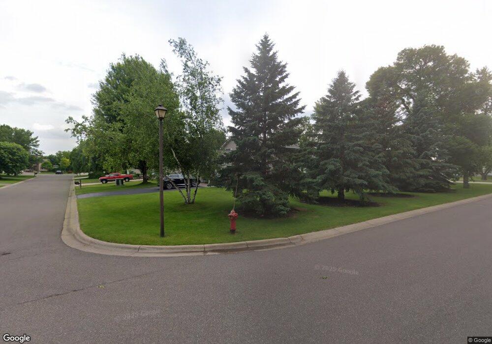
13091 Brookside Trail Rogers, MN 55374
Estimated Value: $410,000 - $486,000
4
Beds
4
Baths
1,804
Sq Ft
$247/Sq Ft
Est. Value
About This Home
This home is located at 13091 Brookside Trail, Rogers, MN 55374 and is currently estimated at $445,747, approximately $247 per square foot. 13091 Brookside Trail is a home located in Hennepin County with nearby schools including Rogers Elementary School, Rogers Middle School, and Rogers Senior High School.
Ownership History
Date
Name
Owned For
Owner Type
Purchase Details
Closed on
Nov 20, 2015
Sold by
Purdie Dennis and Purdie Melissa
Bought by
Purdie Dennis and Purdie Melissa
Current Estimated Value
Home Financials for this Owner
Home Financials are based on the most recent Mortgage that was taken out on this home.
Original Mortgage
$270,750
Outstanding Balance
$213,030
Interest Rate
3.8%
Mortgage Type
New Conventional
Estimated Equity
$232,717
Purchase Details
Closed on
Mar 2, 2007
Sold by
Augustad Paul F and Augustad Stadley Debbie L
Bought by
Brieda Melissa and Purdie Dennis
Purchase Details
Closed on
Nov 15, 1999
Sold by
Schmidt David R and Schmidt Amorah D
Bought by
Stadley Debbie L and Augustad Paul F
Purchase Details
Closed on
Oct 26, 1998
Sold by
Eagle Crest Homes Inc
Bought by
Schmidt David R and Schmidt Amorah D
Purchase Details
Closed on
May 12, 1998
Sold by
Brook Park Realty Inc
Bought by
Eagle Crest Homes Inc
Create a Home Valuation Report for This Property
The Home Valuation Report is an in-depth analysis detailing your home's value as well as a comparison with similar homes in the area
Home Values in the Area
Average Home Value in this Area
Purchase History
| Date | Buyer | Sale Price | Title Company |
|---|---|---|---|
| Purdie Dennis | -- | Titlesmart Inc | |
| Brieda Melissa | $299,000 | -- | |
| Stadley Debbie L | $182,900 | -- | |
| Schmidt David R | $167,900 | -- | |
| Eagle Crest Homes Inc | $34,900 | -- |
Source: Public Records
Mortgage History
| Date | Status | Borrower | Loan Amount |
|---|---|---|---|
| Open | Purdie Dennis | $270,750 |
Source: Public Records
Tax History Compared to Growth
Tax History
| Year | Tax Paid | Tax Assessment Tax Assessment Total Assessment is a certain percentage of the fair market value that is determined by local assessors to be the total taxable value of land and additions on the property. | Land | Improvement |
|---|---|---|---|---|
| 2024 | $5,255 | $404,200 | $78,000 | $326,200 |
| 2023 | $5,217 | $413,800 | $82,000 | $331,800 |
| 2022 | $4,406 | $382,000 | $68,000 | $314,000 |
| 2021 | $4,074 | $322,000 | $59,000 | $263,000 |
| 2020 | $4,087 | $298,000 | $47,000 | $251,000 |
| 2019 | $3,766 | $285,000 | $40,000 | $245,000 |
| 2018 | $3,534 | $284,000 | $42,000 | $242,000 |
| 2017 | $3,416 | $246,000 | $42,000 | $204,000 |
| 2016 | $3,432 | $242,000 | $35,000 | $207,000 |
| 2015 | $3,570 | $241,000 | $45,000 | $196,000 |
| 2014 | -- | $217,000 | $35,000 | $182,000 |
Source: Public Records
Map
Nearby Homes
- 13070 Brookside Ln N
- 19600 104th Place
- 13046 Brookside Ln N
- 12905 Brenly Way
- 12984 Brookside Ln N
- Aspire Plan at Aster Mill - Inspiration
- Oakdale Plan at Aster Mill - Inspiration
- Newberry Plan at Aster Mill - Expressions
- Linwood Plan at Aster Mill - Expressions
- Crisfield Plan at Aster Mill - Inspiration
- Mercer Plan at Aster Mill - Expressions
- Bowman Plan at Aster Mill - Freedom
- Mitchell Plan at Aster Mill - Inspiration
- Hampton Plan at Aster Mill - Inspiration
- Waverly Plan at Aster Mill - Expressions
- Continental Plan at Aster Mill - Expressions
- Duncan Plan at Aster Mill - Freedom
- Ashton Plan at Aster Mill - Freedom
- 12719 Farnham Ln
- 12833 Sawyer Ln
- 13085 Brookside Trail
- 22395 131st Ave N
- 23037 Marie Place
- 12485 Rachael Dr
- 19497 102nd Place
- 19486 102nd Place
- 23028 Marie Place
- 19492 102nd Place
- 19480 102nd Place
- 19490 102nd Place
- 23156 Wood Ln
- 12596 Rachael Dr
- 22900 Wood Ln
- 23122 Wood Ln
- 19483 102nd Place
- 23134 Wood Ln
- 22955 Wood Ln
- 19499 102nd Place
- 23037 Marie Place
- 22905 Wood Ln
