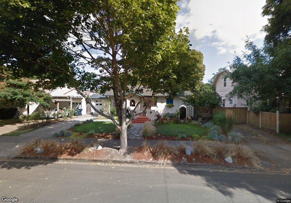
131 N Adams St Eugene, OR 97402
Whiteaker NeighborhoodEstimated Value: $392,000 - $420,000
2
Beds
1
Bath
838
Sq Ft
$482/Sq Ft
Est. Value
About This Home
This home is located at 131 N Adams St, Eugene, OR 97402 and is currently estimated at $403,605, approximately $481 per square foot. 131 N Adams St is a home located in Lane County with nearby schools including River Road/El Camino del Río Elementary School, Kelly Middle School, and North Eugene High School.
Ownership History
Date
Name
Owned For
Owner Type
Purchase Details
Closed on
Aug 16, 2016
Sold by
Pye Margaret Frances and Pye Alan Frank
Bought by
Pye Alan Frank and Pye Margaret Frances
Current Estimated Value
Purchase Details
Closed on
Sep 15, 2015
Sold by
Margulis Ellen
Bought by
Pye Margaret Frances and Pye Alan Frank
Purchase Details
Closed on
Aug 1, 2005
Sold by
Howard Leslie Jon
Bought by
Margulis Ellen
Create a Home Valuation Report for This Property
The Home Valuation Report is an in-depth analysis detailing your home's value as well as a comparison with similar homes in the area
Home Values in the Area
Average Home Value in this Area
Purchase History
| Date | Buyer | Sale Price | Title Company |
|---|---|---|---|
| Pye Alan Frank | -- | None Available | |
| Pye Margaret Frances | $273,000 | Fidelity Natl Title Co Of Or | |
| Margulis Ellen | $210,000 | Multiple |
Source: Public Records
Tax History
| Year | Tax Paid | Tax Assessment Tax Assessment Total Assessment is a certain percentage of the fair market value that is determined by local assessors to be the total taxable value of land and additions on the property. | Land | Improvement |
|---|---|---|---|---|
| 2025 | $3,022 | $155,090 | -- | -- |
| 2024 | $2,984 | $150,573 | -- | -- |
| 2023 | $2,984 | $146,188 | $0 | $0 |
| 2022 | $2,796 | $141,931 | $0 | $0 |
| 2021 | $2,626 | $137,798 | $0 | $0 |
| 2020 | $2,635 | $133,785 | $0 | $0 |
| 2019 | $2,545 | $129,889 | $0 | $0 |
| 2018 | $2,396 | $122,433 | $0 | $0 |
| 2017 | $2,288 | $122,433 | $0 | $0 |
| 2016 | $2,231 | $118,867 | $0 | $0 |
| 2015 | $2,167 | $115,405 | $0 | $0 |
| 2014 | $2,124 | $112,044 | $0 | $0 |
Source: Public Records
Map
Nearby Homes
- 9 N Monroe St Unit B
- 9 N Monroe St Unit D
- 9 N Monroe St Unit A
- 461 Blair Blvd
- 5713 Durst St
- 1030 W 5th Ave
- 527 Monroe St
- 490 W 4th Ave
- 427 Washington St
- 561 Madison St
- 561 577 Madison St
- 577 Madison St
- 1391 W 5th Ave
- 325 River Rd
- 143 Shelton McMurphey Blvd
- 147 Shelton McMurphey Blvd
- 960 W 7th Ave
- 990 W 7th Ave
- 710 Van Buren St
- 104 Holeman Ave
Your Personal Tour Guide
Ask me questions while you tour the home.