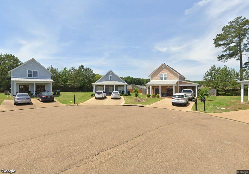
1317 Ashleys Dr Oxford, MS 38655
Estimated Value: $286,000 - $413,000
3
Beds
2
Baths
1,578
Sq Ft
$226/Sq Ft
Est. Value
About This Home
This home is located at 1317 Ashleys Dr, Oxford, MS 38655 and is currently estimated at $357,334, approximately $226 per square foot. 1317 Ashleys Dr is a home with nearby schools including Central Elementary School, Bramlett Elementary School, and Della Davidson Elementary School.
Ownership History
Date
Name
Owned For
Owner Type
Purchase Details
Closed on
Jun 18, 2024
Sold by
J & B Franklin Properties Llc
Bought by
1317 Ashleys Properties Llc
Current Estimated Value
Purchase Details
Closed on
Oct 23, 2015
Sold by
Westbrook Construction Co Of Oxford Llc
Bought by
J & B Franklin Properties Llc
Home Financials for this Owner
Home Financials are based on the most recent Mortgage that was taken out on this home.
Original Mortgage
$151,597
Interest Rate
3.89%
Mortgage Type
Construction
Create a Home Valuation Report for This Property
The Home Valuation Report is an in-depth analysis detailing your home's value as well as a comparison with similar homes in the area
Home Values in the Area
Average Home Value in this Area
Purchase History
| Date | Buyer | Sale Price | Title Company |
|---|---|---|---|
| 1317 Ashleys Properties Llc | -- | None Listed On Document | |
| J & B Franklin Properties Llc | -- | None Available |
Source: Public Records
Mortgage History
| Date | Status | Borrower | Loan Amount |
|---|---|---|---|
| Previous Owner | J & B Franklin Properties Llc | $151,597 |
Source: Public Records
Tax History Compared to Growth
Tax History
| Year | Tax Paid | Tax Assessment Tax Assessment Total Assessment is a certain percentage of the fair market value that is determined by local assessors to be the total taxable value of land and additions on the property. | Land | Improvement |
|---|---|---|---|---|
| 2024 | $2,422 | $23,864 | $0 | $0 |
| 2023 | $2,422 | $23,864 | $0 | $0 |
| 2022 | $2,374 | $23,864 | $0 | $0 |
| 2021 | $906 | $23,864 | $0 | $0 |
| 2020 | $873 | $23,609 | $0 | $0 |
| 2019 | $873 | $23,609 | $0 | $0 |
| 2018 | $873 | $23,609 | $0 | $0 |
| 2017 | $873 | $23,609 | $0 | $0 |
| 2016 | $150 | $4,200 | $0 | $0 |
| 2015 | -- | $2,625 | $0 | $0 |
| 2014 | -- | $2,625 | $0 | $0 |
Source: Public Records
Map
Nearby Homes
- 1701 Rhett's Dr
- 717 Savannah Dr
- 1817 Atlanta Ave
- 710 Happy Ln
- 108 Cedar Hill Dr
- 607 Happy Ln
- 100 Heights Dr
- 133 Heights Dr
- 11 County Road 1057
- 128 Cedar Hill Dr
- 4144 Fieldstone Loop
- 1048 Fieldstone Ln
- 201 Cotton Creek Cove
- 3809 #6 Old Sardis Rd
- 1054 Fieldstone Ln
- 8021 Cart Path Ln
- 8017 Cart Path Ln
- 3809 #5 Old Sardis Rd
- 3809 #9 Old Sardis Rd
- 3809 #11 Old Sardis Rd
- 1319 Ashleys Dr
- 1315 Ashleys Dr
- 1227 Westbrook Dr
- 1313 Ashleys Dr
- 1318 Ashleys Dr
- 1027 Scarlett Dr
- 1311 Ashley's Dr
- 1316 Ashleys Dr
- 1029 Scarlett Dr
- 1027 Scarlet Dr
- 1025 Scarlet Dr
- 1314 Ashleys Dr
- 1312 Ashley's Dr
- 1023 Scarlett Dr
- 1310 Ashley's Dr
- 1310 Ashley's Dr
- 1231 Westbrook Ave
- 1231 Westbrook Dr
- 1026 Scarlet Dr
- 1607 Rhett's Dr