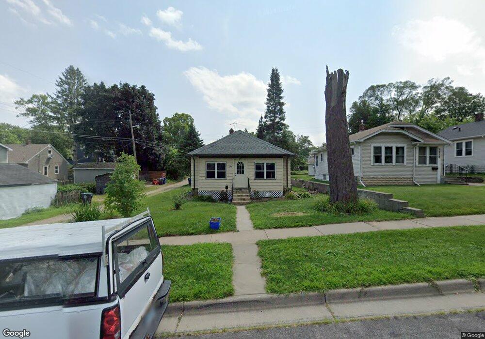
1330 Pacific St Saint Paul, MN 55106
Dayton's Bluff NeighborhoodEstimated Value: $251,000 - $270,000
3
Beds
2
Baths
884
Sq Ft
$293/Sq Ft
Est. Value
About This Home
This home is located at 1330 Pacific St, Saint Paul, MN 55106 and is currently estimated at $259,111, approximately $293 per square foot. 1330 Pacific St is a home located in Ramsey County with nearby schools including Highwood Hills Elementary School, Battle Creek Middle School, and Harding Senior High School.
Ownership History
Date
Name
Owned For
Owner Type
Purchase Details
Closed on
Nov 15, 2016
Sold by
Schwarz Michael R and Schwarz Julie
Bought by
Naing Aung Min
Current Estimated Value
Home Financials for this Owner
Home Financials are based on the most recent Mortgage that was taken out on this home.
Original Mortgage
$135,800
Outstanding Balance
$109,024
Interest Rate
3.42%
Estimated Equity
$150,087
Purchase Details
Closed on
Oct 22, 2010
Sold by
Bremer Bank Na
Bought by
Schwarz Michael R
Purchase Details
Closed on
Oct 19, 2006
Sold by
Johnsen Thomas R and Johnsen Mary D
Bought by
Howard Patrice M and Howard Seab
Create a Home Valuation Report for This Property
The Home Valuation Report is an in-depth analysis detailing your home's value as well as a comparison with similar homes in the area
Home Values in the Area
Average Home Value in this Area
Purchase History
| Date | Buyer | Sale Price | Title Company |
|---|---|---|---|
| Naing Aung Min | $144,242 | Titlesmart Inc | |
| Schwarz Michael R | $90,000 | -- | |
| Howard Patrice M | $165,900 | -- |
Source: Public Records
Mortgage History
| Date | Status | Borrower | Loan Amount |
|---|---|---|---|
| Open | Naing Aung Min | $135,800 |
Source: Public Records
Tax History Compared to Growth
Tax History
| Year | Tax Paid | Tax Assessment Tax Assessment Total Assessment is a certain percentage of the fair market value that is determined by local assessors to be the total taxable value of land and additions on the property. | Land | Improvement |
|---|---|---|---|---|
| 2025 | $3,192 | $246,600 | $29,100 | $217,500 |
| 2023 | $3,192 | $216,700 | $18,600 | $198,100 |
| 2022 | $2,580 | $214,500 | $18,700 | $195,800 |
| 2021 | $2,662 | $174,900 | $18,700 | $156,200 |
| 2020 | $2,460 | $185,200 | $18,700 | $166,500 |
| 2019 | $2,140 | $163,200 | $18,700 | $144,500 |
| 2018 | $1,344 | $143,200 | $18,700 | $124,500 |
| 2017 | $1,350 | $102,500 | $16,800 | $85,700 |
| 2016 | $1,460 | $0 | $0 | $0 |
| 2015 | $1,308 | $92,700 | $14,700 | $78,000 |
| 2014 | $1,160 | $0 | $0 | $0 |
Source: Public Records
Map
Nearby Homes
- 277 English St
- 1320 Wilson Ave
- 449 Birmingham St
- 426 Griffith St
- 1549 Old Hudson Rd
- 1526 Upper Afton Rd
- 1574 Pacific St
- 1591 Old Hudson Rd
- 1323 4th St E
- 1183 Hancock St
- 1063 Burns Ave
- 1237 5th St E
- 1207 5th St E
- 1613 Conway St
- 1631 Conway St
- 1122 6th St E
- 986 Euclid St
- 3 Kennard Ct
- 980 3rd St E
- 1367 Minnehaha Ave E
- 1326 Pacific St
- 1322 Pacific St
- 323 Clarence St
- 319 Clarence St
- 319 319 Clarence-Street-
- 327 Clarence St
- 311 Clarence St
- 1314 Pacific St
- 1331 Mclean Ave
- 1325 Mclean Ave
- 1319 Mclean Ave
- 1333 Pacific St
- 1329 Pacific St
- 1329 1329 Pacific-Street-
- 1325 Pacific St
- 303 Clarence St
- 1337 Pacific St
- 1315 Mclean Ave
- 1343 Pacific St
- 1306 1306 Pacific-Street-