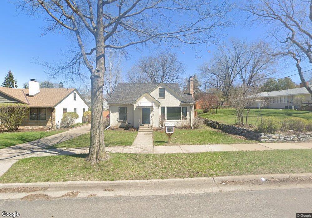
1336 Maywood St Saint Paul, MN 55117
Como Park NeighborhoodEstimated Value: $417,000 - $434,000
3
Beds
3
Baths
987
Sq Ft
$432/Sq Ft
Est. Value
About This Home
This home is located at 1336 Maywood St, Saint Paul, MN 55117 and is currently estimated at $426,007, approximately $431 per square foot. 1336 Maywood St is a home located in Ramsey County with nearby schools including Como Park Elementary School, Murray Middle School, and Como Park Senior High School.
Ownership History
Date
Name
Owned For
Owner Type
Purchase Details
Closed on
Sep 16, 2021
Sold by
Witt and Kimberly
Bought by
Christopher Witt Trust
Current Estimated Value
Purchase Details
Closed on
Jun 16, 2017
Sold by
Madsen Courtney Gavin and Madsen Michael S
Bought by
Witt Christopher and Witt Kimberly
Home Financials for this Owner
Home Financials are based on the most recent Mortgage that was taken out on this home.
Original Mortgage
$295,000
Interest Rate
4.02%
Mortgage Type
Construction
Create a Home Valuation Report for This Property
The Home Valuation Report is an in-depth analysis detailing your home's value as well as a comparison with similar homes in the area
Home Values in the Area
Average Home Value in this Area
Purchase History
| Date | Buyer | Sale Price | Title Company |
|---|---|---|---|
| Christopher Witt Trust | -- | Schromen Law Llc | |
| Witt Christopher | $285,000 | Edina Realty Title Inc |
Source: Public Records
Mortgage History
| Date | Status | Borrower | Loan Amount |
|---|---|---|---|
| Previous Owner | Witt Christopher | $295,000 |
Source: Public Records
Tax History Compared to Growth
Tax History
| Year | Tax Paid | Tax Assessment Tax Assessment Total Assessment is a certain percentage of the fair market value that is determined by local assessors to be the total taxable value of land and additions on the property. | Land | Improvement |
|---|---|---|---|---|
| 2025 | $5,762 | $444,800 | $60,000 | $384,800 |
| 2023 | $5,762 | $374,800 | $60,000 | $314,800 |
| 2022 | $4,992 | $368,000 | $60,000 | $308,000 |
| 2021 | $4,976 | $314,900 | $60,000 | $254,900 |
| 2020 | $4,944 | $324,700 | $60,000 | $264,700 |
| 2019 | $5,096 | $301,900 | $55,000 | $246,900 |
| 2018 | $5,296 | $303,600 | $55,000 | $248,600 |
| 2017 | $4,612 | $319,600 | $49,600 | $270,000 |
| 2016 | $4,496 | $0 | $0 | $0 |
| 2015 | $4,280 | $280,900 | $49,600 | $231,300 |
| 2014 | $4,434 | $0 | $0 | $0 |
Source: Public Records
Map
Nearby Homes
- 1342 Dale St N
- 1241 Maywood St
- 1464 Maywood St
- tbd MacKubin St
- 766 Maryland Ave W
- 1539 Dale St N
- 1457 Arundel St
- 1222 Como Blvd E
- 1005 Como Blvd E
- 1165 Norton St
- 1176 Norton St
- 397 Cottage Ave W Unit 3
- 1175 Arundel St
- 408 Arlington Ave W
- 1063 Dale St N
- 1104 MacKubin St
- 1049 Kent St
- 705 Como Ave
- 373 Nebraska Ave W
- 740 Como Ave
- 1342 Maywood St
- 645 Wheelock Pkwy W
- 1348 Maywood St
- 1341 Dale St N
- 1343 Dale St N
- 1343 1343 Dale St N
- 1347 Dale St N
- 1347 1347 Dale-Street-n
- 625 Wheelock Pkwy W
- 1333 Dale St N
- 1333 1333 Dale St N
- 1354 Maywood St
- 625 Wheelock Pkwy W
- 653 Wheelock Pkwy W
- 1349 Dale St N
- 1333 Maywood St
- 1360 Maywood St
- 659 Wheelock Pkwy W
- 1361 Dale St N
- 1353 Maywood St