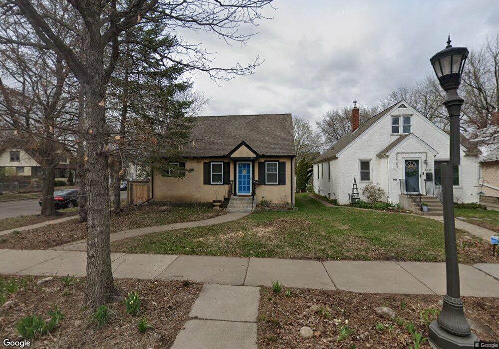
1339 Hubbard Ave Saint Paul, MN 55104
Hamline-Midway NeighborhoodEstimated Value: $222,000 - $260,000
1
Bed
1
Bath
780
Sq Ft
$312/Sq Ft
Est. Value
About This Home
This home is located at 1339 Hubbard Ave, Saint Paul, MN 55104 and is currently estimated at $242,992, approximately $311 per square foot. 1339 Hubbard Ave is a home located in Ramsey County with nearby schools including Galtier Magnet Elementary School, Murray Middle School, and Como Park Senior High School.
Ownership History
Date
Name
Owned For
Owner Type
Purchase Details
Closed on
Aug 18, 2015
Sold by
Blackaller Patrick M and Blackaller Julie C
Bought by
Thao Adam and Thao Pio
Current Estimated Value
Home Financials for this Owner
Home Financials are based on the most recent Mortgage that was taken out on this home.
Original Mortgage
$83,208
Outstanding Balance
$65,152
Interest Rate
3.9%
Mortgage Type
Purchase Money Mortgage
Estimated Equity
$177,840
Purchase Details
Closed on
May 13, 2014
Sold by
Voss Karen L and Voss Fred
Bought by
Blackaller Patrick M and Blackaller Julie C
Home Financials for this Owner
Home Financials are based on the most recent Mortgage that was taken out on this home.
Original Mortgage
$84,800
Interest Rate
4.28%
Mortgage Type
Unknown
Create a Home Valuation Report for This Property
The Home Valuation Report is an in-depth analysis detailing your home's value as well as a comparison with similar homes in the area
Home Values in the Area
Average Home Value in this Area
Purchase History
| Date | Buyer | Sale Price | Title Company |
|---|---|---|---|
| Thao Adam | $85,730 | All American Title Company | |
| Blackaller Patrick M | $109,212 | All American Title Co Inc |
Source: Public Records
Mortgage History
| Date | Status | Borrower | Loan Amount |
|---|---|---|---|
| Open | Thao Adam | $83,208 | |
| Previous Owner | Blackaller Patrick M | $84,800 |
Source: Public Records
Tax History Compared to Growth
Tax History
| Year | Tax Paid | Tax Assessment Tax Assessment Total Assessment is a certain percentage of the fair market value that is determined by local assessors to be the total taxable value of land and additions on the property. | Land | Improvement |
|---|---|---|---|---|
| 2025 | $2,966 | $234,500 | $40,000 | $194,500 |
| 2023 | $2,966 | $202,800 | $40,000 | $162,800 |
| 2022 | $2,618 | $212,800 | $40,000 | $172,800 |
| 2021 | $2,410 | $177,100 | $40,000 | $137,100 |
| 2020 | $2,434 | $170,300 | $40,000 | $130,300 |
| 2019 | $2,284 | $161,900 | $35,000 | $126,900 |
| 2018 | $1,948 | $151,700 | $35,000 | $116,700 |
| 2017 | $1,896 | $137,100 | $26,500 | $110,600 |
| 2016 | $2,242 | $0 | $0 | $0 |
| 2015 | $2,130 | $145,400 | $26,500 | $118,900 |
| 2014 | $2,212 | $0 | $0 | $0 |
Source: Public Records
Map
Nearby Homes
- 1294 Hubbard Ave
- 1292 Taylor Ave W
- 1437 Englewood Ave
- 1236 Hubbard Ave
- 708 Hamline Ave N
- 1391 Van Buren Ave
- 1434 Minnehaha Ave W
- 1310 Blair Ave
- 1258 Blair Ave
- 1473 Blair Ave
- 1527 Minnehaha Ave W
- 1470 Blair Ave
- 1156 Minnehaha Ave W
- 1198 Blair Ave
- 1215 Lafond Ave
- 1515 Blair Ave
- 1506 Blair Ave
- 1231 Thomas Ave
- 1557 Blair Ave
- 641 Asbury St
- 1335 Hubbard Ave
- 1331 Hubbard Ave
- 1327 Hubbard Ave
- 819 Hamline Ave N
- 1336 Hewitt Ave
- 1336 Hewitt Ave Unit Upper
- 815 Hamline Ave N
- 1332 Hewitt Ave
- 811 Hamline Ave N
- 1330 Hewitt Ave
- 1323 Hubbard Ave
- 823 Hamline Ave N
- 806 Hamline Ave N
- 1344 Hewitt Ave
- 1328 Hewitt Ave
- 1319 Hubbard Ave
- 803 Hamline Ave N
- 1330 Hubbard Ave
- 1322 Hewitt Ave
- 1348 Hewitt Ave