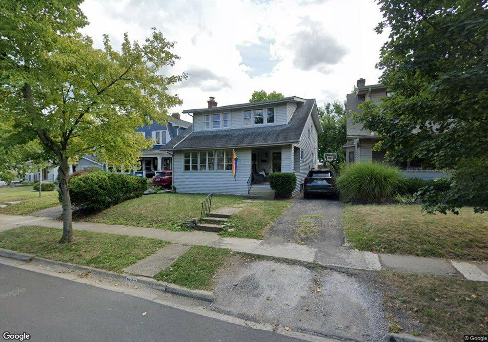
1347 Mulford Rd Columbus, OH 43212
Estimated Value: $579,064 - $633,000
3
Beds
1
Bath
1,792
Sq Ft
$337/Sq Ft
Est. Value
About This Home
This home is located at 1347 Mulford Rd, Columbus, OH 43212 and is currently estimated at $603,266, approximately $336 per square foot. 1347 Mulford Rd is a home located in Franklin County with nearby schools including Robert Louis Stevenson Elementary School, Larson Middle School, and Grandview Heights High School.
Ownership History
Date
Name
Owned For
Owner Type
Purchase Details
Closed on
Sep 24, 2018
Bought by
Pickering Robin R
Current Estimated Value
Create a Home Valuation Report for This Property
The Home Valuation Report is an in-depth analysis detailing your home's value as well as a comparison with similar homes in the area
Home Values in the Area
Average Home Value in this Area
Purchase History
| Date | Buyer | Sale Price | Title Company |
|---|---|---|---|
| Pickering Robin R | -- | -- |
Source: Public Records
Tax History Compared to Growth
Tax History
| Year | Tax Paid | Tax Assessment Tax Assessment Total Assessment is a certain percentage of the fair market value that is determined by local assessors to be the total taxable value of land and additions on the property. | Land | Improvement |
|---|---|---|---|---|
| 2024 | $10,057 | $169,300 | $99,230 | $70,070 |
| 2023 | $8,832 | $169,295 | $99,225 | $70,070 |
| 2022 | $7,132 | $113,960 | $45,150 | $68,810 |
| 2021 | $6,696 | $113,960 | $45,150 | $68,810 |
| 2020 | $6,669 | $113,960 | $45,150 | $68,810 |
| 2019 | $6,344 | $95,800 | $45,150 | $50,650 |
| 2018 | $5,456 | $95,800 | $45,150 | $50,650 |
| 2017 | $5,282 | $95,800 | $45,150 | $50,650 |
| 2016 | $5,434 | $87,680 | $43,050 | $44,630 |
| 2015 | $5,434 | $87,680 | $43,050 | $44,630 |
| 2014 | $5,450 | $87,680 | $43,050 | $44,630 |
| 2013 | $2,494 | $83,475 | $39,130 | $44,345 |
Source: Public Records
Map
Nearby Homes
- 945 Quay Ave Unit 945E
- 945 Quay Ave Unit G
- 932 Mcclain Rd
- 1451 W 2nd Ave
- 1225 Eastview Ave
- 1280 Broadview Ave
- 1081 W 3rd Ave
- 1475 W 3rd Ave Unit 204
- 1240 Oxley Rd
- 1242 Oxley Rd
- 943 Timberman Rd
- 1378 Morning Ave
- 1317 Broadview Ave
- 1083 W 3rd Ave
- 1095 W 3rd Ave
- 1093 W 3rd Ave
- 1343 Thornwood Place
- 1000 Urlin Ave Unit 1607
- 1000 Urlin Ave Unit 511
- 1000 Urlin Ave Unit 917
- 1355 Mulford Rd
- 1341 Mulford Rd
- 1359 Mulford Rd
- 1337 Mulford Rd
- 1363 Mulford Rd
- 1333 Mulford Rd
- 1358A Bluff Ave
- 1358B Bluff Ave
- 1358 Bluff Ave Unit A
- 1362 Bluff Ave Unit 2-1362
- 1362 Bluff Ave Unit B
- 1362 Bluff Ave Unit A
- 1354B Bluff Ave
- 1354A Bluff Ave
- 1354 Bluff Ave Unit B
- 1354 Bluff Ave Unit A
- 1350 Bluff Ave
- 1350 Bluff Ave
- 1350 Bluff Ave Unit A
- 1366 Bluff Ave Unit A