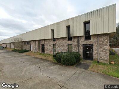
135 Andrew Dr Stockbridge, GA 30281
Estimated Value: $566,093
--
Bed
2
Baths
20,000
Sq Ft
$28/Sq Ft
Est. Value
About This Home
This home is located at 135 Andrew Dr, Stockbridge, GA 30281 and is currently priced at $566,093, approximately $28 per square foot. 135 Andrew Dr is a home located in Henry County with nearby schools including Pate's Creek Elementary School, Dutchtown Middle School, and Dutchtown High School.
Ownership History
Date
Name
Owned For
Owner Type
Purchase Details
Closed on
Dec 15, 2021
Sold by
Superior Manufacturing Corp
Bought by
Cam Investments Llc
Current Estimated Value
Purchase Details
Closed on
Jan 19, 1994
Sold by
Kopp Gerald A and Chatham Richard C
Bought by
Superior Manufacturi Ng Corp
Home Financials for this Owner
Home Financials are based on the most recent Mortgage that was taken out on this home.
Original Mortgage
$410,000
Interest Rate
7.13%
Mortgage Type
Construction
Create a Home Valuation Report for This Property
The Home Valuation Report is an in-depth analysis detailing your home's value as well as a comparison with similar homes in the area
Home Values in the Area
Average Home Value in this Area
Purchase History
| Date | Buyer | Sale Price | Title Company |
|---|---|---|---|
| Cam Investments Llc | $500,000 | -- | |
| Superior Manufacturi Ng Corp | $72,700 | -- |
Source: Public Records
Mortgage History
| Date | Status | Borrower | Loan Amount |
|---|---|---|---|
| Previous Owner | Superior Manufacturi Ng Corp | $410,000 |
Source: Public Records
Tax History Compared to Growth
Tax History
| Year | Tax Paid | Tax Assessment Tax Assessment Total Assessment is a certain percentage of the fair market value that is determined by local assessors to be the total taxable value of land and additions on the property. | Land | Improvement |
|---|---|---|---|---|
| 2024 | $18,668 | $459,800 | $47,840 | $411,960 |
| 2023 | $17,072 | $434,640 | $47,840 | $386,800 |
| 2022 | $8,071 | $200,000 | $35,400 | $164,600 |
| 2021 | $10,337 | $259,080 | $47,840 | $211,240 |
| 2020 | $10,469 | $261,480 | $47,840 | $213,640 |
| 2019 | $10,559 | $263,840 | $47,840 | $216,000 |
| 2018 | $10,130 | $252,640 | $47,840 | $204,800 |
| 2016 | $9,850 | $245,360 | $47,840 | $197,520 |
| 2015 | $9,975 | $241,120 | $47,840 | $193,280 |
| 2014 | $10,166 | $243,040 | $47,840 | $195,200 |
Source: Public Records
Map
Nearby Homes
- 1256 Jodeco Rd
- 1805 Jodeco Rd
- 312 Jodeco Station Cir E
- 2095 Flippen Rd
- 140 Jodeco Station Terrace
- 119 Saint Margrit Cir
- 220 Turnstone Rd
- 257 Chiswick Loop
- 281 Chiswick Loop
- 237 Chiswick Loop
- 506 Olivia Ct
- 124 Dalston Cove
- 195 Northpark Trail
- 106 Saint Margrit Cir
- 0 Killearn Blvd Unit 10142611
- 136 Dalston Cove
- 135 Andrew Dr
- 0 Andrews Dr
- 0 Andrew Dr Unit 10260744
- 0 Andrew Dr Unit 7346422
- 0 Andrew Dr Unit 7524209
- 0 Andrew Dr Unit 8917459
- 0 Andrew Dr
- 171 Andrew Dr
- 206 N Main Ct
- 194 N Main Dr
- 208 N Main Ct Unit N/a
- 208 N Main Ct
- 204 N Main Ct
- 198 N Main Dr
- 199 N Main Dr
- 195 N Main Dr
- 207 N Main Ct
- 0 N Main Ct Unit 7077196
- 0 N Main Ct
- N N Main Ct