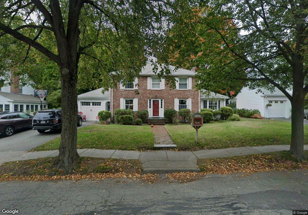
135 Randlett Park West Newton, MA 02465
West Newton NeighborhoodEstimated Value: $1,525,000 - $1,676,000
4
Beds
3
Baths
2,230
Sq Ft
$721/Sq Ft
Est. Value
About This Home
This home is located at 135 Randlett Park, West Newton, MA 02465 and is currently estimated at $1,607,863, approximately $721 per square foot. 135 Randlett Park is a home located in Middlesex County with nearby schools including Franklin Elementary School, Horace Mann Elementary School, and F.A. Day Middle School.
Ownership History
Date
Name
Owned For
Owner Type
Purchase Details
Closed on
Mar 17, 2011
Sold by
Gordon Steven R and Gordon Sharon A
Bought by
Bair William B and Wieder Tamara L
Current Estimated Value
Home Financials for this Owner
Home Financials are based on the most recent Mortgage that was taken out on this home.
Original Mortgage
$656,000
Outstanding Balance
$451,798
Interest Rate
4.84%
Mortgage Type
Purchase Money Mortgage
Estimated Equity
$1,156,065
Create a Home Valuation Report for This Property
The Home Valuation Report is an in-depth analysis detailing your home's value as well as a comparison with similar homes in the area
Home Values in the Area
Average Home Value in this Area
Purchase History
| Date | Buyer | Sale Price | Title Company |
|---|---|---|---|
| Bair William B | $820,000 | -- |
Source: Public Records
Mortgage History
| Date | Status | Borrower | Loan Amount |
|---|---|---|---|
| Open | Bair William B | $656,000 |
Source: Public Records
Tax History Compared to Growth
Tax History
| Year | Tax Paid | Tax Assessment Tax Assessment Total Assessment is a certain percentage of the fair market value that is determined by local assessors to be the total taxable value of land and additions on the property. | Land | Improvement |
|---|---|---|---|---|
| 2025 | $14,196 | $1,448,600 | $909,200 | $539,400 |
| 2024 | $13,726 | $1,406,400 | $882,700 | $523,700 |
| 2023 | $13,053 | $1,282,200 | $670,000 | $612,200 |
| 2022 | $12,489 | $1,187,200 | $620,400 | $566,800 |
| 2021 | $12,051 | $1,120,000 | $585,300 | $534,700 |
| 2020 | $11,693 | $1,120,000 | $585,300 | $534,700 |
| 2019 | $11,363 | $1,087,400 | $568,300 | $519,100 |
| 2018 | $10,865 | $1,004,200 | $514,300 | $489,900 |
| 2017 | $10,535 | $947,400 | $485,200 | $462,200 |
| 2016 | $10,076 | $885,400 | $453,500 | $431,900 |
| 2015 | $9,607 | $827,500 | $423,800 | $403,700 |
Source: Public Records
Map
Nearby Homes
- 53-55 N Gate Park
- 27 Cross St Unit 27
- 41 Kilburn Rd
- 321 Albemarle Rd
- 4 Wiswall St
- 12 Wiswall St
- 287 Cherry St Unit 2
- 318 Austin St Unit A
- 43 Walker St
- 371 Cherry St
- 106 River St Unit 18
- 106 River St Unit 2
- 106 River St Unit 14
- 2 Elm St Unit 6
- 2 Elm St Unit 8
- 123 Mount Vernon St Unit 2
- 429 Cherry St Unit 11
- 66 Webster St
- 354 Linwood Ave Unit 1
- 44 Westland Ave
- 129 Randlett Park
- 141 Randlett Park
- 158 Fairway Dr
- 164 Fairway Dr
- 152 Fairway Dr
- 136 Randlett Park
- 130 Randlett Park
- 121 Randlett Park
- 142 Randlett Park
- 147 Randlett Park
- 170 Fairway Dr
- 146 Fairway Dr
- 124 Randlett Park
- 146 Randlett Park
- 115 Randlett Park
- 159 Fairway Dr
- 153 Randlett Park
- 15 Colman St
- 165 Fairway Dr
- 153 Fairway Dr