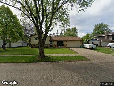
13524 Ferris Ave Saint Paul, MN 55124
Scott Highlands NeighborhoodEstimated Value: $373,993 - $392,000
3
Beds
2
Baths
2,060
Sq Ft
$185/Sq Ft
Est. Value
About This Home
This home is located at 13524 Ferris Ave, Saint Paul, MN 55124 and is currently estimated at $381,748, approximately $185 per square foot. 13524 Ferris Ave is a home located in Dakota County with nearby schools including Greenleaf Elementary School, Falcon Ridge Middle School, and Eastview Senior High School.
Ownership History
Date
Name
Owned For
Owner Type
Purchase Details
Closed on
Oct 3, 2003
Sold by
Berger Michael and Berger Collette
Bought by
Walberer James M
Current Estimated Value
Purchase Details
Closed on
Jun 20, 2001
Sold by
Graf Jon A and Graf Cnthia S
Bought by
Berger Michael and Berger Colette
Purchase Details
Closed on
May 12, 1999
Sold by
Daniels Dennis J and Daniels Donna
Bought by
Graf Jon A and Graf Cynthia
Purchase Details
Closed on
Sep 4, 1998
Sold by
Estate Of Marian E Theisen
Bought by
Daniels Dennis J and Daniels Donna
Create a Home Valuation Report for This Property
The Home Valuation Report is an in-depth analysis detailing your home's value as well as a comparison with similar homes in the area
Home Values in the Area
Average Home Value in this Area
Purchase History
| Date | Buyer | Sale Price | Title Company |
|---|---|---|---|
| Walberer James M | $220,000 | -- | |
| Berger Michael | $187,000 | -- | |
| Graf Jon A | $137,000 | -- | |
| Daniels Dennis J | $13,000 | -- |
Source: Public Records
Mortgage History
| Date | Status | Borrower | Loan Amount |
|---|---|---|---|
| Closed | Daniels Dennis J | -- |
Source: Public Records
Tax History Compared to Growth
Tax History
| Year | Tax Paid | Tax Assessment Tax Assessment Total Assessment is a certain percentage of the fair market value that is determined by local assessors to be the total taxable value of land and additions on the property. | Land | Improvement |
|---|---|---|---|---|
| 2023 | $3,652 | $343,400 | $103,000 | $240,400 |
| 2022 | $3,434 | $343,300 | $102,700 | $240,600 |
| 2021 | $3,298 | $294,900 | $89,300 | $205,600 |
| 2020 | $3,306 | $277,000 | $85,100 | $191,900 |
| 2019 | $3,008 | $269,100 | $81,000 | $188,100 |
| 2018 | $2,842 | $255,500 | $77,100 | $178,400 |
| 2017 | $2,808 | $230,600 | $73,500 | $157,100 |
| 2016 | $2,766 | $215,900 | $70,000 | $145,900 |
| 2015 | $2,638 | $210,100 | $68,600 | $141,500 |
| 2014 | -- | $201,800 | $66,100 | $135,700 |
| 2013 | -- | $184,300 | $61,100 | $123,200 |
Source: Public Records
Map
Nearby Homes
- 13554 Fernando Ave
- 5998 133rd Street Ct
- 13880 Fernando Ave
- 13220 Findlay Ave
- 13205 132nd St W
- 13307 Ellice Ct
- 5999 139th St W
- 13651 Everton Ave
- 13040 Exley Ave
- 14261 Fossil Ln
- 13798 Fordham Ave
- 14217 Footbridge Way
- 13056 Euclid Ave
- 14160 Foxtail Ln
- 13964 Euclid Ct
- 14321 Everest Ave
- 13937 Ember Ct
- 13197 132nd St W
- 5320 132nd St W
- 13930 Ember Ct
- 13524 Ferris Ave
- 13508 Ferris Ave
- 13540 Ferris Ave
- 6205 137th St W
- 13556 Ferris Ave
- 6216 134th St W
- 6232 134th St W
- 6221 137th St W
- 6248 134th St W
- 6252 134th St W
- 6237 137th St W
- 6256 134th St W
- 6204 137th St W
- 6253 137th St W
- 13599 Ferris Ave
- 13588 Ferris Ave
- 6220 137th St W
- 6233 134th St W
- 6260 134th St W
- 6201 134th St W