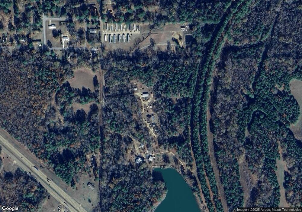
136 R T Braddy Rd Unit RD2 Florence, MS 39073
Estimated Value: $269,000 - $440,918
3
Beds
2
Baths
2,277
Sq Ft
$159/Sq Ft
Est. Value
About This Home
This home is located at 136 R T Braddy Rd Unit RD2, Florence, MS 39073 and is currently estimated at $362,306, approximately $159 per square foot. 136 R T Braddy Rd Unit RD2 is a home located in Rankin County with nearby schools including McLaurin Elementary School.
Ownership History
Date
Name
Owned For
Owner Type
Purchase Details
Closed on
Mar 22, 2017
Sold by
Odom Swafford Betty Jane and Odom Alfred W
Bought by
Davis Timothy A and Davis Shelby
Current Estimated Value
Purchase Details
Closed on
Oct 16, 2015
Sold by
Lamar Wayne T
Bought by
Davis Timothy A and Davis Amber G
Purchase Details
Closed on
Jul 6, 2007
Sold by
Holaday Kennedy Joyce and Peeler Joe Glenn
Bought by
Davis Timothy A and Davis Shelby B
Create a Home Valuation Report for This Property
The Home Valuation Report is an in-depth analysis detailing your home's value as well as a comparison with similar homes in the area
Home Values in the Area
Average Home Value in this Area
Purchase History
| Date | Buyer | Sale Price | Title Company |
|---|---|---|---|
| Davis Timothy A | -- | None Available | |
| Davis Timothy A | -- | None Available | |
| Davis Timothy A | -- | None Available | |
| Davis Timothy A | -- | -- |
Source: Public Records
Tax History Compared to Growth
Tax History
| Year | Tax Paid | Tax Assessment Tax Assessment Total Assessment is a certain percentage of the fair market value that is determined by local assessors to be the total taxable value of land and additions on the property. | Land | Improvement |
|---|---|---|---|---|
| 2024 | $2,358 | $26,395 | $0 | $0 |
| 2023 | $1,295 | $24,852 | $0 | $0 |
| 2022 | $1,276 | $23,086 | $0 | $0 |
| 2021 | $1,093 | $20,694 | $0 | $0 |
| 2020 | $1,093 | $20,694 | $0 | $0 |
| 2019 | $1,124 | $18,518 | $0 | $0 |
| 2018 | $1,101 | $18,518 | $0 | $0 |
| 2017 | $1,101 | $18,518 | $0 | $0 |
| 2016 | $1,423 | $18,139 | $0 | $0 |
| 2015 | $1,423 | $18,139 | $0 | $0 |
| 2014 | $810 | $18,139 | $0 | $0 |
| 2013 | $810 | $18,139 | $0 | $0 |
Source: Public Records
Map
Nearby Homes
- 138 Williams Dr
- 0 Stigler Rosa Dr Unit 4113809
- 109 Stanton Hall Dr
- 140 Dixie Rd
- 148 Stanton Hall Dr
- 203 Wethersfield Dr
- 297 Barnes Rd
- 0 Levi Cooper Rd Unit 4118203
- 000 W Norwood Old Enoch Rd
- 544 Sunset Ln
- 250 Rockwood Rd
- 120 Mcalpin Rd
- Unassigned Hines Cir
- 307 Tremont Dr
- 306 Tremont Dr
- 215 Wethersfield Dr
- 213 Wethersfield Dr
- 211 Wethersfield Dr
- 0 Pickering Unit 11460094
- 204 Wethersfield Dr
- 134 R T Braddy Rd
- 144 R T Braddy Rd
- 130 R T Braddy Rd
- 4104 Highway 49 S
- 150 Monteigne St
- 150 Monteigne St Unit 200
- 124 Katie Ln
- 148 Monteigne St
- 190 Braddy Ln
- 192 R T Braddy Rd
- 147 Monteigne St
- 196 R T Braddy Rd
- 132 Monteigne St
- 104 Lansdowne St
- 203 R T Braddy Rd
- 127 Cherokee Dr
- 4073 Highway 49 S
- 4073 S U Highway 49
- 4061 Highway 49 S
- 210 R T Braddy Rd
