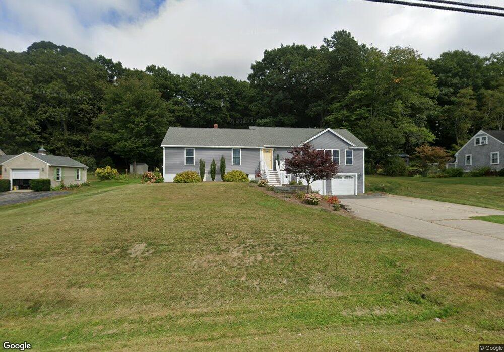
138 Dover Point Rd Dover, NH 03820
Dover Point NeighborhoodEstimated Value: $523,000 - $639,000
3
Beds
2
Baths
1,947
Sq Ft
$300/Sq Ft
Est. Value
About This Home
This home is located at 138 Dover Point Rd, Dover, NH 03820 and is currently estimated at $584,514, approximately $300 per square foot. 138 Dover Point Rd is a home located in Strafford County with nearby schools including Garrison School, Dover Middle School, and Dover Senior High School.
Ownership History
Date
Name
Owned For
Owner Type
Purchase Details
Closed on
Apr 3, 2024
Sold by
Haas Matthew and Haas Amee
Bought by
Haas Ft and Haas
Current Estimated Value
Purchase Details
Closed on
Jun 17, 2003
Sold by
Lewis Robert F and Lewis Donna M
Bought by
Haas Matthew S
Home Financials for this Owner
Home Financials are based on the most recent Mortgage that was taken out on this home.
Original Mortgage
$166,500
Interest Rate
5.77%
Mortgage Type
Purchase Money Mortgage
Purchase Details
Closed on
Jun 22, 2000
Sold by
Walsh Patrick D and Walsh Jacqueline A
Bought by
Lewis Robert F and Lewis Donna M
Purchase Details
Closed on
Jul 31, 1997
Sold by
Smalley-Macco Judith E
Bought by
Walsh Patrick D and Walsh Jacqueline A
Create a Home Valuation Report for This Property
The Home Valuation Report is an in-depth analysis detailing your home's value as well as a comparison with similar homes in the area
Home Values in the Area
Average Home Value in this Area
Purchase History
| Date | Buyer | Sale Price | Title Company |
|---|---|---|---|
| Haas Ft | -- | None Available | |
| Haas Ft | -- | None Available | |
| Haas Matthew S | $185,000 | -- | |
| Haas Matthew S | $185,000 | -- | |
| Lewis Robert F | $131,500 | -- | |
| Lewis Robert F | $131,500 | -- | |
| Walsh Patrick D | $85,500 | -- | |
| Walsh Patrick D | $85,500 | -- |
Source: Public Records
Mortgage History
| Date | Status | Borrower | Loan Amount |
|---|---|---|---|
| Previous Owner | Walsh Patrick D | $153,600 | |
| Previous Owner | Walsh Patrick D | $158,000 | |
| Previous Owner | Walsh Patrick D | $166,500 |
Source: Public Records
Tax History
| Year | Tax Paid | Tax Assessment Tax Assessment Total Assessment is a certain percentage of the fair market value that is determined by local assessors to be the total taxable value of land and additions on the property. | Land | Improvement |
|---|---|---|---|---|
| 2024 | $10,408 | $572,800 | $199,900 | $372,900 |
| 2023 | $9,077 | $485,400 | $176,600 | $308,800 |
| 2022 | $9,136 | $460,500 | $176,600 | $283,900 |
| 2021 | $8,580 | $395,400 | $148,800 | $246,600 |
| 2020 | $8,777 | $353,200 | $148,800 | $204,400 |
| 2019 | $8,441 | $335,100 | $134,800 | $200,300 |
| 2018 | $7,959 | $319,400 | $120,900 | $198,500 |
| 2017 | $4,667 | $180,400 | $102,300 | $78,100 |
| 2016 | $4,314 | $164,100 | $93,000 | $71,100 |
| 2015 | $3,946 | $148,300 | $79,000 | $69,300 |
| 2014 | $3,857 | $148,300 | $79,000 | $69,300 |
| 2011 | $4,039 | $160,800 | $83,100 | $77,700 |
Source: Public Records
Map
Nearby Homes
- 69 Polly Ann Trailer Park
- 16 Polly Ann Park
- 9 Old Colony Rd
- 4 Freedom Dr
- 14 Independence Dr
- 51 Constitution Way
- 6 Revolution Dr
- 1 Independence Dr
- 25 Fosters Dr
- 4 Shore Ln
- 55 Pointe Place Unit 108
- 55 Pointe Place Unit 208
- 55 Pointe Place Unit 304
- 1 Greenfield Dr
- 3 Greenfield Dr Unit C
- 19 Lenox Dr Unit A
- 38 Tideview Dr
- 20 Village Dr
- 116 Heron Cove Rd
- 31 Rosanna Dr
- 136 Dover Point Rd
- Lot 3 Beaumont Dr
- Lot 7 Beaumont Dr
- 140 Dover Point Rd
- 134 Dover Point Rd
- 142 Dover Point Rd
- 132 Dover Point Rd
- 6 Beaumont Dr
- 6 Beaumont Dr
- 10 Beaumont Dr
- 10 Beaumont Dr
- 128 Dover Point Rd
- 12 Beaumont Dr
- 0 Beaumont Dr Unit 2
- 14 Beaumont Dr
- 417 Middle Rd Unit C
- 417 Middle Rd
- 417 Middle Rd Unit 5
- 417 Middle Rd Unit 10
- 417 Middle Rd Unit 2