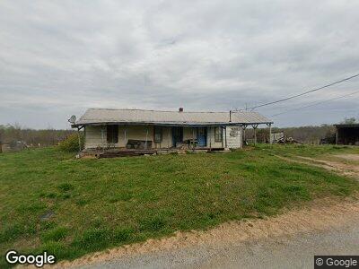
138 Gieske Rd Loretto, TN 38469
Estimated Value: $88,014 - $141,000
--
Bed
1
Bath
950
Sq Ft
$113/Sq Ft
Est. Value
About This Home
This home is located at 138 Gieske Rd, Loretto, TN 38469 and is currently estimated at $107,754, approximately $113 per square foot. 138 Gieske Rd is a home located in Lawrence County with nearby schools including South Lawrence Elementary School, Lawrenceburg Public Elementary School, and Ingram Sowell Elementary School.
Ownership History
Date
Name
Owned For
Owner Type
Purchase Details
Closed on
Sep 29, 2008
Sold by
Mclaughlin Kathy A
Bought by
James Danny
Current Estimated Value
Purchase Details
Closed on
Dec 2, 1998
Sold by
Audean Oakley
Bought by
Joel Townsend
Purchase Details
Closed on
Oct 21, 1991
Bought by
Jones Bennie Loyd and Jones Docia
Purchase Details
Closed on
Jan 24, 1984
Bought by
Jones Bennie Loyd and Jones Docia
Purchase Details
Closed on
Jan 24, 1964
Bought by
Jones Bennie Loyd and Jones Docia
Create a Home Valuation Report for This Property
The Home Valuation Report is an in-depth analysis detailing your home's value as well as a comparison with similar homes in the area
Home Values in the Area
Average Home Value in this Area
Purchase History
| Date | Buyer | Sale Price | Title Company |
|---|---|---|---|
| James Danny | $52,500 | -- | |
| Joel Townsend | $25,000 | -- | |
| Jones Bennie Loyd | $10,000 | -- | |
| Jones Bennie Loyd | -- | -- | |
| Jones Bennie Loyd | -- | -- |
Source: Public Records
Tax History Compared to Growth
Tax History
| Year | Tax Paid | Tax Assessment Tax Assessment Total Assessment is a certain percentage of the fair market value that is determined by local assessors to be the total taxable value of land and additions on the property. | Land | Improvement |
|---|---|---|---|---|
| 2024 | $200 | $9,925 | $7,050 | $2,875 |
| 2023 | $200 | $9,925 | $7,050 | $2,875 |
| 2022 | $200 | $9,925 | $7,050 | $2,875 |
| 2021 | $279 | $9,425 | $6,125 | $3,300 |
| 2020 | $279 | $9,425 | $6,125 | $3,300 |
| 2019 | $279 | $9,425 | $6,125 | $3,300 |
| 2018 | $279 | $9,425 | $6,125 | $3,300 |
| 2017 | $279 | $9,425 | $6,125 | $3,300 |
| 2016 | $279 | $9,425 | $6,125 | $3,300 |
| 2015 | $258 | $9,425 | $6,125 | $3,300 |
| 2014 | $236 | $8,625 | $5,700 | $2,925 |
Source: Public Records
Map
Nearby Homes
- 0 Rascaltown Rd
- 40 Ln
- 374 State Line Rd
- 1 Rascal Town Rd
- 493 Rascal Town Rd
- 188 Beartown Rd
- 176 Beartown Rd
- 1693 County Road 39
- 518 Littrell Rd
- 94 Oak Shadow Dr
- 118 Beartown Rd
- 28 Acres Alabama 64
- 0 Dixon Branch Rd
- 313 S Old Military Rd
- 505 2nd Ave S
- 336 Second Creek Rd
- 155 Stevens Ave
- 10942 County Road 71
- 0 County Road 71 Unit 521587
- 39 acres County Road 71
- 138 Gieske Rd
- 130 Gieske Rd
- 126 Gieske Rd
- 81 Gieske Rd
- 29 Hill Rd
- 41 Hill Rd
- 45 Hill Rd
- 65 Hill Rd
- 112 Saint Mary Rd
- 141 Saint Mary Rd
- 181 Saint Mary Rd
- 155 Saint Mary Rd
- 155 Saint Mary Rd
- 126 Saint Mary Rd
- 300 Rascaltown Rd
- 296 Rascaltown Rd
- 218 Gieske Rd
- 191 Saint Mary Rd
- 191 Saint Mary Rd
- 125 Saint Mary Rd