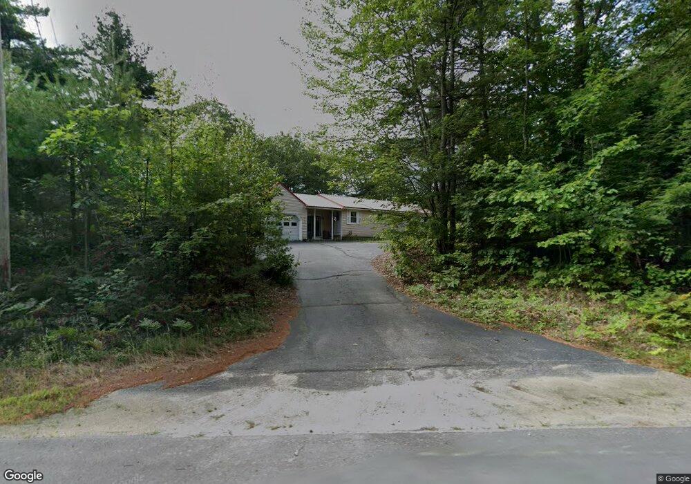
1382 Turnpike Rd New Ipswich, NH 03071
Estimated Value: $421,829 - $508,000
3
Beds
2
Baths
1,642
Sq Ft
$276/Sq Ft
Est. Value
About This Home
This home is located at 1382 Turnpike Rd, New Ipswich, NH 03071 and is currently estimated at $452,957, approximately $275 per square foot. 1382 Turnpike Rd is a home with nearby schools including Highbridge Hill Elementary School, Boynton Middle School, and Mascenic Regional High School.
Ownership History
Date
Name
Owned For
Owner Type
Purchase Details
Closed on
Jan 23, 2003
Sold by
Mckernan Paul J and Mckernan Donna K
Bought by
Aho Francis E and Aho Linda A
Current Estimated Value
Home Financials for this Owner
Home Financials are based on the most recent Mortgage that was taken out on this home.
Original Mortgage
$161,500
Interest Rate
6.11%
Create a Home Valuation Report for This Property
The Home Valuation Report is an in-depth analysis detailing your home's value as well as a comparison with similar homes in the area
Home Values in the Area
Average Home Value in this Area
Purchase History
| Date | Buyer | Sale Price | Title Company |
|---|---|---|---|
| Aho Francis E | $170,000 | -- |
Source: Public Records
Mortgage History
| Date | Status | Borrower | Loan Amount |
|---|---|---|---|
| Open | Aho Francis E | $134,400 | |
| Closed | Aho Francis E | $198,000 | |
| Closed | Aho Francis E | $161,500 |
Source: Public Records
Tax History Compared to Growth
Tax History
| Year | Tax Paid | Tax Assessment Tax Assessment Total Assessment is a certain percentage of the fair market value that is determined by local assessors to be the total taxable value of land and additions on the property. | Land | Improvement |
|---|---|---|---|---|
| 2024 | $5,662 | $372,000 | $109,700 | $262,300 |
| 2023 | $5,376 | $209,200 | $60,400 | $148,800 |
| 2022 | $4,918 | $209,200 | $60,400 | $148,800 |
| 2021 | $4,648 | $209,200 | $60,400 | $148,800 |
| 2020 | $4,446 | $209,200 | $60,400 | $148,800 |
| 2019 | $4,546 | $209,200 | $60,400 | $148,800 |
| 2018 | $4,217 | $150,600 | $54,400 | $96,200 |
| 2017 | $4,021 | $150,600 | $54,400 | $96,200 |
| 2016 | $0 | $150,600 | $54,400 | $96,200 |
| 2015 | $4,203 | $150,600 | $54,400 | $96,200 |
| 2014 | $4,175 | $150,600 | $54,400 | $96,200 |
| 2013 | $3,899 | $174,200 | $79,600 | $94,600 |
Source: Public Records
Map
Nearby Homes
- 122 Timbertop Rd
- 80 Hubbard Pond Rd
- 16 Cat Tail Cir
- 103 Temple Rd
- 714 Old New Ipswich Rd
- 703 Old New Ipswich Rd
- 634 Old New Ipswich Rd
- 265 New Hampshire 123
- 40 Brown Rd
- 811 Turnpike Rd
- 5 Ashby Rd
- 38 Holly View Dr
- 220 Stowell Rd
- 64 Cedar Ridge Dr
- 23 Greenbriar Rd
- 446 Squantum Rd
- 545 Turnpike Rd
- 359 Poor Farm Rd
- 63 Taylor Rd
- 103 Smithville Rd
- 1400 Turnpike Rd Unit 3
- 1400 Turnpike Rd Unit 5
- 1400 Turnpike Rd Unit 6
- 1400 Turnpike Rd Unit 4
- 25 Timbertop Rd
- 41 Timbertop Rd
- 51 Timbertop Rd
- 17 Timbertop Rd
- 20 Timbertop Rd
- 40 Timbertop Rd
- 13 Timbertop Rd
- 7 Timbertop Rd
- 2 Timbertop Rd
- 45 Philmart Dr
- 15 Philmart Dr
- 59 Philmart Dr
- 59 Philmart Dr
- 55 Philmart Dr
- 16-11-1 Philmart Dr
- 58 Philmart Dr