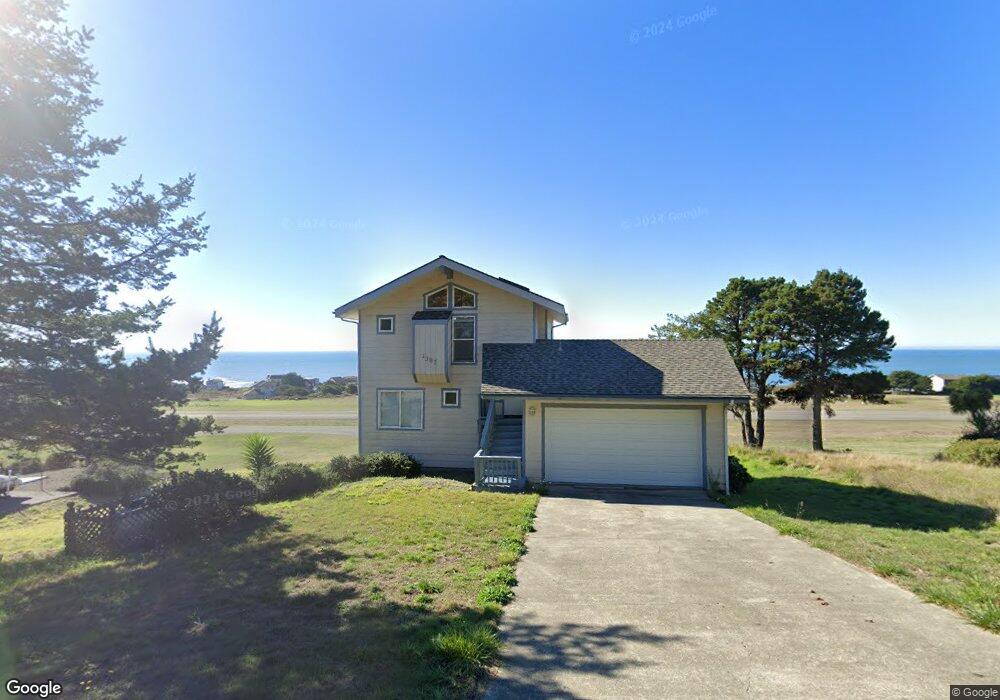
1387 Upper Pacific Dr Whitethorn, CA 95589
Estimated Value: $349,000 - $436,000
2
Beds
2
Baths
1,248
Sq Ft
$299/Sq Ft
Est. Value
About This Home
This home is located at 1387 Upper Pacific Dr, Whitethorn, CA 95589 and is currently estimated at $373,435, approximately $299 per square foot. 1387 Upper Pacific Dr is a home located in Humboldt County.
Ownership History
Date
Name
Owned For
Owner Type
Purchase Details
Closed on
May 13, 1997
Sold by
Manning Thy
Bought by
Manning Patrick F
Current Estimated Value
Purchase Details
Closed on
May 12, 1997
Sold by
Manning Phyllis M and Manning Patrick F
Bought by
Biggin Sally W
Purchase Details
Closed on
Dec 20, 1996
Sold by
Manning Phyllis M
Bought by
Manning Phyllis M
Create a Home Valuation Report for This Property
The Home Valuation Report is an in-depth analysis detailing your home's value as well as a comparison with similar homes in the area
Home Values in the Area
Average Home Value in this Area
Purchase History
| Date | Buyer | Sale Price | Title Company |
|---|---|---|---|
| Manning Patrick F | -- | First American Title Ins Co | |
| Biggin Sally W | $180,000 | First American Title Ins Co | |
| Manning Phyllis M | -- | -- |
Source: Public Records
Tax History
| Year | Tax Paid | Tax Assessment Tax Assessment Total Assessment is a certain percentage of the fair market value that is determined by local assessors to be the total taxable value of land and additions on the property. | Land | Improvement |
|---|---|---|---|---|
| 2025 | $3,109 | $264,951 | $124,261 | $140,690 |
| 2024 | $3,109 | $259,757 | $121,825 | $137,932 |
| 2023 | $3,121 | $254,665 | $119,437 | $135,228 |
| 2022 | $3,076 | $249,673 | $117,096 | $132,577 |
| 2021 | $2,969 | $244,778 | $114,800 | $129,978 |
| 2020 | $2,562 | $203,683 | $73,705 | $129,978 |
| 2019 | $2,505 | $199,690 | $72,260 | $127,430 |
| 2018 | $2,466 | $195,776 | $70,844 | $124,932 |
| 2017 | $2,324 | $191,938 | $69,455 | $122,483 |
| 2016 | $2,311 | $188,176 | $68,094 | $120,082 |
Source: Public Records
Map
Nearby Homes
- 36 Bambi Dr
- 16 Bambi Dr
- 1325&1335 Upper Pacific Dr
- 82 Fawn Dr
- 90 Fawn Dr
- 75 Neptune Rd
- 112 Seafoam Rd
- 126 Neptune Dr
- 22 Spruce Ct
- 60 Spruce Rd
- 680 Lower Pacific Dr
- 454 Lower Pacific Dr
- 806 Lower Pacific Dr
- 58 Lower Pacific Dr
- 794 & 806 Lower Pacific Dr
- 23 Steelhead Ct
- 190 Shaker Rd
- 155 Seafoam Rd
- 142 Oceanview Rd
- 156 Shaker Rd
- 1375 Upper Pacific Dr
- 1397 Upper Pacific Dr
- 1409 Upper Pacific Dr
- 1390 Upper Pacific Dr
- 1390 Upper Pacific Dr
- 1390 Upper Pacific Dr
- 1345 Upper Pacific Dr
- 1412 1422 Upper Pacific Dr
- 1346 Upper Pacific Dr
- 1437 Upper Pacific Dr
- 1432 Upper Pacific Dr
- 16 Bambi Rd
- 9487 Shelter Cove Rd
- 46 Bambi Dr
- 56 Bambi Dr
- 19 Bambi Dr
- 1454 Upper Pacific Dr
- 76 Bambi Dr
- 1464 Upper Pacific Dr
- 1320 Upper Pacific Dr
Your Personal Tour Guide
Ask me questions while you tour the home.