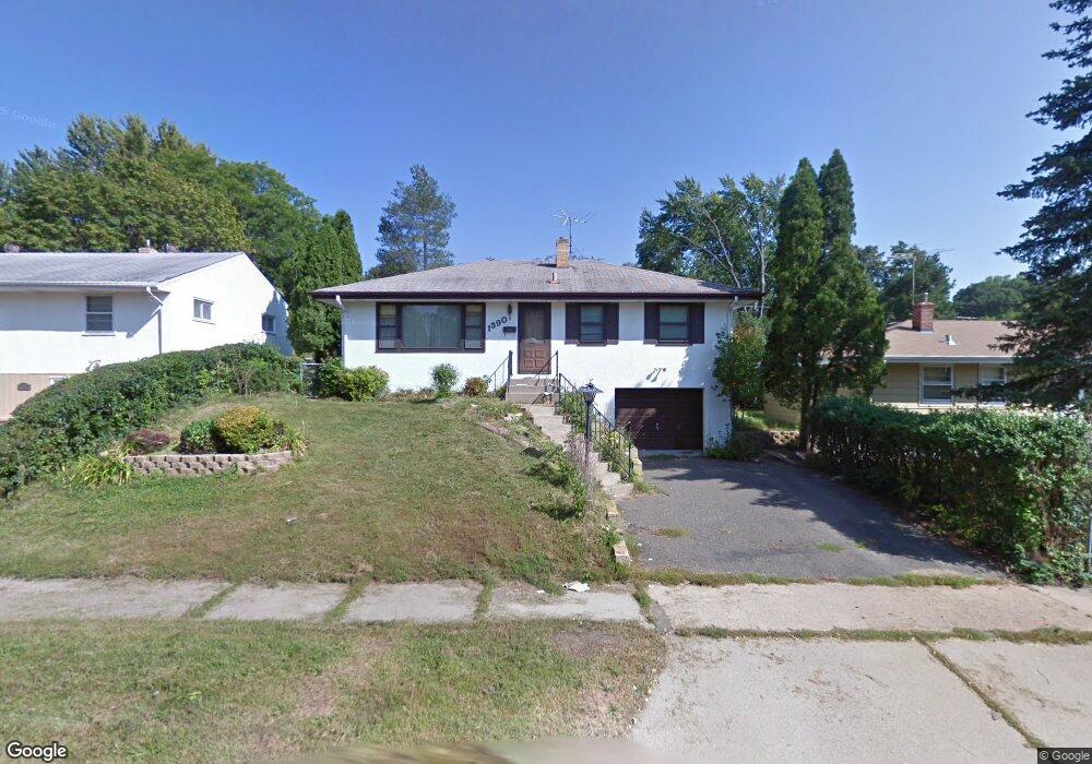
1390 Mcafee St Saint Paul, MN 55106
Estimated Value: $287,000 - $321,000
3
Beds
1
Bath
834
Sq Ft
$359/Sq Ft
Est. Value
About This Home
This home is located at 1390 Mcafee St, Saint Paul, MN 55106 and is currently estimated at $299,802, approximately $359 per square foot. 1390 Mcafee St is a home located in Ramsey County with nearby schools including Frost Lake Elementary School, Txuj Ci HMong Language and Culture Upper Campus, and Johnson Senior High School.
Ownership History
Date
Name
Owned For
Owner Type
Purchase Details
Closed on
Oct 9, 2015
Sold by
Thao Cheng and Yang Mary
Bought by
Thao Vaa and Lor Mee
Current Estimated Value
Home Financials for this Owner
Home Financials are based on the most recent Mortgage that was taken out on this home.
Original Mortgage
$79,365
Outstanding Balance
$62,422
Interest Rate
3.87%
Mortgage Type
FHA
Estimated Equity
$237,380
Purchase Details
Closed on
Sep 30, 2013
Sold by
Cheng Cheng
Bought by
Mee Vaa
Home Financials for this Owner
Home Financials are based on the most recent Mortgage that was taken out on this home.
Original Mortgage
$79,365
Interest Rate
4.32%
Purchase Details
Closed on
Nov 7, 2001
Sold by
Olson Russell V and Olson Joan A
Bought by
Chang Leo
Create a Home Valuation Report for This Property
The Home Valuation Report is an in-depth analysis detailing your home's value as well as a comparison with similar homes in the area
Home Values in the Area
Average Home Value in this Area
Purchase History
| Date | Buyer | Sale Price | Title Company |
|---|---|---|---|
| Thao Vaa | $145,000 | Titlesmart Inc | |
| Mee Vaa | $145,000 | -- | |
| Chang Leo | $167,500 | -- |
Source: Public Records
Mortgage History
| Date | Status | Borrower | Loan Amount |
|---|---|---|---|
| Open | Thao Vaa | $79,365 | |
| Previous Owner | Mee Vaa | $79,365 |
Source: Public Records
Tax History Compared to Growth
Tax History
| Year | Tax Paid | Tax Assessment Tax Assessment Total Assessment is a certain percentage of the fair market value that is determined by local assessors to be the total taxable value of land and additions on the property. | Land | Improvement |
|---|---|---|---|---|
| 2025 | $3,652 | $281,500 | $30,000 | $251,500 |
| 2023 | $3,652 | $245,100 | $25,000 | $220,100 |
| 2022 | $3,326 | $277,900 | $25,000 | $252,900 |
| 2021 | $2,886 | $218,100 | $25,000 | $193,100 |
| 2020 | $2,898 | $198,600 | $17,000 | $181,600 |
| 2019 | $2,848 | $187,500 | $17,000 | $170,500 |
| 2018 | $2,546 | $178,600 | $17,000 | $161,600 |
| 2017 | $2,220 | $164,600 | $17,000 | $147,600 |
| 2016 | $1,954 | $0 | $0 | $0 |
| 2015 | $2,294 | $136,800 | $17,000 | $119,800 |
| 2014 | $1,974 | $0 | $0 | $0 |
Source: Public Records
Map
Nearby Homes
- 1377 Clarence St
- 1357 Birmingham St
- 1450 Arlington Ave E
- 1229 Clarence St
- 1221 Clarence St
- 1343 Maryland Ave E
- 1567 Atlantic St
- 866 Clear Ave E
- 1635 Maryland Ave E
- 1562 Ivy Ave E
- 1639 Clarence St
- 1583 Nevada Ave E
- 1186 Duluth St
- 1672 Manton St
- 1114 Lane Place
- 1607 Hoyt Ave E
- 1532 Larpenteur Ave E
- 1435 Price Ave
- 1714 Duluth St
- 1730 Atlantic St
- 1390 1390 McAfee-street-
- 1396 Mcafee St
- 1384 1384 McAfee-street-
- 1384 Mcafee St
- 1402 Mcafee St
- 1378 Mcafee St
- 1395 Clarence St
- 1395 1395 Clarence-Street-
- 1385 Clarence St
- 1408 Mcafee St
- 1401 Clarence St
- 1381 Clarence St
- 1372 Mcafee St
- 1407 Clarence St
- 1391 Mcafee St
- 1414 Mcafee St
- 1385 Mcafee St
- 1403 Mcafee St
- 1379 Mcafee St
- 1415 Clarence St