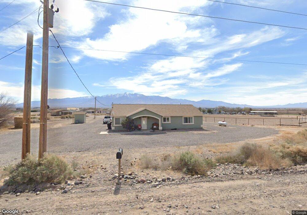
1395 W Safford Bryce Rd Safford, AZ 85546
Estimated Value: $386,018 - $463,000
4
Beds
2
Baths
2,260
Sq Ft
$186/Sq Ft
Est. Value
About This Home
This home is located at 1395 W Safford Bryce Rd, Safford, AZ 85546 and is currently estimated at $420,505, approximately $186 per square foot. 1395 W Safford Bryce Rd is a home located in Graham County with nearby schools including Ruth Powell Elementary School, Dorothy Stinson School, and Lafe Nelson School.
Ownership History
Date
Name
Owned For
Owner Type
Purchase Details
Closed on
Aug 26, 2020
Sold by
Hoisington Charles A and Hoisington Jacquelin L
Bought by
Davis Debrah
Current Estimated Value
Purchase Details
Closed on
Aug 31, 2015
Sold by
Jpmorgan Chase Bank Na
Bought by
Hoisington Charles A and Hoisington Jacquelin L
Purchase Details
Closed on
Jul 15, 2015
Sold by
Villalba Garrett
Bought by
Jp Morgan Chase Bank National Associatio
Purchase Details
Closed on
Mar 13, 2012
Sold by
Rohm Danny S and Rohm Stacey M
Bought by
Villaba Garrett
Home Financials for this Owner
Home Financials are based on the most recent Mortgage that was taken out on this home.
Original Mortgage
$190,714
Interest Rate
3.83%
Mortgage Type
New Conventional
Create a Home Valuation Report for This Property
The Home Valuation Report is an in-depth analysis detailing your home's value as well as a comparison with similar homes in the area
Home Values in the Area
Average Home Value in this Area
Purchase History
| Date | Buyer | Sale Price | Title Company |
|---|---|---|---|
| Davis Debrah | $175,000 | Pioneer Title Agency Inc | |
| Hoisington Charles A | $168,000 | Pioneer Title Agency | |
| Jp Morgan Chase Bank National Associatio | $159,600 | Great American Title Agency | |
| Villaba Garrett | -- | Safford Title Agency Inc |
Source: Public Records
Mortgage History
| Date | Status | Borrower | Loan Amount |
|---|---|---|---|
| Previous Owner | Villaba Garrett | $190,714 |
Source: Public Records
Tax History Compared to Growth
Tax History
| Year | Tax Paid | Tax Assessment Tax Assessment Total Assessment is a certain percentage of the fair market value that is determined by local assessors to be the total taxable value of land and additions on the property. | Land | Improvement |
|---|---|---|---|---|
| 2026 | $1,311 | -- | -- | -- |
| 2025 | $1,311 | $26,975 | $1,772 | $25,203 |
| 2024 | $1,350 | $25,359 | $1,525 | $23,834 |
| 2023 | $1,350 | $21,218 | $1,314 | $19,904 |
| 2022 | $1,322 | $18,722 | $1,314 | $17,408 |
| 2021 | $1,439 | $0 | $0 | $0 |
| 2020 | $1,615 | $0 | $0 | $0 |
| 2019 | $1,672 | $0 | $0 | $0 |
| 2018 | $1,587 | $0 | $0 | $0 |
| 2017 | $1,446 | $0 | $0 | $0 |
| 2016 | $1,343 | $0 | $0 | $0 |
| 2015 | $1,215 | $0 | $0 | $0 |
Source: Public Records
Map
Nearby Homes
- 1395 Skinner Ln
- 0 N Branding Iron Ln Unit 11
- 329 E Calle Mesa Verde
- 257 E Walnut St
- 2030 N Calle Montecito
- 774 E Amber Ridge Rd
- 216 S 6th Ave
- 1867 N Eloisa Ln
- 1614 Porter Ln
- 1672 N Eloisa Ln
- 508 Eagle Meadow Loop
- 417 N 1st Ave
- 2901 Eagle Dr
- 2890 Eagle Dr
- 2914 Eagle Dr
- 2889 Eagle Dr
- 2913 Eagle Dr
- 2926 Eagle Dr
- 2925 Eagle Dr
- 0 La Quinta Unit 1721031
- 2309 N Branding Iron Ln
- 1429 W Safford Bryce Rd
- 1375 W Safford Bryce Rd
- 2401 N Branding Iron Ln
- 2445 N Branding Iron Ln
- TBD N Branding Iron Ln
- TBD N Branding Iron Ln
- 1401 W Safford Bryce Rd
- 1267 W Safford Bryce Rd
- 1285 Morton Way
- 2389 N Branding Iron Ln
- 2360 N Branding Iron Ln
- 1235 W Morton Way
- 2050 N Sochi Ln
- 2385 N Branding Iron Ln
- 1390 W Sirloin Dr
- 2154 N Safford Landfill Rd
- 1370 W Safford Bryce Rd
- 1370 W Safford Bryce Rd
- 2216 N Safford Landfill Rd