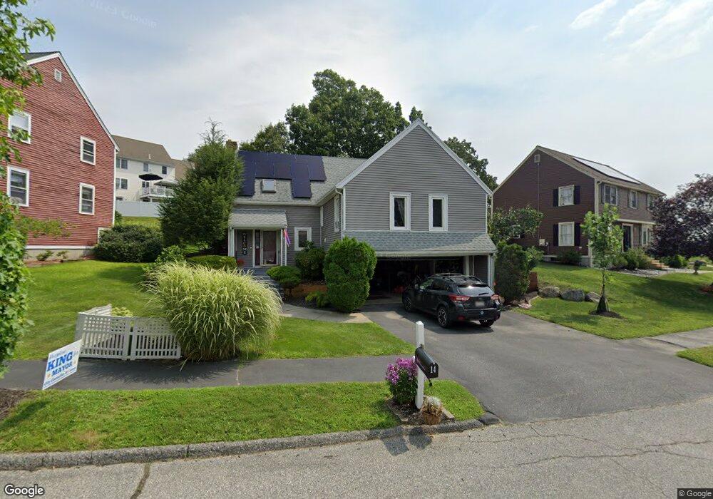
14 Mohave Rd Worcester, MA 01606
Indian Hill NeighborhoodEstimated Value: $447,000 - $576,000
3
Beds
2
Baths
1,404
Sq Ft
$354/Sq Ft
Est. Value
About This Home
This home is located at 14 Mohave Rd, Worcester, MA 01606 and is currently estimated at $497,631, approximately $354 per square foot. 14 Mohave Rd is a home located in Worcester County with nearby schools including Nelson Place Elementary School, Jacob Hiatt Magnet School, and Chandler Magnet.
Ownership History
Date
Name
Owned For
Owner Type
Purchase Details
Closed on
May 2, 2011
Sold by
Heffernan Kathleen A
Bought by
Thornton Paul
Current Estimated Value
Home Financials for this Owner
Home Financials are based on the most recent Mortgage that was taken out on this home.
Original Mortgage
$180,000
Outstanding Balance
$124,398
Interest Rate
4.76%
Mortgage Type
Purchase Money Mortgage
Estimated Equity
$373,233
Purchase Details
Closed on
Jul 16, 2003
Sold by
Celona Kathleen A and Celona Stephen L
Bought by
Celona Kathleen A and Celona Stephen L
Purchase Details
Closed on
Mar 17, 1999
Sold by
Rondeau John F and Rondeau Kathleen A
Bought by
Rondeau Katlheen A
Purchase Details
Closed on
Oct 25, 1989
Sold by
Indian Hill Rt
Bought by
Rondeau John
Create a Home Valuation Report for This Property
The Home Valuation Report is an in-depth analysis detailing your home's value as well as a comparison with similar homes in the area
Home Values in the Area
Average Home Value in this Area
Purchase History
We collect this data history from publicly available records. To have your information removed, we recommend requesting removal directly through your county’s website.
| Date | Buyer | Sale Price | Title Company |
|---|---|---|---|
| Thornton Paul | $210,000 | -- | |
| Celona Kathleen A | -- | -- | |
| Rondeau Katlheen A | $13,000 | -- | |
| Rondeau John | $165,000 | -- |
Source: Public Records
Mortgage History
We collect this data history from publicly available records. To have your information removed, we recommend requesting removal directly through your county’s website.
| Date | Status | Borrower | Loan Amount |
|---|---|---|---|
| Open | Rondeau John | $45,000 | |
| Open | Thornton Paul | $180,000 | |
| Previous Owner | Rondeau John | $144,000 |
Source: Public Records
Tax History
| Year | Tax Paid | Tax Assessment Tax Assessment Total Assessment is a certain percentage of the fair market value that is determined by local assessors to be the total taxable value of land and additions on the property. | Land | Improvement |
|---|---|---|---|---|
| 2025 | $5,825 | $441,600 | $118,100 | $323,500 |
| 2024 | $5,666 | $412,100 | $118,100 | $294,000 |
| 2023 | $5,465 | $381,100 | $102,700 | $278,400 |
| 2022 | $5,216 | $342,900 | $82,200 | $260,700 |
| 2021 | $5,346 | $328,400 | $65,700 | $262,700 |
| 2020 | $4,954 | $291,400 | $65,700 | $225,700 |
| 2019 | $5,022 | $279,000 | $59,100 | $219,900 |
| 2018 | $4,943 | $261,400 | $59,100 | $202,300 |
| 2017 | $4,878 | $253,800 | $59,100 | $194,700 |
| 2016 | $4,753 | $230,600 | $43,200 | $187,400 |
| 2015 | $4,628 | $230,600 | $43,200 | $187,400 |
| 2014 | $4,506 | $230,600 | $43,200 | $187,400 |
Source: Public Records
Map
Nearby Homes
- 125 Indian Hill Rd
- 1 Brookhaven Rd
- 97 Parkton Ave
- 25 Chester St
- 7 Albemarle St
- 53 Barber Ave
- 78 Leeds St
- 11 Tattan Farm Rd
- 44 Boardman St
- 35 Boardman St
- 46 Hastings Ave
- 42 Hastings Ave
- 577 Grove St
- 39 Boyd St
- 33 Hapgood Rd
- 61 Nelson Place
- 38 Hapgood Rd
- 32 Indian Lake Pkwy
- 100 Assumption Ave
- 336 Burncoat St
Your Personal Tour Guide
Ask me questions while you tour the home.