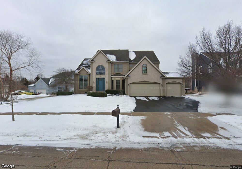
1401 Boulder Bluff Ln Algonquin, IL 60102
Estimated Value: $550,618 - $606,000
4
Beds
4
Baths
3,112
Sq Ft
$184/Sq Ft
Est. Value
About This Home
This home is located at 1401 Boulder Bluff Ln, Algonquin, IL 60102 and is currently estimated at $571,155, approximately $183 per square foot. 1401 Boulder Bluff Ln is a home located in Kane County with nearby schools including Liberty Elementary School, Dundee Middle School, and Harry D Jacobs High School.
Ownership History
Date
Name
Owned For
Owner Type
Purchase Details
Closed on
Jan 25, 2017
Sold by
Lewis Lewis W and Lewis William C
Bought by
Lewis William and Lewis Dale
Current Estimated Value
Home Financials for this Owner
Home Financials are based on the most recent Mortgage that was taken out on this home.
Original Mortgage
$280,000
Interest Rate
4.17%
Mortgage Type
New Conventional
Purchase Details
Closed on
Oct 27, 1998
Sold by
Brittany Hills Lp
Bought by
Lewis W Christopher and Lewis Erin C
Home Financials for this Owner
Home Financials are based on the most recent Mortgage that was taken out on this home.
Original Mortgage
$237,050
Interest Rate
5.5%
Create a Home Valuation Report for This Property
The Home Valuation Report is an in-depth analysis detailing your home's value as well as a comparison with similar homes in the area
Purchase History
| Date | Buyer | Sale Price | Title Company |
|---|---|---|---|
| Lewis William | $350,000 | Chicago Title Insurance Co | |
| Lewis W Christopher | $296,500 | Chicago Title Insurance Co |
Source: Public Records
Mortgage History
| Date | Status | Borrower | Loan Amount |
|---|---|---|---|
| Previous Owner | Lewis William | $280,000 | |
| Previous Owner | Lewis W Christopher | $237,050 |
Source: Public Records
Tax History
| Year | Tax Paid | Tax Assessment Tax Assessment Total Assessment is a certain percentage of the fair market value that is determined by local assessors to be the total taxable value of land and additions on the property. | Land | Improvement |
|---|---|---|---|---|
| 2024 | $11,722 | $154,777 | $28,780 | $125,997 |
| 2023 | $11,206 | $139,263 | $25,895 | $113,368 |
| 2022 | $10,743 | $130,412 | $25,895 | $104,517 |
| 2021 | $10,451 | $123,135 | $24,450 | $98,685 |
| 2020 | $10,253 | $120,366 | $23,900 | $96,466 |
| 2019 | $9,968 | $114,264 | $22,688 | $91,576 |
| 2018 | $10,371 | $115,599 | $22,239 | $93,360 |
| 2017 | $9,597 | $109,977 | $20,804 | $89,173 |
| 2016 | $9,837 | $106,484 | $20,143 | $86,341 |
| 2015 | -- | $103,770 | $25,698 | $78,072 |
| 2014 | -- | $100,904 | $24,988 | $75,916 |
| 2013 | -- | $103,993 | $25,753 | $78,240 |
Source: Public Records
Map
Nearby Homes
- 18N741 Westhill Rd
- 1460 Lancaster Ln
- 1530 Westbourne Pkwy
- 1540 Westbourne Pkwy
- 3434 Blue Ridge Dr
- 350 Coldsprings St
- 1252 Glenmont St
- 1000 Glenmont St
- 1237 Glenmont St
- 1254 Glenmont St
- 1201 Waterford St
- 2248 Stonegate Rd
- 2313 Barrett Dr
- 1951 Broadsmore Dr
- 2224 Barrett Dr
- 1950 Broadsmore Dr
- 35W543 Miller Rd
- 0000 State Route 31
- Adams Plan at Algonquin Meadows - Single Family
- Sequoia Plan at Algonquin Meadows - Single Family
- 1411 Boulder Bluff Ln Unit 1
- 1150 White Chapel Ln
- 1421 Boulder Bluff Ln
- 1191 White Chapel Ln
- 1160 White Chapel Ln
- 1 Tealwood Ct
- 1431 Boulder Bluff Ln
- 1180 White Chapel Ln
- 1170 White Chapel Ln
- 1201 White Chapel Ln
- 1190 White Chapel Ln
- 1441 Boulder Bluff Ln
- 3 Tealwood Ct
- 1200 White Chapel Ln
- 1511 Southridge Trail
- 1521 Southridge Trail
- 1211 White Chapel Ln
- 2 Tealwood Ct
- 1451 Boulder Bluff Ln
- 1501 Southridge Trail
Your Personal Tour Guide
Ask me questions while you tour the home.