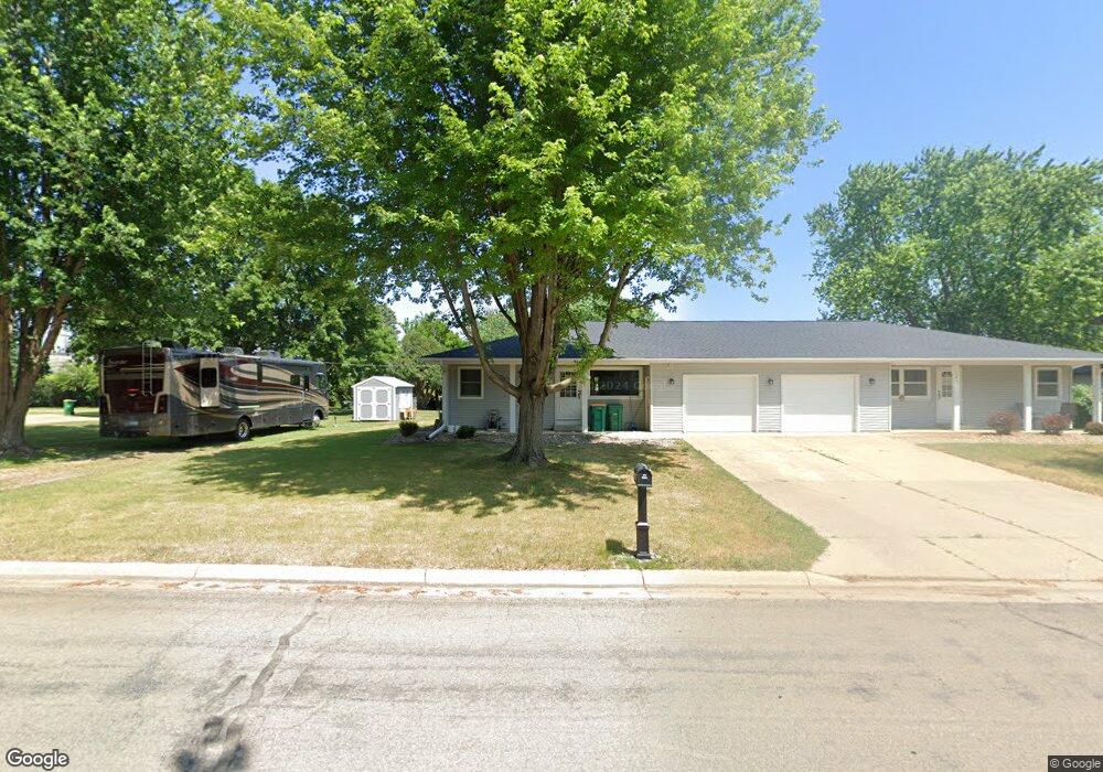
1401 Swanhill Dr Unit 1 Albert Lea, MN 56007
Estimated Value: $200,000 - $225,000
3
Beds
2
Baths
2,034
Sq Ft
$104/Sq Ft
Est. Value
About This Home
This home is located at 1401 Swanhill Dr Unit 1, Albert Lea, MN 56007 and is currently estimated at $212,385, approximately $104 per square foot. 1401 Swanhill Dr Unit 1 is a home located in Freeborn County with nearby schools including Sibley Elementary School, Southwest Middle School, and Albert Lea Senior High School.
Ownership History
Date
Name
Owned For
Owner Type
Purchase Details
Closed on
Dec 28, 2021
Sold by
Woodard Katie
Bought by
Rootes Robert and Rootes Bethanne
Current Estimated Value
Home Financials for this Owner
Home Financials are based on the most recent Mortgage that was taken out on this home.
Original Mortgage
$151,598
Outstanding Balance
$139,477
Interest Rate
2.98%
Mortgage Type
New Conventional
Estimated Equity
$72,908
Purchase Details
Closed on
Jun 14, 2017
Sold by
Wyrum Larry D
Bought by
Woodard Katie A
Home Financials for this Owner
Home Financials are based on the most recent Mortgage that was taken out on this home.
Original Mortgage
$76,000
Interest Rate
4.02%
Mortgage Type
New Conventional
Purchase Details
Closed on
Dec 10, 2013
Sold by
Sandt Cheryl
Bought by
Wyrum Lillian
Create a Home Valuation Report for This Property
The Home Valuation Report is an in-depth analysis detailing your home's value as well as a comparison with similar homes in the area
Home Values in the Area
Average Home Value in this Area
Purchase History
| Date | Buyer | Sale Price | Title Company |
|---|---|---|---|
| Rootes Robert | $160,824 | -- | |
| Woodard Katie A | $95,000 | None Available | |
| Woodard Katie A | $95,000 | None Available | |
| Wyrum Lillian | -- | -- |
Source: Public Records
Mortgage History
| Date | Status | Borrower | Loan Amount |
|---|---|---|---|
| Open | Rootes Robert | $151,598 | |
| Previous Owner | Woodard Katie A | $76,000 |
Source: Public Records
Tax History Compared to Growth
Tax History
| Year | Tax Paid | Tax Assessment Tax Assessment Total Assessment is a certain percentage of the fair market value that is determined by local assessors to be the total taxable value of land and additions on the property. | Land | Improvement |
|---|---|---|---|---|
| 2025 | $2,176 | $197,700 | $23,400 | $174,300 |
| 2024 | $1,854 | $164,500 | $23,400 | $141,100 |
| 2023 | $1,632 | $140,500 | $23,400 | $117,100 |
| 2022 | $1,332 | $127,200 | $23,400 | $103,800 |
| 2021 | $1,290 | $97,500 | $23,400 | $74,100 |
| 2020 | $1,162 | $88,100 | $23,400 | $64,700 |
| 2019 | $1,062 | $83,800 | $23,400 | $60,400 |
| 2018 | $918 | $0 | $0 | $0 |
| 2016 | $1,696 | $0 | $0 | $0 |
| 2015 | $1,692 | $0 | $0 | $0 |
| 2014 | $1,292 | $0 | $0 | $0 |
| 2012 | $656 | $0 | $0 | $0 |
Source: Public Records
Map
Nearby Homes
- 1614 Gateway Dr
- 1429 Spartan Ave
- 1432 Regency Ln
- 1406 Southview Ln
- 1115 Swanhill Dr
- 1722 Southview Ln
- 1810 Michaelle Ln
- 1507 Plainview Ln
- 1608 Plainview Ln
- 1704 Plainview Ln
- 2200 W 9th St
- 2313 W 9th St
- 2334 W 9th St
- 2330 W 9th St
- 919 W Front St
- 715 S 1st Ave
- 730 W Front St
- 821 Madison Ave
- 1315 W Clark St
- 1126 S Newton Ave
- 1405 Swanhill Dr
- 1315 Swanhill Dr Unit 4
- 1313 1313 Swanhill Dr
- 1313 Swanhill Dr
- 1409 Swanhill Dr
- 1313 Swanhill Dr Unit 1
- 1317 Swanhill Dr Unit 3
- 1311 Swanhill Dr Unit 2
- 1317 1317 Swanhill-Drive-
- 1317 1317 Swanhill Dr
- 1602 Gateway Dr
- 1404 Swanhill Dr
- 1413 Swanhill Dr
- 1309 Swanhill Dr
- 1315 1315 Swanhill Dr
- 1408 Swanhill Dr
- 1311 1311 Swanhill-Drive-
- 1606 Gateway Dr
- 1412 Swanhill Dr
- 1417 Swanhill Dr