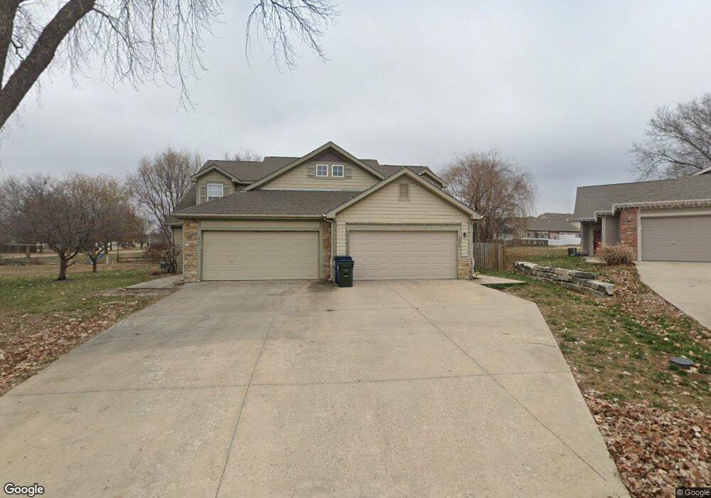
1402 Quinn Ct Lawrence, KS 66049
West Lawrence NeighborhoodEstimated Value: $282,000 - $298,000
3
Beds
3
Baths
1,649
Sq Ft
$176/Sq Ft
Est. Value
About This Home
This home is located at 1402 Quinn Ct, Lawrence, KS 66049 and is currently estimated at $290,543, approximately $176 per square foot. 1402 Quinn Ct is a home located in Douglas County with nearby schools including Langston Hughes Elementary School, Southwest Middle School, and Lawrence Free State High School.
Ownership History
Date
Name
Owned For
Owner Type
Purchase Details
Closed on
May 6, 2021
Sold by
Denmark Sandra L
Bought by
Mccormick Aja L
Current Estimated Value
Home Financials for this Owner
Home Financials are based on the most recent Mortgage that was taken out on this home.
Original Mortgage
$215,650
Outstanding Balance
$195,127
Interest Rate
3%
Mortgage Type
New Conventional
Estimated Equity
$95,416
Purchase Details
Closed on
Apr 27, 2005
Sold by
Highland Construction Inc
Bought by
Denmark Donald C and Denmark Sandra L
Home Financials for this Owner
Home Financials are based on the most recent Mortgage that was taken out on this home.
Original Mortgage
$134,320
Interest Rate
6.06%
Mortgage Type
Fannie Mae Freddie Mac
Create a Home Valuation Report for This Property
The Home Valuation Report is an in-depth analysis detailing your home's value as well as a comparison with similar homes in the area
Home Values in the Area
Average Home Value in this Area
Purchase History
| Date | Buyer | Sale Price | Title Company |
|---|---|---|---|
| Mccormick Aja L | -- | Security 1St Title | |
| Denmark Donald C | -- | Commerce Title |
Source: Public Records
Mortgage History
| Date | Status | Borrower | Loan Amount |
|---|---|---|---|
| Open | Mccormick Aja L | $215,650 | |
| Previous Owner | Denmark Donald C | $134,320 |
Source: Public Records
Tax History Compared to Growth
Tax History
| Year | Tax Paid | Tax Assessment Tax Assessment Total Assessment is a certain percentage of the fair market value that is determined by local assessors to be the total taxable value of land and additions on the property. | Land | Improvement |
|---|---|---|---|---|
| 2025 | $3,844 | $31,326 | $4,600 | $26,726 |
| 2024 | $3,671 | $29,958 | $4,025 | $25,933 |
| 2023 | $3,436 | $26,945 | $4,600 | $22,345 |
| 2022 | $3,354 | $26,105 | $4,025 | $22,080 |
| 2021 | $2,847 | $21,425 | $4,025 | $17,400 |
| 2020 | $2,698 | $20,424 | $4,025 | $16,399 |
| 2019 | $2,537 | $19,240 | $4,025 | $15,215 |
| 2018 | $2,546 | $19,171 | $4,025 | $15,146 |
| 2017 | $2,470 | $18,400 | $4,025 | $14,375 |
| 2016 | $2,341 | $18,228 | $4,025 | $14,203 |
| 2015 | $2,268 | $17,664 | $4,025 | $13,639 |
| 2014 | $2,305 | $18,124 | $4,025 | $14,099 |
Source: Public Records
Map
Nearby Homes
- 1315 Research Park Dr
- 1300 Research Park Dr
- 1601 Research Park Dr
- 1202 Little Knife
- 1347 Kanza Dr
- 5710 Goff Ct
- 1564 Fountain Dr
- 1604 Bob White Dr
- 5024 Cedar Grove Way
- 5117 Harvard Rd
- 1040 Stonecreek Dr
- 1033 Stonecreek Dr
- 1017 Stoneridge Dr
- 4709 Carmel Place
- 1709 Lake Alvamar Dr
- 5204 Foxchase Dr
- 5204 Fox Chase Dr
- 904 Moundridge Dr
- 1526 Legend Trail Dr Unit B
- 1528 Legend Trail Dr Unit A
- 1400 Quinn Ct
- 1404 Quinn Ct
- 1406 Quinn Ct
- 5119 Veronica Dr
- 5121 Veronica Dr
- 5117 Veronica Dr
- 1401 Quinn Ct
- 5123 Veronica Dr
- 5115 Veronica Dr
- 5113 Veronica Dr
- 1403 Quinn Ct
- 1473 Marilee Dr
- 1475 Marilee Dr
- 1465 Marilee Dr
- 5111 Veronica Dr
- 1457 Marilee Dr
- 5109 Veronica Dr
- 1453 Marilee Dr
- 1405 Quinn Ct
- 1467 Marilee Dr