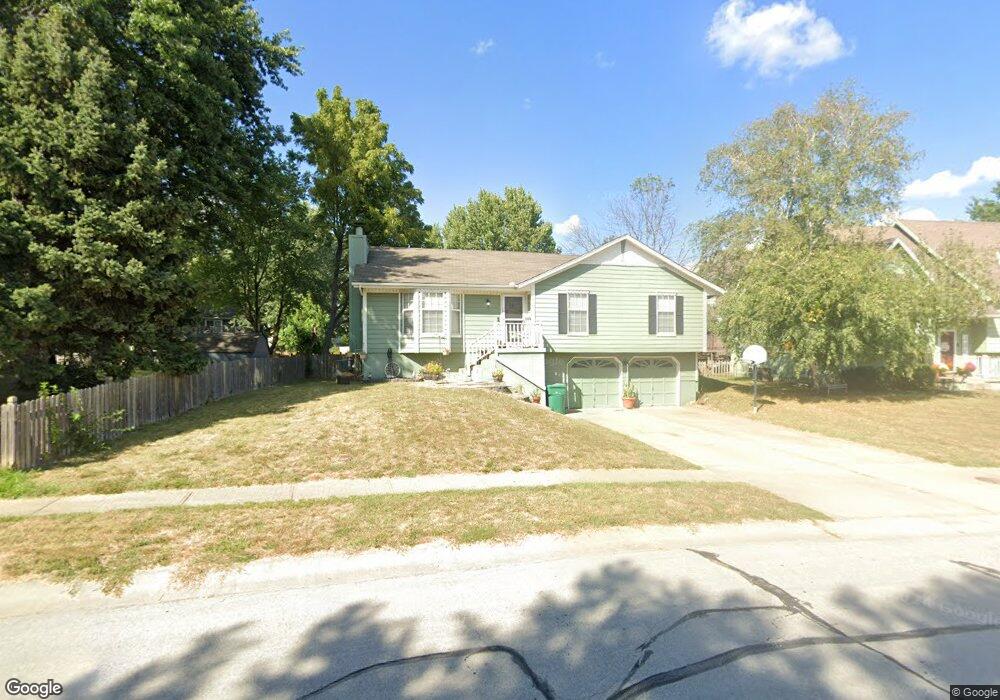
1404 NE Mulberry St Lees Summit, MO 64086
Estimated Value: $306,000 - $337,000
3
Beds
2
Baths
1,200
Sq Ft
$264/Sq Ft
Est. Value
About This Home
This home is located at 1404 NE Mulberry St, Lees Summit, MO 64086 and is currently estimated at $316,525, approximately $263 per square foot. 1404 NE Mulberry St is a home located in Jackson County with nearby schools including Underwood Elementary School, Bernard C. Campbell Middle School, and Lee's Summit North High School.
Ownership History
Date
Name
Owned For
Owner Type
Purchase Details
Closed on
Sep 22, 2010
Sold by
Whitehead D Neal and Whitehead Violet June Fields
Bought by
Seese Joshua M
Current Estimated Value
Purchase Details
Closed on
Oct 5, 1996
Sold by
Wright John W and Wright Shana Lee
Bought by
Whitehead D Neal and Claycomb David M
Home Financials for this Owner
Home Financials are based on the most recent Mortgage that was taken out on this home.
Original Mortgage
$75,600
Interest Rate
8.33%
Mortgage Type
Purchase Money Mortgage
Create a Home Valuation Report for This Property
The Home Valuation Report is an in-depth analysis detailing your home's value as well as a comparison with similar homes in the area
Home Values in the Area
Average Home Value in this Area
Purchase History
| Date | Buyer | Sale Price | Title Company |
|---|---|---|---|
| Seese Joshua M | -- | Continental Title Co | |
| Whitehead D Neal | -- | Chicago Title Insurance Co |
Source: Public Records
Mortgage History
| Date | Status | Borrower | Loan Amount |
|---|---|---|---|
| Previous Owner | Whitehead D Neal | $75,600 |
Source: Public Records
Tax History Compared to Growth
Tax History
| Year | Tax Paid | Tax Assessment Tax Assessment Total Assessment is a certain percentage of the fair market value that is determined by local assessors to be the total taxable value of land and additions on the property. | Land | Improvement |
|---|---|---|---|---|
| 2025 | $3,567 | $38,946 | $7,613 | $31,333 |
| 2024 | $3,541 | $49,400 | $7,220 | $42,180 |
| 2023 | $3,541 | $49,400 | $7,220 | $42,180 |
| 2022 | $2,377 | $29,450 | $6,175 | $23,275 |
| 2021 | $2,427 | $29,450 | $6,175 | $23,275 |
| 2020 | $2,340 | $28,120 | $6,175 | $21,945 |
| 2019 | $2,412 | $28,120 | $6,175 | $21,945 |
| 2018 | $2,352 | $26,971 | $3,944 | $23,027 |
| 2017 | $2,352 | $26,971 | $3,944 | $23,027 |
| 2016 | $2,317 | $26,296 | $4,541 | $21,755 |
| 2014 | $2,220 | $24,700 | $4,238 | $20,462 |
Source: Public Records
Map
Nearby Homes
- 1632 NE Stonewood Dr
- 1817 NE Burgandy Cir
- 1424 NE Stonewood Dr
- 1425 NE Stonewood Dr
- 1408 NE Whitestone Dr
- 1400 NE Colbern Rd
- 1637 NE Westwind Dr
- 27008 E Olive Dr
- 27104 E Cedar Grove Dr
- 1717 NE Luther Rd
- 1220 NE Hendrix Dr
- 1121 NE Ridgeview Dr
- 808 NE Mulberry St
- 809 NE Mulberry St
- 1708 NE Balboa St
- 1676 NE Ozark Dr
- 800 NE Mulberry St
- 732 NE Deerbrook St
- 1809 NE Griffin Dr
- 1345 NE Foxwood Dr
- 1408 NE Mulberry St
- 1601 NE Jade St
- 1605 NE Jade St
- 1412 NE Mulberry St
- 1405 NE Mulberry St
- 1409 NE Mulberry St
- 1613 NE Jade Ct
- 1604 NE Tawny Dr
- 1401 NE Mulberry St
- 1413 NE Mulberry St
- 1608 NE Tawny Dr
- 1600 NE Jade St
- 1604 NE Jade St
- 1617 NE Jade Ct
- 1608 NE Jade St
- 1536 NE Jade St
- 1529 NE Jade St
- 1612 NE Tawny Dr
- 1612 NE Jade St
- 1601 NE Tawny Dr