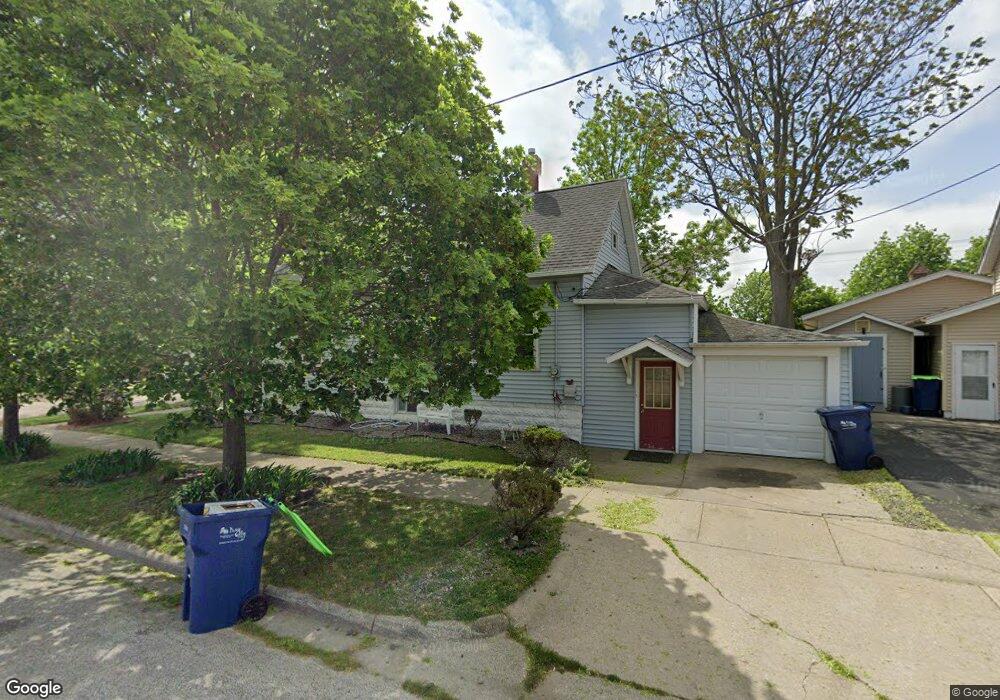
1411 N Sheridan St Bay City, MI 48708
Estimated Value: $77,000 - $107,000
2
Beds
1
Bath
792
Sq Ft
$113/Sq Ft
Est. Value
About This Home
This home is located at 1411 N Sheridan St, Bay City, MI 48708 and is currently estimated at $89,469, approximately $112 per square foot. 1411 N Sheridan St is a home located in Bay County with nearby schools including Washington Elementary School, Handy Middle School, and Bay City Central High School.
Ownership History
Date
Name
Owned For
Owner Type
Purchase Details
Closed on
Sep 28, 2010
Sold by
Fannie Mae
Bought by
Edwards Ernest
Current Estimated Value
Purchase Details
Closed on
May 10, 2010
Sold by
Edwards Ernest and Edwards Rosa
Bought by
Alegria Oriole
Purchase Details
Closed on
Oct 16, 2009
Sold by
Dunn Tracey L and Dunn Wilbert Orlando
Bought by
Federal National Mortgage Association
Purchase Details
Closed on
Aug 25, 2000
Sold by
Dunn Tracey L
Bought by
Dunn Tracey L
Purchase Details
Closed on
Feb 19, 1999
Sold by
Smith Lynn S and Maxwell Tracey L
Bought by
Maxwell Tracey L
Purchase Details
Closed on
Oct 9, 1998
Sold by
Hall Raymond C
Bought by
Hall Raymond C and Smith Lynn S
Purchase Details
Closed on
Oct 13, 1987
Sold by
Jacobs Lawrence H Estate Of
Bought by
Hall Raymond C
Create a Home Valuation Report for This Property
The Home Valuation Report is an in-depth analysis detailing your home's value as well as a comparison with similar homes in the area
Home Values in the Area
Average Home Value in this Area
Purchase History
| Date | Buyer | Sale Price | Title Company |
|---|---|---|---|
| Edwards Ernest | $20,500 | E Title Agency Inc | |
| Alegria Oriole | -- | None Available | |
| Federal National Mortgage Association | $47,337 | None Available | |
| Dunn Tracey L | -- | -- | |
| Maxwell Tracey L | -- | -- | |
| Hall Raymond C | -- | -- | |
| Hall Raymond C | $15,500 | -- |
Source: Public Records
Tax History Compared to Growth
Tax History
| Year | Tax Paid | Tax Assessment Tax Assessment Total Assessment is a certain percentage of the fair market value that is determined by local assessors to be the total taxable value of land and additions on the property. | Land | Improvement |
|---|---|---|---|---|
| 2025 | $1,073 | $35,300 | $0 | $0 |
| 2024 | $883 | $32,000 | $0 | $0 |
| 2023 | $841 | $27,550 | $0 | $0 |
| 2022 | $966 | $24,250 | $0 | $0 |
| 2021 | $908 | $23,100 | $23,100 | $0 |
| 2020 | $966 | $20,000 | $20,000 | $0 |
| 2019 | $945 | $19,500 | $0 | $0 |
| 2018 | $948 | $19,300 | $0 | $0 |
| 2017 | $952 | $19,400 | $0 | $0 |
| 2016 | $981 | $21,050 | $0 | $21,050 |
| 2015 | $953 | $20,800 | $0 | $20,800 |
| 2014 | $953 | $22,500 | $0 | $22,500 |
Source: Public Records
Map
Nearby Homes
- 1216 4th St
- 103 Nebobish Ave
- 1509 5th St
- 1110 Chase St
- 1213 Center Ave
- 909 Center Ave
- 1715 5th St
- 820 N Johnson St
- 118 Fillmore Place
- 701 Center Ave
- 1010 6th Street 6th St
- 1912 5th St
- 904 6th St
- 2122 2nd St
- 1708 6th St
- 2101 5th St
- 1530 Elizabeth St
- 510 N Farragut St
- 3030 N Water St
- 1111 N Water St Unit 403
- 1407 N Sheridan St
- 1408 N Sherman St
- 1412 N Sheridan St
- 1408 N Sheridan St
- 1411 N Lincoln St
- 1409 N Lincoln St
- 1412 N Lincoln St
- 1410 N Lincoln St
- 1408 N Lincoln St
- 1321 N Sherman St
- 1400 Woodside Ave
- 310 Ketchum St
- 1333 N Farragut St
- 1402 Woodside Ave
- 314 Ketchum St
- 1509 N Birney St
- 1000 Woodside Ave
- 1505 N Birney St
- 1408 Woodside Ave
- 1410 Woodside Ave