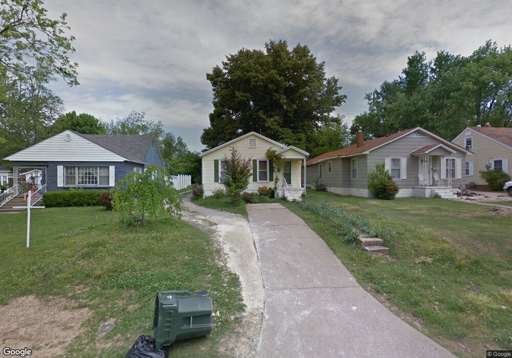
1418 High St Union City, TN 38261
Estimated Value: $81,606 - $102,000
--
Bed
1
Bath
1,031
Sq Ft
$89/Sq Ft
Est. Value
About This Home
This home is located at 1418 High St, Union City, TN 38261 and is currently estimated at $92,152, approximately $89 per square foot. 1418 High St is a home located in Obion County with nearby schools including Union City Elementary School, Union City Middle School, and Union City High School.
Ownership History
Date
Name
Owned For
Owner Type
Purchase Details
Closed on
May 4, 2015
Sold by
Armstrong Charles E
Bought by
Armstrong Charles E and Bond Lisa Michelle
Current Estimated Value
Purchase Details
Closed on
Mar 23, 2015
Sold by
Futhey Jennifer Tremean
Bought by
Armstrong Charles E
Purchase Details
Closed on
Feb 2, 2010
Sold by
Armstrong Charles E
Bought by
Armstrong Charles E
Purchase Details
Closed on
Feb 22, 2006
Bought by
Armstrong Charles and Armstrong Kathy Bell
Purchase Details
Closed on
Feb 1, 1999
Sold by
Deckard Cathy R
Bought by
Deckard Cathy R
Purchase Details
Closed on
Sep 11, 1997
Sold by
Chapman William L
Bought by
Chapman Cathy R
Purchase Details
Closed on
Oct 30, 1992
Bought by
Chapman William L and Chapman Cathy R
Purchase Details
Closed on
Apr 24, 1989
Bought by
Sturkie David Clark and Kimberly Lynn
Purchase Details
Closed on
Jan 1, 1985
Bought by
Roney Edna Katherine
Purchase Details
Closed on
Jan 1, 1981
Create a Home Valuation Report for This Property
The Home Valuation Report is an in-depth analysis detailing your home's value as well as a comparison with similar homes in the area
Home Values in the Area
Average Home Value in this Area
Purchase History
| Date | Buyer | Sale Price | Title Company |
|---|---|---|---|
| Armstrong Charles E | -- | -- | |
| Armstrong Charles E | -- | -- | |
| Armstrong Charles E | -- | -- | |
| Armstrong Charles | $35,900 | -- | |
| Deckard Cathy R | -- | -- | |
| Chapman Cathy R | -- | -- | |
| Chapman William L | $37,000 | -- | |
| Sturkie David Clark | $32,000 | -- | |
| Roney Edna Katherine | $31,000 | -- | |
| -- | $28,000 | -- |
Source: Public Records
Tax History Compared to Growth
Tax History
| Year | Tax Paid | Tax Assessment Tax Assessment Total Assessment is a certain percentage of the fair market value that is determined by local assessors to be the total taxable value of land and additions on the property. | Land | Improvement |
|---|---|---|---|---|
| 2025 | -- | $17,375 | $0 | $0 |
| 2024 | -- | $17,375 | $2,000 | $15,375 |
| 2023 | $487 | $17,375 | $2,000 | $15,375 |
| 2022 | $148 | $9,250 | $2,250 | $7,000 |
| 2021 | $145 | $9,250 | $2,250 | $7,000 |
| 2020 | $148 | $9,250 | $2,250 | $7,000 |
| 2019 | $344 | $9,250 | $2,250 | $7,000 |
| 2018 | $342 | $9,250 | $2,250 | $7,000 |
| 2017 | $347 | $9,100 | $2,250 | $6,850 |
| 2016 | $347 | $9,100 | $2,250 | $6,850 |
| 2015 | $345 | $9,100 | $2,250 | $6,850 |
| 2014 | -- | $9,100 | $2,250 | $6,850 |
Source: Public Records
Map
Nearby Homes
- 0 S Miles Ave Unit 41030
- 817 Exchange St
- 803 E Main St
- 1813 E Vine St
- 724 E Martin Luther King
- 901 S Home St
- 1009 E Cheatham St
- 633 E Jackson St
- 1326 Holiday Rd
- 0 Tennessee 431
- 1361 S Miles Ave
- 610 Perkins St
- 1319 Honeysuckle Dr
- 1405 S Sunswept Dr
- 501 N 1st St
- 42 Wilma Dr Unit Lot 42
- 38 Wilma Dr Unit Lot 38
- 49 Wilma Dr Unit Lot 49
- 39 Wilma Dr Unit Lot 39
- 37 Wilma Dr Unit Lot 37