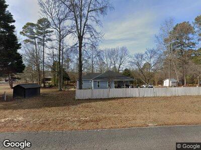
142 Memory Ln Benson, NC 27504
Elevation NeighborhoodEstimated Value: $95,018 - $232,000
2
Beds
1
Bath
784
Sq Ft
$209/Sq Ft
Est. Value
About This Home
This home is located at 142 Memory Ln, Benson, NC 27504 and is currently estimated at $163,509, approximately $208 per square foot. 142 Memory Ln is a home located in Johnston County with nearby schools including Benson Elementary School, Benson Middle School, and South Johnston High School.
Ownership History
Date
Name
Owned For
Owner Type
Purchase Details
Closed on
Nov 20, 2020
Sold by
Silverline Properties Of Nc Llc
Bought by
Apariclo Tolentino
Current Estimated Value
Purchase Details
Closed on
Oct 8, 2020
Sold by
Stephens Ken
Bought by
Silverline Properties Of Nc Llc
Purchase Details
Closed on
Oct 2, 2020
Sold by
Ford Brian
Bought by
Stephens Ken
Purchase Details
Closed on
Sep 29, 2017
Sold by
Stephens Ken
Bought by
Ford Brian
Purchase Details
Closed on
Dec 30, 2011
Sold by
Cummings David Jackson and Cummings Diane
Bought by
Stephens Ken and Ford Brian
Purchase Details
Closed on
Sep 23, 2011
Sold by
Levinson James R
Bought by
Cummings David Jackson and Cummings Diane
Home Financials for this Owner
Home Financials are based on the most recent Mortgage that was taken out on this home.
Original Mortgage
$48,000
Interest Rate
4.3%
Mortgage Type
Purchase Money Mortgage
Create a Home Valuation Report for This Property
The Home Valuation Report is an in-depth analysis detailing your home's value as well as a comparison with similar homes in the area
Home Values in the Area
Average Home Value in this Area
Purchase History
| Date | Buyer | Sale Price | Title Company |
|---|---|---|---|
| Apariclo Tolentino | $65,000 | None Available | |
| Silverline Properties Of Nc Llc | -- | None Available | |
| Stephens Ken | -- | None Available | |
| Ford Brian | -- | None Available | |
| Stephens Ken | $50,000 | None Available | |
| Cummings David Jackson | $50,000 | None Available | |
| Levinson James R | $38,000 | None Available |
Source: Public Records
Mortgage History
| Date | Status | Borrower | Loan Amount |
|---|---|---|---|
| Previous Owner | Levinson James R | $48,000 | |
| Previous Owner | Watkins Ralph Mcdonald | $12,500 |
Source: Public Records
Tax History Compared to Growth
Tax History
| Year | Tax Paid | Tax Assessment Tax Assessment Total Assessment is a certain percentage of the fair market value that is determined by local assessors to be the total taxable value of land and additions on the property. | Land | Improvement |
|---|---|---|---|---|
| 2024 | $295 | $36,430 | $25,000 | $11,430 |
| 2023 | $284 | $36,430 | $25,000 | $11,430 |
| 2022 | $299 | $36,430 | $25,000 | $11,430 |
| 2021 | $291 | $36,430 | $25,000 | $11,430 |
| 2020 | $302 | $36,430 | $25,000 | $11,430 |
| 2019 | $302 | $36,430 | $25,000 | $11,430 |
| 2018 | $244 | $28,760 | $19,580 | $9,180 |
| 2017 | $244 | $28,760 | $19,580 | $9,180 |
| 2016 | $244 | $28,760 | $19,580 | $9,180 |
| 2015 | $244 | $28,760 | $19,580 | $9,180 |
| 2014 | $244 | $28,760 | $19,580 | $9,180 |
Source: Public Records
Map
Nearby Homes
- 13 Parkers Pointe Dr
- 22 Wynd Crest Way
- 153 Wynd Crest Way
- 171 Wynd Crest Way
- 94 Starry Sky Dr
- 120 Starry Sky Dr
- 146 Starry Sky Dr
- 209 Constellation Ct
- 235 Starry Sky Dr
- 165 Dawn Rd
- 255 Constellation Ct
- 271 Starry Sky Dr
- 262 Starry Sky Dr
- 279 Constellation Ct
- 321 Constellation Ct
- 8 Pal Ct
- 1033 Silas Moore Rd
- 3943 Baileys Xrds Rd
- 3963 Baileys Xrds Rd
- 19 E American Marigold Dr Unit 34
- 142 Memory Ln
- 136 Memory Ln
- 0 Memory Ln Unit 1936101
- 0 Memory Ln Unit 1 TR1936101
- 0 Memory Ln Unit 1
- 232 Memory Ln
- 310 Memory Ln
- 141 Memory Ln
- 231 Memory Ln
- 133 Memory Ln
- 340 Memory Ln
- 130 Memory Ln
- 375 Memory Ln
- 124 Memory Loop
- 401 Memory Ln
- 122 Memory Ln
- 430 Memory Ln
- 427 Memory Ln
- 82 Memory Ln
- 418 Turlington Dr
