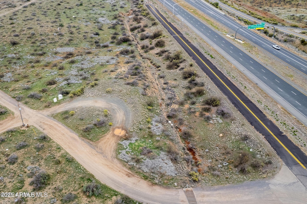
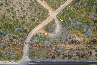
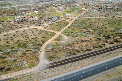
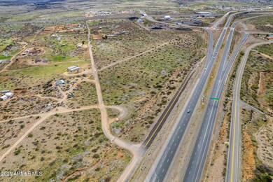
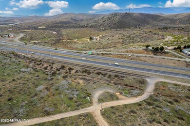
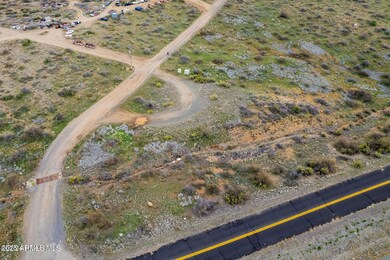
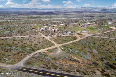
14228 S State Route 69 Mayer, AZ 86333
Cordes Lakes NeighborhoodEstimated payment $529/month
Highlights
- Panoramic View
- No HOA
- Level Lot
- 0.7 Acre Lot
About This Lot
Industrial lot in Mayer on .70 of an acre. High visibility location on HWY 69 and easy access on and off HWY 69. The master plan for this area is to rezone from residential to commercial.
Listing Agent
Keller Williams Arizona Realty License #SA532126000 Listed on: 05/01/2025

Property Details
Property Type
- Land
Est. Annual Taxes
- $8
Lot Details
- 0.7 Acre Lot
- Level Lot
- Property is zoned RCU-2A
Property Views
- Panoramic Views
Schools
- Mayer Elementary School
- Mayer High School
Community Details
- No Home Owners Association
Listing and Financial Details
- Assessor Parcel Number 500-06-016-B
Map
Home Values in the Area
Average Home Value in this Area
Tax History
| Year | Tax Paid | Tax Assessment Tax Assessment Total Assessment is a certain percentage of the fair market value that is determined by local assessors to be the total taxable value of land and additions on the property. | Land | Improvement |
|---|---|---|---|---|
| 2026 | $8 | -- | -- | -- |
| 2024 | $9 | -- | -- | -- |
| 2023 | $9 | $75 | $75 | $0 |
| 2022 | $9 | $75 | $75 | $0 |
| 2021 | $10 | $75 | $75 | $0 |
| 2020 | $10 | $0 | $0 | $0 |
| 2019 | $10 | $0 | $0 | $0 |
| 2018 | $10 | $0 | $0 | $0 |
| 2017 | $10 | $0 | $0 | $0 |
| 2016 | $11 | $0 | $0 | $0 |
| 2015 | -- | $0 | $0 | $0 |
| 2014 | -- | $0 | $0 | $0 |
Property History
| Date | Event | Price | List to Sale | Price per Sq Ft |
|---|---|---|---|---|
| 05/01/2025 05/01/25 | For Sale | $100,000 | -- | -- |
Purchase History
| Date | Type | Sale Price | Title Company |
|---|---|---|---|
| Interfamily Deed Transfer | -- | None Available |
Source: Arizona Regional Multiple Listing Service (ARMLS)
MLS Number: 6860074
APN: 500-06-016B
Disclaimer: Certain information contained herein is derived from information provided by parties other than Homes.com. All information provided is deemed reliable, but is not guaranteed to be accurate and should be independently verified.
![]() All information should be verified by the recipient and none is guaranteed as accurate by ARMLS
All information should be verified by the recipient and none is guaranteed as accurate by ARMLS
Listing Information presented by local MLS brokerage: Ten-X, local REALTOR®- Arlene Richardson - (888)-952-6393
- 18899 E Copper Star Rd
- Tbd E Kennedy Dr
- Tbd E Arcosanti Rd
- Tbd E Arcosanti Rd
- 17862 E Hummingbird Ln
- 17798 E Trails End Rd
- 17759 E Bob White Rd
- 15380 S Val Vista Dr
- 17707 E Jackrabbit Rd
- 15788 S Val Vista Dr
- 17661 E Bluejay Dr
- 00
- 00 Tbd (500-04-007g H J K)
- 19754 E Saddleback Ln
- 00 Tbd (500-04-007h)
- 19555 E Ironwood Dr
- 13794 S Mesquite Trail
- 00 Tbd (500-04-007k)
- 00 Tbd (500-04-007j)
- 17571 E Hummingbird Ln
- 17270 E Peach Tree Rd
- 15835 S Cordes Lakes Dr
- 20526 E Cedar Canyon Dr
- 12900 E State Route 169
- 175 N Village Way Unit 61
- 175 N Village Way Unit 65
- 12351 E Bradshaw Mountain Rd
- 679 N Blanco Ct
- 11900 E Powderhorn Pass
- 320 S Hoss Rd
- 1299 N Tapadero Dr Unit D
- 10676 E Singletree Trail
- 7239 E Barefoot Ln
- 1915 N Bittersweet Way
- 2976 N Yavapai Rd E Unit 2
- 3101 N Corrine Dr Unit 1
- 8683 E Commons Cir Unit 203
- 8683 E Commons Cir Unit A313
- 8683 E Commons Cir Unit 102
- 3325 E Yavapai Rd Unit B